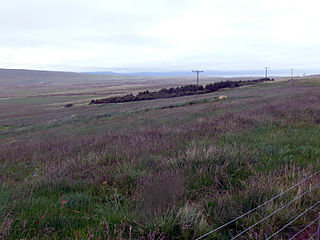
Bagual (San Luis) | |
|---|---|
Municipality and village | |
 | |
| Country | |
| Province | San Luis Province |
| Time zone | UTC−3 (ART) |
Bagual (San Luis) is a village and municipality in San Luis Province in central Argentina. [1]
Bagual (San Luis) | |
|---|---|
Municipality and village | |
 | |
| Country | |
| Province | San Luis Province |
| Time zone | UTC−3 (ART) |
Bagual (San Luis) is a village and municipality in San Luis Province in central Argentina. [1]

Laxárdalur is a valley in Dalasýsla in northwestern Iceland, formed by the River Laxá. It was the home of the Laxdælir, a group of Icelanders whose doings are described in the Laxdæla saga.

Banderilla is a municipality in the Mexican state of Veracruz. It is located about 9 km from the state capital, Xalapa. It has a surface area of 22.21 km2. It is located at 19°35′N96°56′W.
Lagunillas, San Luis Potosí is a town and municipality in the Mexican state of San Luis Potosí in central Mexico.
Fortuna (San Luis) is a village and municipality in San Luis Province in central Argentina.
Las Vertientes (San Luis) is a village and municipality in San Luis Province in central Argentina.
Navia (San Luis) is a village and municipality in San Luis Province in central Argentina.
Talita is a village and municipality in San Luis Province in central Argentina.

Unión is a village and municipality in San Luis Province, Argentina, it is located at the intersection of National Route 188 and Provincial Route 3, in the southern of the province.

San Francisco de Alfarcito is a rural municipality and village in Jujuy Province in Argentina.
Casa de Piedra (La Paz) is a village and municipality in Catamarca Province in northwestern Argentina.
Infanzón is a village and municipality in Catamarca Province in northwestern Argentina.

Demorest Glacier is a glacier on the northeast side of Hemimont Plateau which flows southeast into Whirlwind Inlet between Flint Glacier and Matthes Glacier, on the east coast of Graham Land. It was discovered by Sir Hubert Wilkins on a flight of December 20, 1928, and photographed from the air by the United States Antarctic Service in 1940. It was charted by the Falkland Islands Dependencies Survey in 1947 and named for Max H. Demorest, an American glaciologist.

The Goodenough Glacier is a broad sweeping glacier to the south of the Batterbee Mountains, flowing from the west shore of Palmer Land, Antarctica, into George VI Sound and the George VI Ice Shelf.
Tofani Glacier is a glacier flowing northeast into the head of Solberg Inlet, Bowman Coast, to the north of Houser Peak. The feature was photographed from the air by United States Antarctic Service (USAS), 1940, U.S. Navy, 1966, and was surveyed by Falkland Islands Dependencies Survey (FIDS), 1946–48. Named by Advisory Committee on Antarctic Names (US-ACAN) in 1977 after Dr. Walter Tofani, M.D., station physician at Palmer Station, 1975.

Renaud Glacier is a heavily crevassed glacier on the east side of Hemimont Plateau flowing southeast to enter Seligman Inlet between Lewis Glacier and Choyce Point, on the east coast of Graham Land. The glacier was first photographed by the United States Antarctic Service (USAS), 1939–41. Named by United Kingdom Antarctic Place-Names Committee (UK-APC) for Andre Renaud, Swiss glaciologist and chairman of the Swiss Glacier Commission, 1955–74.
Robillard Glacier is a narrow glacier flowing east-northeast and entering the north side of the head of Solberg Inlet, on the east coast of Graham Land. It was discovered by members of East Base of the United States Antarctic Service (USAS), 1939–41, and was photographed from the air in 1947 by the Ronne Antarctic Research Expedition (RARE), under Ronne, and charted in 1948 by the Falkland Islands Dependencies Survey (FIDS). It was named by Ronne for Captain George Robillard, U.S. Navy, of the legal section of the Bureau of Ships, who assisted in gaining Congressional support which resulted in procuring the expedition ship.
German submarine U-150 was a Type IID U-boat of Nazi Germany's Kriegsmarine during World War II. Her keel was laid down on 25 May 1940 by Deutsche Werke in Kiel as yard number 279. She was launched on 19 October 1940 and commissioned on 27 November with Hinrich Kelling in command.

Los Titanes is a seaside resort in Canelones Department, Uruguay.