
The Baie de Seine (Bay of the Seine River) is a bay in northern France.
The Baie de Seine (Bay of the Seine River) is a bay in northern France.
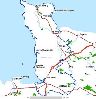
It is a wide, rectangular inlet of the English Channel, approximately 100 kilometres (east-west) by 45 kilometres, bounded in the west by the Cotentin Peninsula, in the south by the Normandy coast and in the east by the estuary of the river Seine at Le Havre. The coast alternates between sandy beaches and rocky promontories and, in general, it offers little shelter for shipping. At the western end of the bay are the Îles Saint-Marcouf.
Le Havre is the major port of the region; there are minor harbours at Barfleur, Port-en-Bessin, Courseulles-sur-Mer, Langrune-sur-Mer, Ouistreham, Trouville-sur-Mer and Honfleur.
Domestic and foreign tourists visit the coast, given its World War II associations, sandy beaches and proximity to Paris. There are coastal resorts at Arromanches, Deauville, Cabourg, Houlgate, Villers-sur-Mer, Trouville-sur-Mer and Honfleur.
The Battles of Barfleur and La Hogue were naval battles fought off Barfleur and Saint-Vaast-la-Hougue in the 17th century.
The Normandy coast was the location, during World War II, of the main Allied landings in France; the unavailability of significant harbours caused the Allies to construct artificial harbours (Mulberries) at Arromanches and Omaha Beach. There are remains of these harbours at Arromanches.
Coordinates: 49°30′N0°30′W / 49.500°N 0.500°W
| Authority control |
|
|---|

Normandy is a geographical and cultural region, roughly coextensive with the historical Duchy of Normandy.

Le Havre is an urban French commune and city in the Seine-Maritime department in the Normandy region of northwestern France. It is situated on the right bank of the estuary of the river Seine on the Channel southwest of the Pays de Caux. Le Havre is the most populous commune of Upper Normandy, although the total population of the greater Le Havre conurbation is smaller than that of Rouen. After Reims, it is also the second largest subprefecture in France. The name Le Havre means "the harbour" or "the port". Its inhabitants are known as Havrais or Havraises.

The Seine is a 775-kilometre-long (482 mi) river in northern France. Its drainage basin is in the Paris Basin covering most of northern France. It rises at Source-Seine, 30 kilometres (19 mi) northwest of Dijon in northeastern France in the Langres plateau, flowing through Paris and into the English Channel at Le Havre. It is navigable by ocean-going vessels as far as Rouen, 120 kilometres (75 mi) from the sea. Over 60 percent of its length, as far as Burgundy, is negotiable by large barges and most tour boats, and nearly its whole length is available for recreational boating; excursion boats offer sightseeing tours of the river banks in the capital city, Paris.

Calvados is a department in the Normandy region in northwestern France. It takes its name from a cluster of rocks off the English Channel coast.

Dieppe is a coastal community in the Arrondissement of Dieppe in the Seine-Maritime department in the Normandy region of northern France. The population stood at 29,080 in 2017.
The Cotentin Peninsula, also known as the Cherbourg Peninsula, is a peninsula in Normandy that forms part of the northwest coast of France. It extends north-westward into the English Channel, towards Great Britain. To its west lie the Channel Islands and to the southwest lies the peninsula of Brittany.

Mulberry harbours were temporary portable harbours developed by the United Kingdom during the Second World War to facilitate the rapid offloading of cargo onto beaches during the Allied invasion of Normandy in June 1944. After the Allies successfully held beachheads following D-Day, two prefabricated harbours were taken in sections across the English Channel from the UK with the invading army and assembled off Omaha Beach and Gold Beach.

The Independent Belgian Brigade was a Belgian and Luxembourg military unit in the Free Belgian forces during World War II, commonly known as the Piron Brigade after its commanding officer Jean-Baptiste Piron. It saw action in Western Europe and participated in the Battle of Normandy, the Liberation of Belgium, and fighting in the Netherlands over 1944-1945.

Asnelles is a commune in the Calvados department in the Normandy region of north-western France.

Honfleur is a commune in the Calvados department in northwestern France. It is located on the southern bank of the estuary of the Seine across from le Havre and very close to the exit of the Pont de Normandie. Its inhabitants are called Honfleurais.

Gold, commonly known as Gold Beach, was the code name for one of the five areas of the Allied invasion of German-occupied France in the Normandy landings on 6 June 1944, during the Second World War. Gold, the central of the five areas, was located between Port-en-Bessin on the west and La Rivière on the east. High cliffs at the western end of the zone meant that the landings took place on the flat section between Le Hamel and La Rivière, in the sectors code-named Jig and King. Taking Gold was to be the responsibility of the British Army, with sea transport, mine sweeping, and a naval bombardment force provided by the Royal Navy as well as elements from the Dutch, Polish and other Allied navies.
Arromanches-les-Bains is a commune in the Calvados department in the Normandy region of north-western France.

The Touques is a small 108-kilometre-long (67 mi) coastal river in Pays d'Auge in Normandy, France. The Touques is officially navigable up to the Pont des Belges, 800 m (2,600 ft) from its estuary. Its source is in the Perche hills, south of Gacé. The river runs northwards, and flows into the English Channel between the communes of Deauville and Trouville-sur-Mer in North-Western Calvados. Two ports, the Port of Trouville-sur-Mer and Port of Deauville are situated on the river mouth opposite each other.

The arrondissement of Le Havre is an arrondissement of France in the Seine-Maritime department in the Normandy region. It has 149 communes. Its population is 387,520 (2016), and its area is 1,221.2 km2 (471.5 sq mi).

The arrondissement of Lisieux is an arrondissement of France in the Calvados department in the Normandy region. It has 160 communes. Its population is 162,678 (2016), and its area is 1,756.2 km2 (678.1 sq mi).

The Côte Fleurie stretches for approximately 40 km (25 mi) between Merville-Franceville-Plage, at the mouth of the Orne river, opposite Ouistreham to the west and Honfleur on the Seine estuary in the east. It forms part of the eastern Basse-Normandie coast on the English Channel to the north of the Pays d'Auge in the Calvados department. The coast between the towns of Trouville and Honfleur, although part of the Côte Fleurie, is named Côte de Grace. Dives-sur-Mer is on the Côte Fleurie but possesses no beach or seafront. The Côte de Nacre continues west from the Touques estuary.
The Port of Dives-sur-Mer, Port de Dives-sur-Mer, is the harbour of the Norman town of Dives-sur-Mer, France. It is from this harbour that William the Conqueror left for England to claim the throne.

The Port of Trouville-sur-Mer is the harbour of the city of Trouville-sur-Mer, France. The large town's position on the estuary of the River Touques was a natural establishment of a fish dock.
The Canton of Fécamp is a canton in the Seine-Maritime département and in the Normandy region of northern France.
The canton of Honfleur-Deauville is an administrative division of the Calvados department, northwestern France. It was created at the French canton reorganisation which came into effect in March 2015. Its seat is in Honfleur.