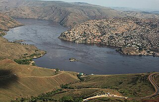
Matadi is the chief sea port of the Democratic Republic of the Congo and the capital of the Kongo Central province. It has a population of 245,862 (2004). Matadi is situated on the left bank of the Congo River, 148 km (92 mi) from the mouth and 8 km (5.0 mi) below the last navigable point before the rapids that make the river impassable for a long stretch upriver. It was founded by Sir Henry Morton Stanley in 1879.
Weko is a community in the Democratic Republic of the Congo.

Kananga, formerly known as Luluabourg or Luluaburg, is the capital city of the Kasai-Central Province in the Democratic Republic of the Congo and was the capital of the former Kasaï-Occidental Province. In 2015 the city had an estimated population of 1,271,704

Moanda is one of the largest towns in Gabon, lying on the N3 road in Haut Ogooué. It is also one of the most important manganese mining towns in the world, under the auspices of the Compagnie Minière de l'Ogooué (COMILOG), which began mining in 1957. Moanda has a population of around 39,298 inhabitants and is the second largest city in the Haut Ogooué Region, after Franceville. It is also a border town, lying 100 km away from the border with the Republic of Congo.
Belinga is a location in Gabon with as yet unexploited iron ore deposits. These ore deposits extend into neighbouring Cameroon and Congo.

Tshela is the main town of Bas-fleuve district, in Kongo Central Province in the Democratic Republic of Congo (DRC). The town was linked to the port of Boma, Congo by an isolated narrow gauge railway, the Mayumbe Line. This 610 mm gauge line lasted from 1889–1984.
Kongolo is a town in Tanganyika Province in the Democratic Republic of the Congo. It is located on the west bank of the Lualaba River, the largest headstream of the Congo River. It has 62,455 inhabitants.

Mweka is a town in southern-central Democratic Republic of the Congo, situated on the Kasai railway line between Kananga and the Kasai River port of Ilebo.
The Bakwa Dishi is a people belonging to the Luba ethnic group living today in the Kasai-Oriental Province in the Democratic Republic of Congo. Miabi, the Dishi Capital, is located 16 miles (26 km) West of Mbuji-Mayi. The territory of the Bakwa Dishi lies on approximately 1,900 square miles (4,900 km2), which is known as the Miabi territory.
Miabi is a territory of the Kasai-Oriental province of the Democratic Republic of the Congo. It is inhabited by the Bakwa Dishi and the land which is approximately 1,900 square miles (4,900 km2) is owned by its royal family.
Kabalo is one of a number of towns in the Democratic Republic of the Congo with this name. This one is on the Lualaba River, in Tanganyika Province.

Songololo is a town in Kongo Central Province in the Democratic Republic of the Congo.

Lukula is a town in, and a territory of Kongo Central province, Democratic Republic of the Congo. It lies on the road and disused Mayumbe railway line between Boma, to the south, and Tshela, to the north, on the southern bank of the Lakula river. Lukula lies at an altitude of 646 ft above sea level. Economic activity includes cement production, utilising locally occurring limestone, and commercial Logging.
Ango Ango is a town in the Bas-Congo province of the Democratic Republic of the Congo.
Kenge, Bas Congo is a town in Bas-Congo in the Democratic Republic of the Congo.
Mpozo is a town in the Bas-Congo province of the Democratic Republic of the Congo near the border with Angola.
Mungbere is a small town in Orientale Province, in the north of the Democratic Republic of Congo.
Bakwa-Kalonji is a town with an estimated population of 58,092 located in the Kasai-oriental province of the Democratic Republic of the Congo. The elevation of the town is estimated to be 462 meters above sea level. The Bakwa Kalonji tribe has as King Mutombo Katshi, at his death the king's successor Lutonga was very young to take the throne and this was given to his brother Kabengele Dibwa. Kabengele Dibwa has more than a hundred wives and has more than four hundred sons including daughters.
Bakwa-Tshileu or Bakwa-Tshileo is a village/town in the Democratic Republic of the Congo. It is located in the territory of Gandajika and in the province of Lomami Province

