
The Wayfarer's Walk is a long distance footpath in England from Walbury Hill, Berkshire to Emsworth, Hampshire.

Caer Caradoc is a hill in the English county of Shropshire. It overlooks the town of Church Stretton and the village of All Stretton and offers panoramic views to the north towards the Wrekin, east to Wenlock Edge, and west over the nearby Long Mynd. On a clear day it is possible to see the hills of north-east Wales to the north, the high-rise buildings of Birmingham to the east, Worcester Beacon in the Malvern Hills to the south-east, and Hay Bluff in the Black Mountains and the peaks of the Brecon Beacons, to the south. Caer Caradoc is hill G/WB-006 in Summits on the Air. It is not to be confused with another hillfort of the same name 1 km west of Chapel Lawn near Bucknell.

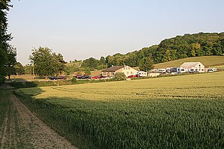
Quarley is a village and civil parish in the Test Valley district of Hampshire, England. It is about 7 mi (11 km) west of Andover and according to the 2001 census had a population of 161, reducing to 150 at the 2011 Census.

Y Garn Goch is a hill in the Brecon Beacons National Park in the east of Carmarthenshire, Wales. The name means the 'red cairn'. It lies near the village of Bethlehem, three miles southwest of Llangadog and four miles east of Llandeilo on the southern side of the broad Towy Valley. It is also commonly known as either Garn Goch or Carn Goch. Current landowners are the Brecon Beacons National Park Authority.

Ladle Hill lies on Great Litchfield Down, near the village of Burghclere and Watership Down, in north Hampshire. It is immediately to the east of Beacon Hill. Part of the hill is a 10.37 hectares biological SSSI, number 1000642, first notified in 1978. It is 232 metres high and has a hillfort and a tumulus on its slopes. The hill is easily accessed from the nearby cross county footpath, Wayfarer's Walk. The hill falls within the North Wessex Downs Area of Outstanding Natural Beauty.

The Frith is a small univallate Iron Age hillfort to the north of Silchester, Calleva Atrebatum, Roman town. A single bank covers all sides apart from the south east, and is at the most about 5 feet (1.5 m) high on the western edge. A ditch is also traceable for the length of the bank, although at varying states.

Helsby hill fort is an Iron Age hillfort overlooking the village of Helsby in Cheshire, northwest England. Helsby Hill has steep cliffs on the northern and western sides, providing a natural semicircular defence. Double rampart earthworks extend to the south and east to provide protection to those flanks. Two additional banks have been discovered enclosing a rock ledge on the cliff to the north side. Excavations last century revealed a wall composed of sand and rubble, revetted with stone to the back and front. The hill has a summit of 141 m AOD, and is a prominent landmark rising above the Cheshire Plain, with fine views overlooking the Mersey Estuary and into Wales. Much of the hill is owned and managed by the National Trust. The surrounding areas are well wooded to the southwest, northwest and northeast with farmland to the southeast. The hill fort is protected as a Scheduled Ancient Monument.
Ashley's Copse is the site of an Iron Age hillfort near to Salisbury. The Hampshire Wiltshire border runs right through the middle of this site. The site is half wooded, and here can be found the best preserved earthworks, but there is also visible evidence of some of the earthworks on the eastern spur of the hill. To the Southeast of the fort lies a steep valley, forming a natural defense. The flanks to the North and East are also tightly contoured. The ground on the other aspects slopes less steeply. The fort site itself is not located on the summit of the (unnamed) hill, but lies slightly to the East of the 166m AOD summit, at between 155m and 160m AOD.
Dunwood Camp is the site of an Iron Age hillfort located in Hampshire. It occupies the summit of a sandy hill. It has a single Rampart (fortification) but no definite indication of a ditch and it is possible that this earthwork was never completed.

Norsebury Ring is the site of an Iron Age univallate hillfort located in Hampshire. Now mostly ploughed out to the South and east, some ditches and ramparts remain within a small copsed area to the North and west, which are surprisingly intact with a small outer ditch, then a bank, then another larger ditch followed by larger bank. However the trees and undergrowth hide the earthworks from immediate view.
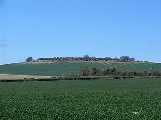
Quarley Hill is the site of an Iron Age univallate hill fort in Hampshire, southern England. The hill affords commanding views of the surrounding countryside.

Tidbury Ring is the site of an Iron Age univallate hillfort located in Hampshire. The earthworks have been heavily destroyed by ploughing, but some sections to the south remain in better condition. The entrance lies to the southeast of the fort. The interior is for the most part farmland with the earthworks now covered by small trees and undergrowth Two Roman buildings, possibly a courtyard villa complex were found within the hill-fort. The site is now listed as a scheduled ancient monument no.87

Whitsbury Castle, or Whitsbury Castle Ditches, is the site of an Iron Age univallate hillfort located near the village of Whitsbury in Hampshire. The fort is roughly pear-shaped, located on a chalk outcrop, and covering approximately sixteen acres. The defenses comprise two large ramparts with outer ditches and an additional counter scarp bank on the northern half. The original entrance was at the southwestern corner but has been destroyed by the construction of a post-medieval manor house. The site has been in use throughout the ages, with excavation revealing mesolithic activity, an association with a Bronze Age ranch boundary, an Iron Age hillfort settlement, followed much later by Anglo-Saxon renovation and reuse of the defences. The site is privately owned but is flanked externally on all sides but east by public bridleways.

Battlesbury Camp is the site of an Iron Age bivallate hill fort on Battlesbury Hill near the town of Warminster in Wiltshire, South West England. Excavations and surveys at the site have uncovered various finds and archaeological evidence.

Bratton Castle is a bivallate Iron Age hill fort on Bratton Down, at the western edge of the Salisbury Plain escarpment. The hill fort comprises two circuits of ditch and bank which together enclose a pentagonal area of 9.3 hectares.

Caesar's Camp is an Iron Age hill fort straddling the border of the counties of Surrey and Hampshire in southern England. The fort straddles the borough of Waverley in Surrey and the borough of Rushmoor and the district of Hart, both in Hampshire. Caesar's Camp is a Scheduled Ancient Monument with a list entry identification number of 1007895. It lies approximately 3 kilometres (1.9 mi) north of the town of Farnham, and a similar distance west of Aldershot. The hillfort lies entirely within the Bourley and Long Valley Site of Special Scientific Interest. Caesar's Camp is a multivallate hillfort, a fort with multiple defensive rings, occupying an irregular promontory, with an entrance on the south side. The site has been much disturbed by military activity, especially at the southeast corner. The remains of the hillfort are considered to be of national importance.
Clearbury Ring is a univallate Iron Age hillfort which is partly in the parish of Downton in the county of Wiltshire in southwest England, approximately 5 kilometres (3 mi) due south of Salisbury city centre. The site, which is a Scheduled Ancient Monument, straddles the boundary with Odstock parish, and a slight scarp runs across the interior of the fort, marking the parish boundary.
King John's Hill is the site of an Iron Age hillfort located in Hampshire, in southeast England. The hill is situated in the parish of Worldham, in East Hampshire District. It is a Scheduled Ancient Monument with a list entry identification number of 1020314, and a Monument Number of 243207.

Crooksbury Hill is a 17.2-hectare (43-acre) nature reserve within Puttenham and Crooksbury Commons east of Farnham in Surrey. It is owned by Surrey County Council and managed by the Surrey Wildlife Trust. Soldier's Ring on the north side of the hill is a Scheduled Monument. It is a hillfort dating to the late Bronze Age or early Iron Age.


