
Putnam County is a county located in the central portion of the U.S. state of Georgia. As of the 2020 census, the population was 22,047. The county seat is Eatonton.
The Trail of Tears was the forced displacement of about 60,000 people of the "Five Civilized Tribes" between 1830 and 1850, and the additional thousands of Native Americans and their enslaved African Americans within that were ethnically cleansed by the United States government.

Columbia County is a county located in the east central portion of the U.S. state of Georgia. As of the 2020 census, the population was 156,010. The legal county seat is Appling, but the de facto seat of county government is Evans.

Ball Ground is a city in Cherokee County, Georgia, United States. The city was originally Cherokee territory before they were removed from the land and it was given to white settlers. A railroad was built in 1882 and a town was formed around the resulting railroad stop. The town was incorporated on January 1, 1883, and became an industrial-based economy largely centered around its marble industry until around the mid-20th century when the industries began to leave and the city started to decline. From 2000 onwards the city saw rapid growth; as of the 2020 census the city had a population of 2,560, which is over three times the city's population of 730 in 2000.

Commerce is a city in Jackson County, Georgia, 70 miles (110 km) northeast of Atlanta. As of the 2020 census, the city had a population of 7,387.

Talking Rock is a town in Pickens County, Georgia, United States. The population as of the 2020 census was 91.

George Walton was a Founding Father of the United States who signed the United States Declaration of Independence while representing Georgia in the Continental Congress. Walton also served briefly as the second chief executive of Georgia in 1779 and was again named governor in 1789–1790. In 1795, he was appointed to the U.S. Senate, to complete the unexpired term of a senator who had resigned.

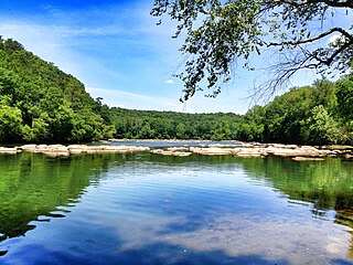
The Chattahoochee River is a river in the Southeastern United States. It forms the southern half of the Alabama and Georgia border, as well as a portion of the Florida and Georgia border. It is a tributary of the Apalachicola River, a relatively short river formed by the confluence of the Chattahoochee and Flint rivers and emptying from Florida into Apalachicola Bay in the Gulf of Mexico. The Chattahoochee River is about 430 miles (690 km) long. The Chattahoochee, Flint, and Apalachicola rivers together make up the Apalachicola–Chattahoochee–Flint River Basin. The Chattahoochee makes up the largest part of the ACF's drainage basin.

The Tennessee River is a 652 mi (1,049 km) long river located in the southeastern United States in the Tennessee Valley. Flowing through the states of Tennessee, Alabama, Mississippi, Kentucky, it begins at the confluence of French Broad and Holston rivers at Knoxville, and drains into the Ohio River near Paducah, Kentucky. It is the largest tributary of the Ohio, and drains a basin of 40,876 sq mi (105,870 km2).

The Chattooga River is the main tributary of the Tugaloo River.
John Martin was an American planter, soldier, and politician.

The Oostanaula River is a principal tributary of the Coosa River, about 49 miles (79 km) long, formed by the confluence of the Conasauga and Coosawattee in northwestern Georgia in the United States. Via the Coosa and Alabama rivers, it is part of the watershed of the Mobile River, which flows to the Gulf of Mexico.
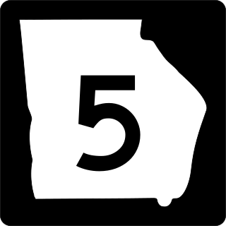
State Route 5 (SR 5) is a 155.325-mile-long (249.971 km) state highway that travels south-to-north through portions of Carroll, Douglas, Cobb, Cherokee, Pickens, Gilmer, and Fannin counties in the western and northern parts of the U.S. state of Georgia. The highway travels from its southern terminus at SR 48 at the Alabama state line, north-northwest of Ephesus, to its northern terminus at SR 60 and SR 68 at the Tennessee state line on the McCaysville–Copperhill line, bisecting the northwestern portion of the state.
Chattahoochee River National Recreation Area (CRNRA) preserves a series of sites between Atlanta and Lake Sidney Lanier along the Chattahoochee River in Georgia, U.S. The 48-mile (77 km) stretch of the river affords public recreation opportunities and access to historic sites. The national recreation area, a National Park Service unit, was established on August 15, 1978, by President Jimmy Carter.
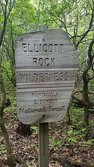
Ellicott Rock Wilderness is a wild area lying at and around the tripoint of Georgia, North Carolina, and South Carolina, spanning 8,274 acres. It is managed by the United States Forest Service and is part of the National Wilderness Preservation System.

The Coosawattee River is a 49.3-mile-long (79.3 km) river located in northwestern Georgia, United States.
The Battle of Taliwa was fought in Ball Ground, Georgia, in 1755. The battle was part of a larger campaign of the Cherokee against the Muscogee Creek people, where a contingent of 500 Cherokee warriors led by war chief Oconostota defeated the Muscogee Creek people and pushed them south from their northern Georgia homelands, allowing the Cherokee to begin settling in the region.
Talking Rock Creek is a stream in the northwestern Georgia, United States, that is a tributary of the Coosawattee River.
Town Creek is a stream in the U.S. state of Georgia. It is a tributary to Talking Rock Creek.
