Related Research Articles
Newtown may refer to:
Milltown may refer to:

Saul is a village in County Down, Northern Ireland, within the civil parish of Saul and Ballee.

Drumbeg is a small village, townland and civil parish on the south bank of the River Lagan in County Down, Northern Ireland. The village is covered by the Lisburn City Council area and forms part of the suburban fringe of Belfast.
Lambeg is a small village and civil parish in County Antrim, Northern Ireland. Located between Belfast and Lisburn, it was once a small rural village, but is now within the Greater Belfast conurbation. Lambeg is also an electoral ward of Lisburn Council. In the 2001 Census it had a population of 60 people. The civil parish of Lambeg covers areas of County Down as well as County Antrim.

Tullylish is a small village, townland and civil parish in County Down, Northern Ireland. It sits on the River Bann, along the main road between the towns of Banbridge and Portadown. In the 2001 census it had a population of 105 people. It lies within the civil parish of Tullylish and Banbridge District.

Drumbo is a small village, townland and civil parish in County Down, Northern Ireland. It is about 6 miles (10 km) south of Belfast city centre, 3 miles (5 km) east of Lisburn and 3 miles (5 km) west of Carryduff. It is in the historic barony of Castlereagh Upper.
Derryneill is a townland of 1,049 acres in County Down, Northern Ireland, near to Leitrim, County Down. It is situated in the civil parish of Drumgooland and the historic barony of Iveagh Upper, Lower Half. Derryneill is mainly made up of small rocky drumlins.

Kilcoo is a small village and civil parish in County Down, Northern Ireland. It lies between Rathfriland and Castlewellan and is within the Newry, Mourne and Down District Council area. The village is on the A25 Dublin Road 6 kilometres (4 mi) south-west of Castlewellan. Kilcoo had a population 1415 people in the 2001 Census.

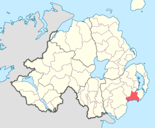
Lecale Lower is a barony in County Down, Northern Ireland. It lies to the east of the county with Strangford Lough to its north and the Irish Sea to its right. It is bordered by five other baronies: Lecale Upper to the south; Ards Upper to the north-east just across the mouth of Strangford Lough; Dufferin to the north; Castlereagh Upper to the north-west; and Kinelarty to the west.
Lecale Upper is a barony in County Down, Northern Ireland. To its south lies the Irish Sea, and it is bordered by three other baronies; Lecale Lower and Kinelarty to the north; and Iveagh Upper, Lower Half to the west.
Greenan may refer to:

Tullynakill is a civil parish and townland in County Down, Northern Ireland. It is situated in the historic barony of Castlereagh Lower.

Legacurry is a townland of 100 acres in County Down, Northern Ireland. It is situated in the civil parish of Drumbo and the historic barony of Castlereagh Upper.

Kilclief is a civil parish in County Down, Northern Ireland. It is situated in the historic baronies of Lecale Lower and Lecale Upper. It is also a townland of 623 acres.
References
- 1 2 "Ballytrustan". IreAtlas Townlands Database. Retrieved 16 May 2015.