Ban Khung Taphao บ้านคุ้งตะเภา (English: Bend of Argosy Watercourse Village) | |
---|---|
Village | |
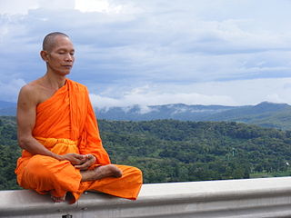
Kungthapao villagers performs a ceremony to worship about a stream Thailand. | |
Coordinates: 17°39′24.44″N100°8′54.56″E / 17.6567889°N 100.1484889°E Coordinates: 17°39′24.44″N100°8′54.56″E / 17.6567889°N 100.1484889°E | |
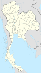
Country | Thailand |
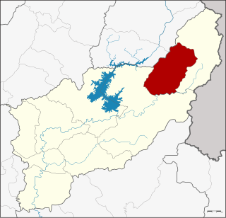
Province | Uttaradit |
Amphoe | Mueang Uttaradit |
Tambon | Khung Taphao |
Government | |
• Phu Yai Ban | Somchai Samphaothong |
Time zone | Thailand (UTC+7) |
Postal code | 53000 |
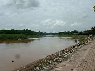
Chief watercourse | Nan River |
Ban Khung Taphao (Thai : บ้านคุ้งตะเภา) is a village in the Khung Taphao subdistrict of Mueang Uttaradit of Uttaradit Province, Thailand.
Thai, Central Thai or Ayutthaya or Siamese, is the sole official and national language of Thailand and the first language of the Central Thai people and vast majority of Thai of Chinese origin. It is a member of the Tai group of the Kra–Dai language family. Over half of Thai vocabulary is derived from or borrowed from Pali, Sanskrit, Mon and Old Khmer. It is a tonal and analytic language, similar to Chinese and Vietnamese.
Uttaradit is one of the northern provinces (changwat) of Thailand. Neighboring provinces are Phitsanulok, Sukhothai, Phrae and Nan. To the east it borders Xaignabouli of Laos. Uttaradit is 488 km north of Bangkok, and 238 km southeast of Chiang Mai.
Thailand, officially the Kingdom of Thailand and formerly known as Siam, is a country at the center of the Southeast Asian Indochinese peninsula composed of 76 provinces. At 513,120 km2 (198,120 sq mi) and over 68 million people, Thailand is the world's 50th largest country by total area and the 21st-most-populous country. The capital and largest city is Bangkok, a special administrative area. Thailand is bordered to the north by Myanmar and Laos, to the east by Laos and Cambodia, to the south by the Gulf of Thailand and Malaysia, and to the west by the Andaman Sea and the southern extremity of Myanmar. Its maritime boundaries include Vietnam in the Gulf of Thailand to the southeast, and Indonesia and India on the Andaman Sea to the southwest. Although nominally a constitutional monarchy and parliamentary democracy, the most recent coup in 2014 established a de facto military dictatorship.
The first element ban, (Thai: บ้าน) means village. [1] The second element khung, (Thai: คุ้ง) means bend of watercourse. The third element taphao, (Thai: ตะเภา) means a sailing ship. [2]
Ban Khung Taphao lies in the northern portion of Tambon Khung Taphao on the Nan River.
The Nan River is a river in Thailand. It is one of the most important tributaries of the Chao Phraya River.
The current village headman of Ban Khung Taphao is Phu Yai Ban Somchai Samphaothong (Thai:สมชาย สำเภาทอง). The headman is an elected post, followed by appointment by the Ministry of the Interior.
Residents are Theravada Buddhists. Ancestor worship is practiced, and homes often have shrines dedicated to elders of the family who have died; offerings of food and drink are placed beside the shrines.
Theravāda is the most ancient branch of extant Buddhism today, and the one that preserved their version of the teachings of Gautama Buddha in the Pāli Canon. The Pāli Canon is the only complete Buddhist canon which survives in a classical Indian language, Pāli, which serves as both sacred language and lingua franca of Theravāda Buddhism. For more than a millennium, Theravāda has focused on preserving the dhamma as preserved in its texts, and it tends to be very conservative with regard to matters of doctrine and monastic discipline. Since the 19th century, meditation practice has been re-introduced, and has become popular with a lay audience, both in traditional Theravada countries and in the west.
Children attend school at the Ban Khung Taphao School. They travel to Ban Khung Taphao School by bicycle or on foot. Traditional ethnic clothing is no longer worn by villagers, other than for certain religious ceremonies.
Wat Khung Taphao is a Buddhist temple (wat) is an ancient monastery located in Ban Khung Taphao, Mueang Uttaradit District of Uttaradit Province in Northern Thailand, near Khung Taphao intersection on national highway route number 11. This temple is in under control of the Maha Nikaya, comprising one of nine important local temples. In the year 2018, There are 20 monks and 3 novices that The Most Ven.Phra Ajahn Somchai jirapunno is the leader and to be abbot of Wat Khung Taphao and have Ven. Dr. Phramaha Tevaprapas Makklay is the Deputy Abbot.
A polling place is where voters cast their ballots in elections.
Muban is the lowest administrative sub-division of Thailand. Usually translated as village and sometimes as hamlet, they are a subdivision of a tambon. As of 2008, there were 74,944 administrative muban in Thailand. As of the 1990 census, the average village consisted of 144 households or 746 persons.
Ban Tak is a district (amphoe) in the northern part of Tak Province, western Thailand.
Tron is a district (amphoe) of Uttaradit Province, northern Thailand.
Mueang Uttaradit is the capital district of Uttaradit Province, northern Thailand.
Fak Tha is a district (amphoe) of Uttaradit Province, northern Thailand.
Manorom is a district (amphoe) in the northeastern part of Chai Nat Province, central Thailand.
Ban Sam Ruen is a village in the Nakhon Pa Mak subdistrict of Amphoe Bang Krathum District of Phitsanulok Province, Thailand.
Ban Grong Greng is a rural village in the north-west portion of the Nakhon Pa Mak subdistrict of Bang Krathum District of Phitsanulok Province, Thailand.
Ban Dongphayom is a village (muban) in the Nakhon Pa Mak sub-district of Bang Krathum District of Phitsanulok Province, Thailand.
Ban Laemphrathat is a village (muban) in the Nakhon Pa Mak subdistrict of Amphoe Bang Krathum District of Phitsanulok Province, Thailand.
Tha Pho is a subdistrict in the Mueang Phitsanulok District of Phitsanulok Province, Thailand.
Ban Ko is a tambon (sub-district) of Mueang Uttaradit District, in Uttaradit Province, Thailand. In 2005 it had a population of 8,863 people. The tambon contains eight villages.
Khung Taphao is a tambon (sub-district) of Mueang Uttaradit District, in Uttaradit Province, Thailand. In 2016 it had a population of 8,899 people.
Ban Dan Na Kham is a village and tambon (sub-district) of Mueang Uttaradit District, in Uttaradit Province, Thailand. In 2005 it had a population of 10,329 people. The tambon contains 11 villages.
Ban Dan is a village and tambon (sub-district) of Mueang Uttaradit District, in Uttaradit Province, Thailand. In 2005 it had a population of 5,118 people. The tambon contains 12 villages.
Uttaradit railway station is the main railway station for Uttaradit province. It is owned by the State Railway of Thailand and serves the Northern Line. Uttaradit railway station is located 485.17 kilometres (301.5 mi) from Bangkok railway station. It is also a Class 1 Station and is also the base for lots of maintenance subdivisions.
The Thai school uniform is compulsory for all students in Thai public and private school systems, including colleges and universities. Few variations from the standard model are permitted, but schools are not restricted from adopting additional, non-standard uniforms.
![]() | Wikimedia Commons has media related to Ban Khung Taphao . |
![]() | This Uttaradit Province location article is a stub. You can help Wikipedia by expanding it. |