Järntorget is a small public square in Gamla stan, the old town in central Stockholm, Sweden. Located in the southernmost corner of the old town, the square connects the thoroughfares Västerlånggatan and Österlånggatan, while the two alleys, Södra Bankogränd and Norra Bankogränd, stretches east to connect the square to Skeppsbron, and two other alleys, Järntorgsgatan and Triewaldsgränd, leads south to Slussplan and Kornhamnstorg respectively.

Österlånggatan is a street in Gamla stan, the old town of Stockholm, Sweden. Stretching southward from Slottsbacken to Järntorget, it forms a parallel street to Baggensgatan and Skeppsbron. Major sights include the statue of Saint George and the Dragon on Köpmanbrinken and the restaurant Den Gyldene Freden on number 51, established in 1722 and mentioned in Guinness Book of Records as one of the oldest with an unaltered interior.

Packhusgränd is an alley in Gamla stan, the old town of Stockholm, Sweden. Stretching west from Skeppsbron to Österlånggatan, it forms a parallel street to Johannesgränd and Tullgränd.

Norra Bankogränd is an alley in Gamla stan, the old town of Stockholm, Sweden. Connecting Skeppsbron to Österlånggatan and Järntorget, it forms a parallel street to Tullgränd and Södra Bankogränd.
Södra Bankogränd is an alley in Gamla stan, the old town of Stockholm, Sweden. Connecting Skeppsbron to Österlånggatan and Järntorget, it forms a parallel street to Norra Bankogränd and Norra Dryckesgränd.
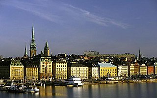
Skeppsbron is both a street and a quay in Gamla stan, the old town of Stockholm, capital of Sweden, stretching from the bridge Strömbron in front of the Royal Palace southward to Slussen.
Kornhamnstorg is a public square in Gamla stan, the old town in central Stockholm, Sweden. Known as Kornhaffn (1427), Jernboen (1586), Åkaretorget (1644), and Kornhampns torget (1651), it is connected to the streets: Munkbroleden, Lilla Nygatan, Stora Nygatan, Torgdragargränd, Funckens Gränd, Triewaldsgränd.
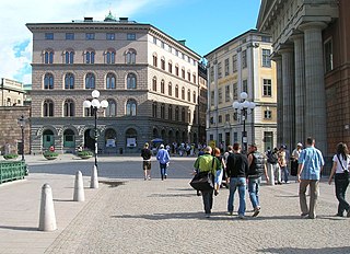
Mynttorget is a public square in Gamla stan, the old town in central Stockholm, Sweden.

Kanslikajen is a quay in Gamla stan, the old town of Stockholm, Sweden, leading west along the southern shore of the canal Stallkanalen from Stallbron and Mynttorget to Vasabron.

Munkbrohamnen is a quay and a footway passing along the western waterfront of Gamla stan, the old town in central Stockholm, Sweden. Stretching along the western side of Centralbron, the motorway and railway bridge passing north-south between the islands Stadsholmen and Riddarholmen, Munkbrohamnen offers pedestrian access from and to the metro station of the old town, and a panoramic view over the bay Riddarfjärden.
Munkbron is a public square on the western waterfront of Gamla stan, the old town in central Stockholm, Sweden. Connected to the square are Stora Gråmunkegränd, Gåsgränd, Lilla Nygatan, Yxsmedsgränd, and Munkbrogatan; while the traffic route Munkbroleden separates it from the canal Riddarholmskanalen. The square is divided into a northern and a southern part by the block Aurora in which the so-called Petersen House is found.
Mälartorget is a public square in Gamla stan, the old town in central Stockholm, Sweden, named after its location on the western waterfront of the old town facing Lake Mälaren. Connected to the square are the streets and alleys Munkbrogatan, Schönfeldts Gränd, Tyska Brinken, and Lejonstedts Gränd, while the traffic route Munkbroleden separates it from the quay. The main exit of the Gamla stan metro station is located on Mälartorget.

Lejonstedts Gränd is an alley in Gamla stan, the old town in central stockholm, Sweden. Stretching from Stora Nygatan to Mälartorget and crossed by Lilla Nygatan, it forms a parallel street to Tyska Brinken and Kornhamnstorg. It is named after the Country marshal (lantmarskalk) and Councillor of the Realm Anders Lejonstedt (1649–1725). Lejonstedt who before knighthood was named Volimhaus, owned the block taking up the north-eastern part of the street in the late-17th century together with his brother Jakob.

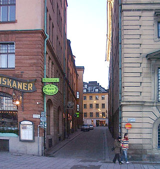
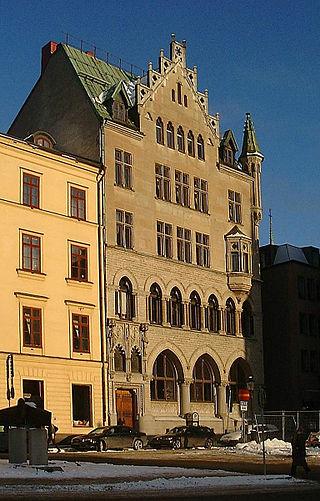
Köpmanbrinken is a street composed of two slopes, in Gamla stan, the old town in central Stockholm, Sweden. Both slopes connect the street Österlånggatan west up to the small Köpmantorget and the street Köpmangatan.

Slottskajen is a quay and a street in Gamla stan, the old town in central Stockholm, Sweden.

Riddarhusgränd is an alley in Gamla stan, the old town in central Stockholm, Sweden. Stretching north from the square Riddarhustorget to the bridge Vasabron, it passes between the Swedish House of Knights (Riddarhuset) and the Bonde Palace forming a parallel street to Rådhusgränd. On either side of its northern end are the quays Riddarhuskajen and Kanslikajen.
Riddarhuskajen is a quay in Gamla stan, the old town in central Stockholm, Sweden. Located north of both the square Riddarhustorget and the House of Knights, it stretches east from the north-western corner of the island Stadsholmen to the bridge Vasabron and the alley Riddarhusgränd. Just west of the quay passes the motorway Centralbron, while the quay Kanslikajen forms an eastward extension leading past Kanslihuset to Stallbron and Mynttorget.
Rådhusgränd is an alley in Gamla stan, the old town in central Stockholm, Sweden. Stretching from the junction between the street Myntgatan and the square Riddarhustorget, and passing between the Bonde Palace and Kanslihuset, it leads north to the bridge Vasabron, while forming a parallel street to Riddarhusgränd. Along the waterfront north of the alley passes the quay Kanslikajen.

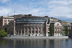
Riksgatan is a street in Gamla stan, the old town in central Stockholm, Sweden. Located on Helgeandsholmen, and passing between the eastern and the western buildings of the Swedish Parliament House, makes it the official address of the Parliament.
Fisketorget or Fiskaretorget is a historical public square in Gamla stan, the old town in central Stockholm, Sweden. It was once located on the east shore of the island Stadsholmen, between the present streets Österlånggatan and Skeppsbron, and between the present alleys Nygränd and Brunnsgränd.