Related Research Articles
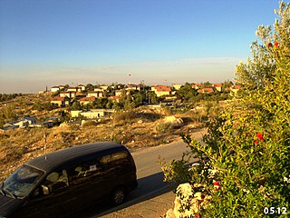
Hilltop, outpost or lot 26, was an illegal outpost, consisting of a mobile home, founded by Netanel Ozeri outside Hebron in the West Bank. It lay approximately 100 metres (330 ft) from the Kiryat Arba settlement, in the Beqa'a valley. At the time of its destruction. Despite court orders, he kept expanding his outpost, refused to bullet-proof the caravan, fence the area he claimed in, or accept protection from the IDF.

Baqa al-Gharbiyye is a predominantly Arab city in the "Triangle" region of Israel near the Green Line. In 2003, Baqa al-Gharbiyye united with the Jatt local council to form Baqa-Jatt, a unification that was dissolved a few years later. The city had a population of 31,397 in 2022.

Kiryat Arba or Qiryat Arba is an urban Israeli settlement on the outskirts of Hebron, in the southern West Bank. Founded in 1968, in 2022 it had a population of 7,490.

Efrat, or previously officially Efrata, is an Israeli settlement in the West Bank, established in 1983 in the Judean Mountains. Efrat is located 12 kilometers (7.5 mi) south of Jerusalem, between Bethlehem and Hebron, 6.5 km (4 mi) east of the Green Line, at the Palestinian side of the West Bank wall. The settlement stands at an altitude of up to 960 metres above sea level and covers about 6,000 dunam. Israeli settlements in the West Bank are illegal under international law.

Giv'at Ze'ev is an urban Israeli settlement in the West Bank, five kilometers northwest of Jerusalem. The settlement was founded in 1977 on the site of the abandoned Jordanian military camp, adjacent to the site of ancient Gibeon. While it lies within the borders of the Matte Binyamin Regional Council, it is a separate municipal entity. In 2022 it had a population of 21,097.
Ma'on is an Israeli settlement organized as a moshav shitufi in the West Bank. Located in the Judean Hills south of Hebron and north of Beersheba, it falls under the jurisdiction of Har Hevron Regional Council. In 2022, it had a population of 607.

Adora is an Israeli settlement organised as a community settlement in the Judean Mountains in the southern West Bank, northwest of Hebron. Established in 1984, the community ideologically identifies with the Herut–Betar farming organization and falls under the jurisdiction of Har Hevron Regional Council. Under the terms of the Oslo Accords of 1993 between Israel and the Palestine Liberation Organization, Adora was designated Area "C" under full Israeli civil and security control. In 2022 its population was 515.

Beit HaShalom, or the Rajabi House, also known as Beit HaMeriva, is a four-story apartment building located in the H-2 Area of Hebron, in the West Bank.
The ongoing conflict between Palestinians and Jewish Israeli settlers in the West Bank city of Hebron is part of the wider Israeli–Palestinian conflict. Hebron has a Palestinian majority, consisting of an estimated 208,750 citizens (2015) and a small Jewish minority, variously numbered between 500 and 800. The H1 sector of Hebron, home to around 170,000 Palestinians, is governed by the Palestinian Authority. H2, which was inhabited by around 30,000 Palestinians, is under Israeli military control with an entire brigade in place to protect some 800 Jewish residents living in the old Jewish quarter. As of 2015, Israel has declared that a number of special areas of Old City of Hebron constitute a closed military zone. Palestinians shops have been forced to close; despite protests Palestinian women are reportedly frisked by men, and residents, who are subjected every day to repeated body searches, must register to obtain special permits to navigate through the 18 military checkpoints Israel has set up in the city center.
Tawani or at-Tuwani is a small Palestinian village in the south Hebron Hills of the Hebron Governorate. Many of the village's residents live in caves. The village is located south-east of the village of Yatta. Approximately one kilometre away lies Tel Tuwani, near the Israeli settlement of Ma’on. Frequent disputes occur between at-Tawani's residents and settlers over land, roads and water resources. The village had a population of 194 residents in 2017.
The 2002 Hebron ambush took place in the Wadi an-Nasara neighborhood in Hebron in the West Bank on 15 November 2002. Israeli forces were subjected to a double attack by fighters from the Palestinian Islamic Jihad. The battle was referred to in Israel as "The attack on the worshippers' route", Hebrew: הפיגוע בציר המתפללים. The place where the attack took place became known as the "Alley of Death" both in Hebrew and Arabic. The ambush was initially dubbed as the "Sabbath massacre" by official Israeli spokespersons.

Jalud is a Palestinian village in the Nablus Governorate in the northern West Bank. It is approximately 30 kilometers (19 mi) south of Nablus and is situated just east of Qaryut, south of Qusra and northeast of Shilo, an Israeli settlement. Its land area consists of 16,517 dunams, 98 of which constitutes its built-up area. Jalud is encircled by four illegal outposts: Esh Kodesh, Adi Ad, Ahiya and Shvut Rachel. Jalud residents were blocked by both IDF forces and settlers from tending most of their farms from 2001 to 2007. In 2007 permission was given to farm their groves, twice a year for a few days, on condition that prior coordinating arrangements are made with the IDF.

Worshippers Way or Prayers Road in Hebron, West Bank is a road linking the Israeli settlement of Kiryat Arba with the Cave of the Patriarchs and with the Jewish settlements in Hebron. The road is used by Israelis and tourists who visit the Cave and the Old City of Hebron. Palestinians are denied vehicular use of the road. The road was expanded after an ambush near Kiryat Arba that took place in November 2002. The expansion required that adjacent Palestinian land be expropriated, which resulted in a legal battle. A number of buildings of architectural and historical value, dating back to the Mamluk-Ottoman period, were also expropriated and destroyed.
Al Baqa or Al Baqa'a, also spelled Al-Beqa or Al baqr, is a Palestinian village located just east of Hebron. It has been occupied by Israel since 1967, together with the rest of the West Bank. It is sandwiched between the Israeli settlements Givat Harsina and Kiryat Arba. Wadi al-Ghrous or Wadi al Gruz is a locality of Hebron that borders Al Baqa on the west.
Al Bowereh or Al-Bweireh, also known as Aqabat Injeleh, is a Palestinian village located just east of Hebron. It is situated adjacent to and north of the Israeli settlement of Givat Harsina. The village is occupied by Israel since 1967, together with the rest of the West Bank.
Wadi al Hussein, sometimes referred to as 'Wadi Nasara, is a wadi east of and adjacent to the city of Hebron. The valley connects the Kiryat Arba settlement with the Israeli-controlled H2 area of Hebron's old city. The borders of the valley are Othman Bin Afan Street, also known as Zion Street or Worshipers' Way in the west; Wadi Al Nassara in the north; the Kiryat Arba fence in the east; Wadi Al Ghrous and the road connecting Kiryat Arba with Zion Street in the south.
List of violent events related to the Israeli-Palestinian conflict occurring in the second half of 2015.
This is a Timeline of events related to the Israeli–Palestinian conflict during 2016.

Givat Harsina, also Ramat Mamre, is an Israeli settlement on the outskirts of the Palestinian city of Hebron, in the Judean Mountains region of the West Bank. Israel officially considers it part of the settlement of Kiryat Arba, and its population statistics are included with those of Kiryat Arba.
References
- 1 2 3 Center of the Storm: A Case Study of Human Rights Abuses in Hebron District, p. 56; Vol. 13, No. 2(E). Human Rights Watch, 1 April 2001. On
- 1 2 3 HEBRON: Creeping Annexation spreading East and West from Wadi al-Ghroos. Jerry Levin, CPT, 9 January 2004
- 1 2 3 The Colony of Kharsina Expands on the Expense of the City of Hebron. POICA, 3 December 2008
- 1 2 3 HEBRON: Further Land Confiscation in Hebron's Beqa'a Valley. Nathan Bender and Dianne Roe, CPT, 25 January 2002
- 1 2 Expanding Settlements Means Removing Palestinian People from their Land: The Story of Baqa'a. Ahmad Jaradat, Ma'an News Agency, 10 April 2008
- ↑ Humanitarian Update for oPt (01-07 October 2003) Archived 4 March 2016 at the Wayback Machine . OCHA, 10 October 2003
- ↑ Israel fences in Wadi el-Ghroos, site of first home demolition CPT witnessed; soldier assaults children. CPT, 12 September 2003
- ↑ OCHAoPt,Humanitarian update 1 December – 15 December 2003 Archived 4 March 2016 at the Wayback Machine , pp. 3-4
- ↑ HEBRON: Creeping Annexation Continues in Wadi al-Ghroos. Jerry Levin, CPT, 19 December 2003
- 1 2 HEBRON: Settlers seize 2000 dunams of Palestinian farmland around Givat HaHarsina Archived 2019-07-26 at the Wayback Machine . Jerry Levin, CPT, 21 January 2004
- 1 2 One hundred settlers gather to violate construction freeze; Israeli soldiers threaten besieged Palestinian family. ISM, 2 September 2010
- ↑ Mitzpe Avihai outpost evacuated again. Efrat Weiss, YnetNews, 16 June 2009
- 1 2 New settlers attack on Al Baqa'a neighborhood Archived 2014-07-14 at the Wayback Machine . POICA, 6 November 2009
- ↑ Several videos of demolition and destruction of agricultural property are published on YouTube:
*"This used to be Paradise", Video of settlers and army, destroying a water system of Atta Jaber in the Baqa'a Valley on 8 June 2009. Christian Peacemaker Teams, 10 September 2009; On:
*Israeli Border Police Destroy Vegetable Fields in Al Baqa'a Valley. CPT, 7 July 2010; On:
*Israeli Authorities Destroy Cistern and Water Infrastructure in the Baqa'a Valley (Hebron) on 19 July 2010. CPT, 20 July 2010
*Illegal Destruction of Water Cistern of Yihya Jaber by israeli forces on 2 May 2012. Palreports, Khalil, 10 May 2012; On: . See also Israeli military demolishes cistern in Beqa’a Valley Archived 2016-03-05 at the Wayback Machine . CPT, 8 May 2012 and palsolidarity - ↑ Israel destroys wells near Hebron. AFP, 2 March 2011
- ↑ Israeli forces demolish water well in Hebron. Ma'an News Agency, 22 October 2012
- ↑ Israeli Civil Administration set to demolish a clinic and 11 homes near Hebron. APJP, 16 February 2008