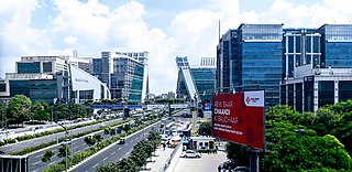
Haryana is a state in India located in the northern-part of the country. It was carved out of the former state of East Punjab on 1 November 1966 on a linguistic basis. It is ranked 21st in terms of area, with less than 1.4% of India's land area. The state capital is Chandigarh and the most populous city is Faridabad, which is a part of the National Capital Region. The city of Gurgaon is among India's largest financial and technology hubs. Haryana has 6 administrative divisions, 22 districts, 72 sub-divisions, 93 revenue tehsils, 50 sub-tehsils, 140 community development blocks, 154 cities and towns, 6,848 villages, and 6,222 villages panchayats.

Rajasthan is a state in northern India. It covers 342,239 square kilometres (132,139 sq mi) or 10.4 percent of India's total geographical area. It is the largest Indian state by area and the seventh largest by population. It is on India's northwestern side, where it comprises most of the wide and inhospitable Thar Desert and shares a border with the Pakistani provinces of Punjab to the northwest and Sindh to the west, along the Sutlej-Indus River valley. It is bordered by five other Indian states: Punjab to the north; Haryana and Uttar Pradesh to the northeast; Madhya Pradesh to the southeast; and Gujarat to the southwest. Its geographical location is 23.3 to 30.12 North latitude and 69.30 to 78.17 East longitude, with the Tropic of Cancer passing through its southernmost tip.

Madhya Pradesh is a state in central India. Its capital is Bhopal, and the largest city is Indore, with Jabalpur, Ujjain, Gwalior, Satna being the other major cities. Madhya Pradesh is the second largest Indian state by area and the fifth largest state by population with over 72 million residents. It borders the states of Uttar Pradesh to the northeast, Chhattisgarh to the southeast, Maharashtra to the south, Gujarat to the west, and Rajasthan to the northwest.

The Godavari is India's second longest river after the Ganga and third largest in India, drains about 10% of India's total geographical area. Its source is in Trimbakeshwar, Nashik, Maharashtra. It flows east for 1,465 kilometres (910 mi), draining the states of Maharashtra (48.6%), Telangana (18.8%), Andhra Pradesh (4.5%), Chhattisgarh (10.9%) and Odisha (5.7%). The river ultimately empties into the Bay of Bengal through an extensive network of tributaries. Measuring up to 312,812 km2 (120,777 sq mi), it forms one of the largest river basins in the Indian subcontinent, with only the Ganga and Indus rivers having a larger drainage basin. In terms of length, catchment area and discharge, the Godavari is the largest in peninsular India, and had been dubbed as the Dakshina Ganga.

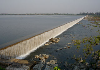
The Kaveri is an Indian river flowing through the states of Karnataka and Tamil Nadu. In Ancient times, It was also called as Ponni in Tamil literature. The Kaveri river rises at Talakaveri in the Brahmagiri range in the Western Ghats, Kodagu district of the state of Karnataka, at an elevation of 1,341 m above mean sea level and flows for about 800 km before its outfall into the Bay of Bengal. It reaches the sea in Poompuhar in Mayiladuthurai district. It is the third largest river – after Godavari and Krishna – in southern India and the largest in the State of Tamil Nadu, which, on its course, bisects the state into North and South.

Jharkhand is a state in eastern India. The state shares its border with the states of Bihar to the north, Uttar Pradesh to the northwest, Chhattisgarh to the west, Odisha to the south and West Bengal to the east. It has an area of 79,710 km2 (30,778 sq mi). It is the 15th largest state by area, and the 14th largest by population. Hindi is the official language of the state. The city of Ranchi is its capital and Dumka its sub-capital. The state is known for its waterfalls, hills and holy places; Baidyanath Dham, Parasnath and Rajrappa are major religious sites. The state was formed in 2000, from the territory that had previously been part of Bihar.

The Beas River is a river in north India. The river rises in the Himalayas in central Himachal Pradesh, India, and flows for some 470 kilometres (290 mi) to the Sutlej River in the Indian state of Punjab. Its total length is 470 kilometres (290 mi) and its drainage basin is 20,303 square kilometres (7,839 sq mi) large.

The Yamuna is the second-largest tributary river of the Ganga by discharge and the longest tributary in India. Originating from the Yamunotri Glacier at a height of 6,387 metres (20,955 ft) on the southwestern slopes of Banderpooch peaks of the Lower Himalaya in Uttarakhand, it travels a total length of 1,376 kilometres (855 mi) and has a drainage system of 366,223 square kilometres (141,399 sq mi), 40.2% of the entire Ganga Basin. It merges with the Ganga at Triveni Sangam, Prayagraj, which is a site of the Kumbh Mela, a Hindu festival held every 12 years.

Wayanad, is an Indian district in the north-east of Kerala state with administrative headquarters at the municipality of Kalpetta. It is the sole Plateau in Kerala. The Wayanad Plateau forms a continuation of Mysore Plateau, which is the southern portion of Deccan Plateau. It is set high on the Western Ghats with altitudes ranging from 700 to 2100 meters. Vellari Mala, a 2,240 m (7,349 ft) high peak situated on the trijunction of Wayanad, Malappuram, and Kozhikode districts, is the highest point in Wayanad district. The district was formed on 1 November 1980 as the 12th district in Kerala by carving out areas from Kozhikode and Kannur districts. About 885.92 sq.km of area of the district is under forest. Wayanad has three municipal towns—Kalpetta, Mananthavady and Sulthan Bathery. There are many indigenous tribals in this area. The Kabini River, which is a tributary of Kaveri River, originates at Wayanad. Wayanad district, along with the Chaliyar valley in neighbouring Nilambur region in Malappuram district, is known for natural Gold fields, which is also seen in other parts of Nilgiri Biosphere Reserve. Chaliyar river, which is the fourth longest river of Kerala, originates in Wayanad plateau. The historically important Edakkal Caves are located in Wayanad district.

The Narmada River, also called the Reva and previously also known as Narbada or anglicised as Nerbudda, is the 5th longest river and overall longest west-flowing river in India, and largest flowing river of the state of Madhya Pradesh. This river flows through Madhya Pradesh and Gujarat states of India. It is also known as "Life Line of Madhya Pradesh and Gujarat" for its huge contribution to the state of Madhya Pradesh and Gujarat in many ways. Narmada rises from Amarkantak Plateau in Anuppur district Madhya Pradesh. It forms the traditional boundary between North India and South India and flows westwards over a length of 1,312 km (815.2 mi) before draining through the Gulf of Khambhat into the Arabian Sea, 30 km (18.6 mi) west of Bharuch city of Gujarat.

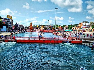
Nashik is an ancient city and the largest city in the northern region of the Indian state of Maharashtra. Situated on the banks of river Godavari, Nashik is the fifth largest city in Maharashtra, after Mumbai, Pune, Nagpur and Thane. Nashik is well known for being one of the Hindu pilgrimage sites of the Kumbh Mela, which is held every 12 years. Nashik is located about 190 km north of state capital Mumbai. The city is called the "Wine Capital of India" as more than half of India's vineyards and wineries are located here. Around 90% of all wine produced in India comes from the Nashik Valley.

The Mahanadi is a major river in East Central India. It drains an area of around 132,100 square kilometres (51,000 sq mi) and has a total length of 900 kilometres (560 mi). Mahanadi is also known for the Hirakud Dam. The river flows through the states of Chhattisgarh and Odisha.

The Hooghly River or the Bhāgirathi-Hooghly, called the 'Ganga' or the 'Kati-Ganga' in mythological texts, is the eastern distributary of the Ganges River in West Bengal, India, rising close to Giria in Murshidabad. It is referred to as an arm of the Ganges in the Encyclopedia Britannica and was previously the major flow of the waters of the Ganga It is because of this reason, people believe the holy waters of the Ganga still flow through the Bhagirathi-Hoogly and hence it is still worshipped today. The other distributary of Ganga then flows into Bangladesh as the Padma. Today there is a man-made canal called the Farakka Feeder Canal connecting the Ganges to the Bhagirathi.

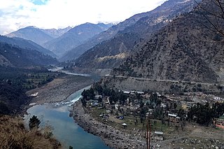
The Chenab River is a major river that flows in India and Pakistan, and is one of the 5 major rivers of the Punjab region. It is formed by the union of two headwaters, Chandra and Bhaga, which rise in the upper Himalayas in the Lahaul and Spiti district of Himachal Pradesh state, India. Chenab flows through the Jammu region of Jammu and Kashmir, India into the plains of Punjab, Pakistan, before flowing into the Indus River near the city of Uch Sharif.

Teesta River is a 414 km (257 mi) long river that rises in the Pauhunri Mountain of eastern Himalayas, flows through the Indian states of Sikkim and West Bengal through Bangladesh and enters the Bay of Bengal. It drains an area of 12,540 km2 (4,840 sq mi). In India, it flows through North Sikkim district, East Sikkim district, Pakyong District, Kalimpong district, Darjeeling District, Jalpaiguri District, Cooch Behar districts and the cities of Rangpo, Jalpaiguri and Mekhliganj. It joins Brahmaputra River at Phulchhari Upazila in Bangladesh. 305 km (190 mi) portion of the river lies in India and rest in Bangladesh. Teesta is the largest river of Sikkim and second largest river of West Bengal after Ganges.

Damodar River is a river flowing across the Indian states of Jharkhand and West Bengal. Rich in mineral resources, the valley is home to large-scale mining and industrial activity. Earlier known as the Sorrow of Bengal because of its ravaging floods in the plains of West Bengal, the Damodar and its tributaries have been somewhat tamed with the construction of several dams. It is the most polluted river of India.

Akola district is a district in the Indian state of Maharashtra. The city of Akola is the district headquarters. Akola district forms the central part of Amravati Division, which was the former British Raj Berar Province.

Dhavaleshwar is a village in the southern state of Karnataka, India. It is located in the Mahalingpur taluk of Bagalkot district in Karnataka. Dhavaleshwar is located on the bank of Ghataprabha river. The river bifurcates the Belgaum and Bagalkot districts. Just on the other side of the river, there is one more village which, is also known as Dhavaleshwar. This Dhavaleshwar belongs to Gokak Taluk of Belgaum district. Many politicians promised to build a bridge between both villages, but no one has initiated. The villagers grow sugar cane, which is the source of their income.


