Notes and references
- ↑ REDACCION (2019-08-02). "El pescado es la principal fuente de alimento en Barrancas del Orinoco". El Periodico del Delta (in Spanish). Retrieved 2021-12-14.
Barrancas del Orinoco | |
|---|---|
| Coordinates: 8°42′07″N62°11′58″W / 8.70194°N 62.19944°W | |
| Country | Venezuela |
| State | Monagas |
| Municipality | Sotillo |
Barranca del Orinoco is the capital of the municipality of Sotillo in the state of Monagas in Venezuela.
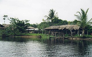
At the site where Barrancas is located today, archaeological objects and utensils have been found that belonged to the so-called Barrancoid and Saladoid cultures, the oldest of which have been dated to 1000 years before the Christian era. The archaeological evidence that has been found (and is still being found) has established that Barrancas has been continuously inhabited since at least the 11th century AD, making it the oldest town in Venezuela and one of the oldest on the American continent.
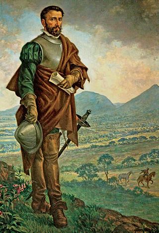
Diego de Ordaz, a Spanish explorer obsessed with finding the legendary site of El Dorado, arrived in the village in August 1531 after traveling up the Orinoco River via the Caño Manamo. Impressed by its number of inhabitants - which he estimated at "more than 400 bohíos" - he decided to descend and meet personally with the cacique "Naricagua", lord of his territories, whose name of the river "Uyapari" was associated with the village. The chronicler Juan de Castellanos, in his famous Elegies of Illustrious Men of the Indies, describes it as "a powerful town with a large crowd on the ravines of the Cacique de Uyapari lordship.
The Aragonese Capuchin friars began to arrive at the end of the 17th century and in 1790, Fray Joaquín de Morata founded the mission of San Rafael Arcángel de Barrancas with the help of aborigines of the Warao ethnic group and built a church. Because of the war of independence, the religious were forced to abandon the village, which nevertheless remained inhabited by the natives. Already in the 20th century, during the presidency of Juan Vicente Gómez, Barrancas experiences a remarkable growth with the arrival of entrepreneurs to install businesses and offer services associated with the growth of oil exploration and production in the Orinoco delta; by mid-century it had become an important cattle production center.
Under the direction of the Corporación Venezolana de Guayana, several hectares of Caribbean pine were planted between Barrancas and the nearby town of Uverito, an activity that significantly boosted the development of the area; By the 1970s it was the most important town and port in the state of Monagas, mainly due to the lack of road connections to the main nearby cities, such as Tucupita (Delta Amacuro) and Puerto Ordaz (Bolívar State), although today it continues to be an important center for the transport of goods and passengers to these cities. A significant part of the local economy has historically been fueled by informal trade with countries such as Guyana and Trinidad and Tobago.
The cuisine typical is the arepa made with maize and river fish. [1]

The Orinoco is one of the longest rivers in South America at 2,140 km (1,330 mi).

El Dorado is commonly associated with the legend of a gold city, kingdom, or empire purportedly located somewhere in the Americas. Originally, El Hombre Dorado or El Rey Dorado, was the term used by the Spanish in the 16th century to describe a mythical tribal chief (zipa) or king of the Muisca people, an indigenous people of the Altiplano Cundiboyacense of Colombia, who as an initiation rite, covered himself with gold dust and submerged himself in Lake Guatavita.

Anzoátegui State is one of the 23 states of Venezuela, located in the northeastern region of the country. Anzoátegui is well known for its beaches that attract many visitors. Its coast consists of a single beach approximately 100 km (62 mi) long. Its capital is the city of Barcelona, and significant cities include Puerto la Cruz and El Tigre.
Valle del Cauca, or Cauca Valley, is a department in western Colombia abutting the Pacific Ocean. Its capital is Santiago de Cali. Other cities such as Buenaventura, Buga, Cartago, Palmira and Tuluá have great economical, political, social and cultural influence on the department's life. Valle del Cauca has the largest number of independent towns with over 100,000 inhabitants in the country, counting six within its borders. Buenaventura has the largest and busiest seaport in Colombia, moving about 8,500,000 tons of merchandise annually.

Barinas State is one of the 23 states of Venezuela. The state capital is Barinas.

Bolívar is one of the 23 states of Venezuela. The state capital city is Ciudad Bolívar and the largest city is Ciudad Guayana. Bolívar State covers a total surface area of 242,801 km2 (93,746 sq mi) and as of the 2011 census, had a population of 1,410,964. The state contains Angel Falls.
Delta Amacuro State is one of the 23 states of Venezuela, and is the location of the Orinoco Delta. The Paria Gulf and the Atlantic Ocean are found to the north, Bolívar State is found to the south, the Atlantic Ocean and Guyana are found to the east, and Monagas State is found to the west. The state capital city is Tucupita.

Guárico State is one of the 23 states of Venezuela. The state capital is San Juan de Los Morros and the largest city is Calabozo, other important city centers include Valle de la Pascua and Zaraza. Guárico State covers a total surface area of 64,986 km2 (25,091 sq mi) and, in 2011, had a census population of 747,739. It is named for the Guárico River.
Monagas State is one of the 23 states of Venezuela.

The Sucre State is one of the 23 states of Venezuela. The state capital is Cumaná city. Sucre State covers a total surface area of 11,800 km2 (4,600 sq mi) and, as of the 2011 census, had a population of 896,921. The most important river in the state is the Manzanares River.

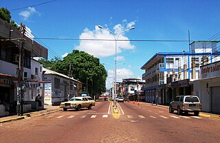
Maturín is a city in Venezuela, the capital of the Venezuelan state of Monagas and a centre for instrumental exploration and development of the petroleum industry in Venezuela. The metropolitan area of Maturín has a population of 401,384 inhabitants. Maturín is also a busy regional transportation hub, connecting routes from the northeastern coast to the Orinoco Delta and the Gran Sabana.
Puerto Ayacucho is the capital and largest city of Amazonas State in Venezuela. Puerto Ayacucho is located across the Orinoco River from the Colombian village of Casuarito.

Ciudad Guayana is a city in Bolívar State, Venezuela. It stretches 40 kilometers along the south bank of the Orinoco river, at the point where it is joined by its main tributary, the Caroní river. The Caroní flows through the city from south to north, dividing it into its predominant halves — the old town of San Félix, to the east, and the newer area of Puerto Ordaz, to the west.

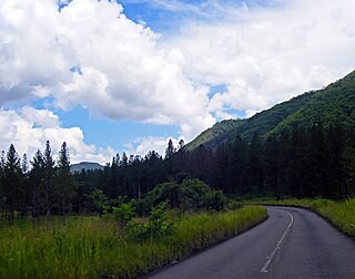
Caripe is a town in Caripe Municipality in the mountainous north of the state of Monagas in eastern Venezuela. The official name of the town is Caripe del Guácharo 'Caripe of the Oilbird', referring to a colony of nocturnal birds which lives in a nearby cave, the Cueva del Guácharo. The species was unknown to science until 1799 when Alexander von Humboldt came to Caripe during his Latin American Expedition.

Municipalities of Venezuela are subdivisions of the States of Venezuela. There are 335 municipalities dividing the 23 states and the Capital District.

The Guayana Region is an administrative region of eastern Venezuela.

Dulce Nombre de Jesús de Petare is a neighborhood in Miranda, Venezuela, and is part of the Metropolitan District of Caracas. It is located in the Sucre Municipality, one of the five divisions of Caracas. The city was founded in 1621 under the name of San Jose de Guanarito. It grew to become a part of the Greater Caracas area as the latter expanded in area and population. Petare had a population of 372,106 inhabitants and about 448,861 according to 2020 estimates. Petare is the biggest slum in Venezuela, and in South America.
Cabruta is a Venezuelan fishing town on the Orinoco river in Las Mercedes Municipality, Guárico State, site of a Jesuit mission, and the site of a proposed bridge across the Orinoco to Caicara, Bolívar State.

San Cristóbal de la Barranca is a town and municipality, in Jalisco in central-western Mexico. The municipality covers an area of 523 km².
The Spanish conquest of the Muisca took place from 1537 to 1540. The Muisca were the inhabitants of the central Andean highlands of Colombia before the arrival of the Spanish conquistadors. They were organised in a loose confederation of different rulers; the psihipqua of Muyquytá, with his headquarters in Funza, the hoa of Hunza, the iraca of the sacred City of the Sun Sugamuxi, the Tundama of Tundama, and several other independent caciques. The most important rulers at the time of the conquest were psihipqua Tisquesusa, hoa Eucaneme, iraca Sugamuxi and Tundama in the northernmost portion of their territories. The Muisca were organised in small communities of circular enclosures, with a central square where the bohío of the cacique was located. They were called "Salt People" because of their extraction of salt in various locations throughout their territories, mainly in Zipaquirá, Nemocón, and Tausa. For the main part self-sufficient in their well-organised economy, the Muisca traded with the European conquistadors valuable products as gold, tumbaga, and emeralds with their neighbouring indigenous groups. In the Tenza Valley, to the east of the Altiplano Cundiboyacense where the majority of the Muisca lived, they extracted emeralds in Chivor and Somondoco. The economy of the Muisca was rooted in their agriculture with main products maize, yuca, potatoes, and various other cultivations elaborated on elevated fields. Agriculture had started around 3000 BCE on the Altiplano, following the preceramic Herrera Period and a long epoch of hunter-gatherers since the late Pleistocene. The earliest archaeological evidence of inhabitation in Colombia, and one of the oldest in South America, has been found in El Abra, dating to around 12,500 years BP.