Related Research Articles

Gloucestershire is a ceremonial county in South West England. It is bordered by Herefordshire to the north-west, Worcestershire to the north, Warwickshire to the north-east, Oxfordshire to the east, Wiltshire to the south, Bristol and Somerset to the south-west, and the Welsh county of Monmouthshire to the west. The city of Gloucester is the largest settlement and the county town.

Avon was a non-metropolitan and ceremonial county in the west of England that existed between 1974 and 1996. The county was named after the River Avon, which flows through the area. It was formed from the county boroughs of Bristol and Bath, together with parts of the administrative counties of Gloucestershire and Somerset.

Kingswood is a town and civil parish in the South Gloucestershire district of the ceremonial county of Gloucestershire, England. The town is situated 3 miles (4.8 km) east-northeast of Bristol.
Easton is an inner city area of the city of Bristol in the United Kingdom. Informally the area is considered to stretch east of Bristol city centre and the M32 motorway, centred on Lawrence Hill. Its southern and eastern borders are less defined, merging into St Philip's Marsh and Eastville. The area includes the Lawrence Hill and Barton Hill estates.
Fishponds is a large suburb in the north-east of the English city of Bristol, about 3 miles (5 km) from the city centre. It has two large Victorian-era parks: Eastville Park and Vassall's Park. The River Frome runs through both with the Frome Valley Walkway alongside it. A restored mill found at Snuff Mills near the Vassall's Park end of the river has kept its original waterwheel, which can still be seen and heard turning. Eastville Park has a large boating lake with central wildlife reserves. Fishponds is mainly residential. Two main bus routes pass through. Housing is typically terraced Victorian. The high street shops include an international supermarket, Asian food store, charity shops, takeaways and Lidl, Aldi and Morrisons supermarkets. It has a small student population from the presence of the Glenside campus of the University of the West of England. The name Fishponds derives from when it was a quarry district, like nearby Soundwell. The empty quarries became large fishponds, which have since been filled in. One remained until the mid-1970s, when it was officially closed: a popular swimming area named "The Lido" by locals. It now belongs to an angling club.

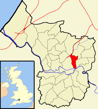
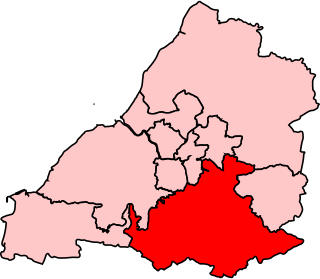
Kingswood is a constituency in South Gloucestershire. It is currently represented in the House of Commons of the UK Parliament by Damien Egan of the Labour Party since 2024.
Wansdyke was a county constituency represented in the House of Commons of the Parliament of the United Kingdom. It elected one Member of Parliament (MP) by the first past the post system of election.

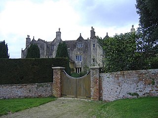
Siston is a small village in South Gloucestershire, England. It is 7 miles (11 km) east of Bristol at the confluence of the two sources of the Siston Brook, a tributary of the River Avon. The village consists of a number of cottages and farms centred on St Anne's Church, and the grand Tudor manor house of Siston Court. Anciently it was bordered to the west by the royal Hunting Forest of Kingswood, stretching westward most of the way to Bristol Castle, always a royal possession, caput of the Forest. The local part of the disafforested Kingswood became Siston Common but has recently been eroded by the construction of the Avon Ring Road and housing developments. In 1989 the village and environs were classed as a conservation area and thus have statutory protection from overdevelopment.
Soundwell, Bristol is a suburb of Bristol, England in the South Gloucestershire District. It is situated between Kingswood and Staple Hill.

Warmley is a village in South Gloucestershire, England.

Kingswood or Kingswood with Burgh Heath is a residential area on the North Downs in the borough of Reigate and Banstead in Surrey, England. Part of the London commuter belt, Kingswood is just to the east of the A217 separating it from Tadworth and has a railway station. Burgh Heath in its north is combined with it to form a ward. Reigate is 3.6 miles (5.8 km) south of its centre and London is 15.5 miles (24.9 km) to the north northeast. Kingswood with Burgh Heath had a population of 6,891 in 2011.
The A420 is a road between Bristol and Oxford in England. Between Swindon and Oxford it is a primary route.

Filton and Bradley Stoke is a constituency represented in the House of Commons of the UK Parliament since 2010 by Jack Lopresti, a Conservative.
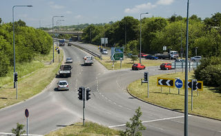
The A4174 is a major ring road in England which runs around the northern and eastern edge of Bristol, mainly in South Gloucestershire, and through the southern suburbs of the city. When it was first conceived it was planned to circle the whole of Bristol, and is commonly referred to as the "Avon Ring Road", or less accurately the "Bristol Ring Road", on road signs. The road does not circle the whole city, instead covering roughly half of the route. It is broken in part where it is concurrent with the A4.

The A431 is an A road running from Bristol to Bath in England. It runs parallel to, and about 3 miles (4.8 km) to the north of, the A4, the principal route between Bristol and Bath on the south side of the River Avon.
Baptist Mills an area of the city of Bristol, England. The name derives from the former mills which stood in that area.
Parkfield Colliery, near Pucklechurch, South Gloucestershire, was sunk in 1851 under the ownership of Handel Cossham. Coal was reached in 1853. The shaft was 840 ft deep, but only the upper series of coal veins were worked. These were the Hard, the Top, the Hollybush and Great veins. The quality of the coal mined was extremely good, and was used for gas manufacture and house coal.

Lodge Causeway is an ancient passage through the former Royal Forest of Kingswood and now the main road between Fishponds and Kingswood in Bristol, England. The road is designated the B4048.
Bradley is a small village in the Stroud District, in the county of Gloucestershire, England.

Two Mile Hill is a small district and parish on the eastern edge of the City of Bristol, just to the west of Kingswood which itself is in South Gloucestershire. Two Mile Hill Primary School is located in the area.
References
- ↑ "Moated site 725m north east of Mount Pleasant Farm". National Heritage List for England. Historic England. Retrieved 18 February 2016.
- ↑ "Footsteps into History - Barrs Court". Bristol Post. 24 November 2009. Retrieved 18 February 2016.[ permanent dead link ]
- ↑ "Mughal Palace - Contact & Map". mughalpalace.co.uk. Retrieved 16 November 2023.