Narayani was one of the fourteen zones of Nepal until the restructuring of zones to Provinces, located in the central south of the country. The headquarters of Narayani are Hetuda. Narayani Zone is named after the Narayani River which is on the western border of the zone, separating it from the Gandaki and Lumbini zones. Narayani means beloved of Narayan which is Parvati his sister, and Narayan refers to Lord Vishnu in the Hindu religion.

Banke District (Nepali: बाँके जिल्लाListen , a part of Lumbini Province, is one of the 77 districts of Nepal. The district, located in midwestern Nepal with Nepalganj as its district headquarters, covers an area of 2,337 km2 and had a population of 385,840 in 2001 and 491,313 in 2011. There are three main cities in the Banke District: Nepalganj, Kohalpur and Khajura Bajaar.

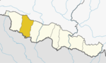
Bara District lies in Province No. 2. It is one of the seventy-seven districts of Nepal. The district, with Kalaiya as its district headquarters, covers an area of 1,190 km2 (460 sq mi) and has a population (2011) of 687,708. Bakaiya, Jamuniya, Pasaha, Dudhaura and Bangari are the main rivers of Bara. The main languages spoken in Bara are Bhojpuri, Bajjika, Tharu and Nepali.

Birgunj is a metropolitan city in Parsa District in Province No. 2 of southern Nepal. It lies 135 km (84 mi) south of the capital Kathmandu, attached in the north to Raxaul in the border of the Indian state of Bihar. As an entry point to Nepal from Patna and Kolkata, it is known as the "Gateway to Nepal". It is also called "Commercial capital of Nepal". The town has significant economic importance for Nepal as most of the trade with India is via Birgunj and the Indian town of Raxaul. Tribhuvan Highway links Birgunj to Nepal's capital, Kathmandu. Birgunj was one of the first three municipalities formed during the rule of Prime Minister Mohan Shumsher Jang Bahadur Rana. It was declared a Metropolitan City on 22 May 2017 along with Biratnagar and Pokhara. Birgunj is currently the second-largest city in the Terai region of Nepal after Biratnagar and Birgunj is the sixth most populated metropolis of the nation.

Hetauda is a sub-metropolitan city in the Makwanpur District of Bagmati Pradesh in central Nepal. It is the administrative headquarters of the Makwanpur District and the Capital of Bagmati Pradesh as declared by majority Provincial Assembly Members on 12 January 2020. It is one of the largest cities of Nepal. At the time of the 2015 Nepal census, it had a population of 153,875 people.

Amlekhganj (Nepali:अमलेखगंज) is a town and Village Development Committee in Bara District in the Narayani Zone of south-eastern Nepal. At the time of the 2011 Nepal census it had a population of 6,709 people living in 1370 individual households. There were 3,413 males and 3,296 females at the time of census. At one time it was famed as the starting point of the Nepal Government Railway (NGR) which connected it with Raxaul in India.
Baghawan ward no 14, sub-metropolitan Kalaiya Bara, Nepal.
Banjariya is a town and Village Development Committee in Bara District in the Narayani Zone of south-eastern Nepal. At the time of the 2011 Nepal census it had a population of 5,999 persons residing in 835 individual households. There were 3,020 males and 2,979 females at the time of census.
Bishnupurwa is a town and Village Development Committee in Bara District in the Narayani Zone of south-eastern Nepal. At the time of the 1991 Nepal census it had a population of 3,606 persons living in 617 individual households.
Dharmanagar is a village and Village Development Committee in Bara District in the Narayani Zone of south-eastern Nepal. At the time of the 2011 Nepal census it had a population of 5,357 persons living in 770 individual households. There were 2,786 males and 2,571 females at the time of census.
Fattepur is a town in Jitpur Simara Sub Metropolitan City in Bara District in the Narayani Zone of south-eastern Nepal. The formerly Village Development Committee was merged to form new municipality on 18 May 2014. Fattepur falls under ward council number 12 of Jitpur Simara Sub Metropolitan City(http://jeetpursimaramun.gov.np/en). At the time of the 2011 Nepal census it had a population of 8,890 persons living in 1,504 individual households. Its elevation is 377 ft.There were 4,521 males and 4,369 females at the time of census.
Inarwasira is a ward of Jeetpursimara sub-metropolitan city in Bara District in the Narayani Zone of south-eastern Nepal. At the time of the 1991 Nepal census, it had a population of 8,588. But now from 2017 election, its population has increased. Now, the population is 15,000 in this ward. It is an important ward of the Jeetpursimara metropolitan city. In this ward some banks like Sana Kishan bank, some saving banks and Exchanges are also have been established. It has a higher secondary school. It has a global road to reach Kalaiya & Jeetpur. The Road is named as Hulaki Marg and is under construction process. The most important thing in this village is a market, called "Inarwa Bazar" and is famous around the area. As a whole, the village is growing day by day.
South Jhitakaiya is a town and Village Development Committee, near by Dewapur- Chowk/Pokhara/Mandir/School/Police Station and Pashah River, Bara District in the Narayani Zone of south-eastern Nepal. At the time of the 1991 Nepal census it had a population of 7,235.
Motisar is a village and Village Development Committee in Bara District in the Narayani Zone of south-eastern Nepal. At the time of the 1991 Nepal census it had a population of 2,633 persons living in 399 individual households.
Pipra Basatpur is a town and Village Development Committee in Bara District in the Narayani Zone of south-eastern Nepal. At the time of the 1991 Nepal census it had a population of 2,922 persons living in 528 individual households.
Raghunathpur is a Village Development Committee in Bara District in the Narayani Zone of south-eastern Nepal. At the time of the 1991 Nepal census it had a population of 3,037 persons residing in 471 individual households.
Damarkhu Shivalaya is a town and Village Development Committee in Khotang District in the Sagarmatha Zone of eastern Nepal. At the time of the 1991 Nepal census it had a population of 3,237 persons living in 602 individual households.
Jeetpursimara is a sub-metropolitan city in Bara District in Province No. 2 of southern Nepal that was formed on 10 March 2017 after merging Gadhimai Municipality, Inarwasira, Amlekhganj, as well as parts of Manharwa, Haraiya and Rampur Tokani to form a new sub-metropolitan city. At the time of the 2011 Nepal census, the former settlements that would make up the sub-metropolitan city had a joint population of 117,094 people living in 21,670 individual households.

Province No. 2 is a province in the southeastern region of Nepal that was formed after the adoption of the Constitution of Nepal. It is Nepal's second most populous province, and smallest province by area. It borders Province No. 1 to the east, Bagmati Pradesh to the north, and India to the south. It has an area of 9,661 km2 (3,730 sq mi)-about 6.5% of the country's total area. With a population of 5,404,145 per the 2011 Census of Nepal, making it most densely populated province of Nepal.