
A plough or plow is a farm tool for loosening or turning the soil before sowing seed or planting. Ploughs were traditionally drawn by oxen and horses but in modern farms are drawn by tractors. A plough may have a wooden, iron or steel frame with a blade attached to cut and loosen the soil. It has been fundamental to farming for most of history. The earliest ploughs had no wheels; such a plough was known to the Romans as an aratrum. Celtic peoples first came to use wheeled ploughs in the Roman era.

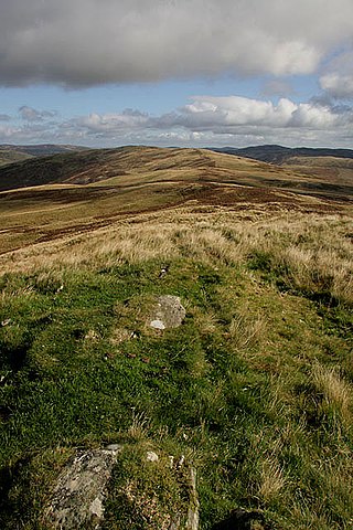
The Highlands is a historical region of Scotland. Culturally, the Highlands and the Lowlands diverged from the Late Middle Ages into the modern period, when Lowland Scots language replaced Scottish Gaelic throughout most of the Lowlands. The term is also used for the area north and west of the Highland Boundary Fault, although the exact boundaries are not clearly defined, particularly to the east. The Great Glen divides the Grampian Mountains to the southeast from the Northwest Highlands. The Scottish Gaelic name of A' Ghàidhealtachd literally means "the place of the Gaels" and traditionally, from a Gaelic-speaking point of view, includes both the Western Isles and the Highlands.

Corn dollies or corn mothers are a form of straw work made as part of harvest customs of Europe before mechanisation.

Perth and Kinross is one of the 32 council areas of Scotland and a lieutenancy area. It borders onto the Aberdeenshire, Angus, Argyll and Bute, Clackmannanshire, Dundee, Fife, Highland and Stirling council areas. Perth is the administrative centre. With the exception of a large area of south-western Perthshire, the council area mostly corresponds to the historic counties of Perthshire and Kinross-shire.

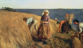
A reaper is a farm implement or person that reaps crops at harvest when they are ripe. Usually the crop involved is a cereal grass. The first documented reaping machines were Gallic reapers that were used in Roman times in what would become modern-day France. The Gallic reaper involved a comb which collected the heads, with an operator knocking the grain into a box for later threshing.
The Lowlands is a cultural and historical region of Scotland.

The Agricultural Revolution in Scotland was a series of changes in agricultural practice that began in the 17th century and continued in the 19th century. They began with the improvement of Scottish Lowlands farmland and the beginning of a transformation of Scottish agriculture from one of the least modernised systems to what was to become the most modern and productive system in Europe. The traditional system of agriculture in Scotland generally used the runrig system of management, which had possibly originated in the Late Middle Ages. The basic pre-improvement farming unit was the baile and the fermetoun. In each, a small number of families worked open-field arable and shared grazing. Whilst run rig varied in its detail from place to place, the common defining detail was the sharing out by lot on a regular basis of individual parts ("rigs") of the arable land so that families had intermixed plots in different parts of the field.
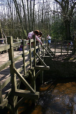
Common land is land owned by a person or collectively by a number of persons, over which other persons have certain common rights, such as to allow their livestock to graze upon it, to collect wood, or to cut turf for fuel.

Ridge and furrow is an archaeological pattern of ridges and troughs created by a system of ploughing used in Europe during the Middle Ages, typical of the open-field system. It is also known as rigand furrow, mostly in the North East of England and in Scotland.

Run rig, or runrig, also known as rig-a-rendal, was a system of land tenure practised in Scotland, particularly in the Highlands and Islands. It was used on open fields for arable farming.

Crofting is a form of land tenure and small-scale food production particular to the Scottish Highlands, the islands of Scotland, and formerly on the Isle of Man. Within the 19th-century townships, individual crofts were established on the better land, and a large area of poorer-quality hill ground was shared by all the crofters of the township for grazing of their livestock. In the 21st century, crofting is found predominantly in the rural Western and Northern Isles and in the coastal fringes of the western and northern Scottish mainland.

Comrie is a village and parish in the southern Highlands of Scotland, towards the western end of the Strathearn district of Perth and Kinross, 7 mi (11 km) west of Crieff. Comrie is a historic conservation village in a national scenic area along the river Earn. Its position on the Highland Boundary Fault explains why it has more earth tremors than anywhere else in Britain. The parish is twinned with Carleton Place, Ontario, Canada.

A harvest festival is an annual celebration that occurs around the time of the main harvest of a given region. Given the differences in climate and crops around the world, harvest festivals can be found at various times at different places. Harvest festivals typically feature feasting, both family and public, with foods that are drawn from crops.

The Highland Clearances were the forced evictions of a significant number of tenants in the Scottish Highlands and Islands, mostly in two phases from 1750 to 1860.
The Scottish people or Scots are an ethnic group and nation native to Scotland. Historically, they emerged in the early Middle Ages from an amalgamation of two Celtic peoples, the Picts and Gaels, who founded the Kingdom of Scotland in the 9th century. In the following two centuries, Celtic-speaking Cumbrians of Strathclyde and Germanic-speaking Angles of Northumbria became part of Scotland. In the High Middle Ages, during the 12th-century Davidian Revolution, small numbers of Norman nobles migrated to the Lowlands. In the 13th century, the Norse-Gaels of the Western Isles became part of Scotland, followed by the Norse of the Northern Isles in the 15th century.
The geography of Scotland in the early modern era covers all aspects of the land in Scotland, including physical and human, between the sixteenth century and the beginnings of the Agricultural Revolution and industrialisation in the eighteenth century. The defining factor in the geography of Scotland is the distinction between the Highlands and Islands in the north and west and the Lowlands in the south and east. The Highlands were subdivided by the Great Glen and the Lowlands into the fertile Central Lowlands and the Southern Uplands. The Uplands and Highlands had a relatively short growing season, exacerbated by the Little Ice Age, which peaked towards the end of the seventeenth century.

Agriculture in Scotland in the Middle Ages includes all forms of farm production in the modern boundaries of Scotland, between the departure of the Romans from Britain in the fifth century and the establishment of the Renaissance in the early sixteenth century. Scotland has between a fifth and a sixth of the amount of the arable or good pastoral land of England and Wales, mostly located in the south and east. Heavy rainfall encouraged the spread of acidic blanket peat bog, which with wind and salt spray, made most of the western islands treeless. The existence of hills, mountains, quicksands and marshes made internal communication and agriculture difficult. Most farms had to produce a self-sufficient diet of meat, dairy products and cereals, supplemented by hunter-gathering. The early Middle Ages were a period of climate deterioration resulting in more land becoming unproductive. Farming was based around a single homestead or a small cluster of three or four homes, each probably containing a nuclear family and cattle were the most important domesticated animal.
A bandwin was a team of agricultural workers in the Scottish Lowlands before the agricultural revolution, who carried out the harvest.

Deil's Dyke, Pict's Dyke or Celt's Dyke in south-west lowland Scotland is a linear earthwork that roughly follows the contours that divide upland pasture from lowland arable land, effectively acting like the head-dykes of medieval and later times although its true purpose has not been settled. The Deil's Dyke, sometimes written as 'dike', is formed from an earthen berm of rounded form that varies from 2.0-4.0m wide and a maximum of 0.7m high sometimes having a stone core. Where a fosse accompanies the bank it is usually an inconsequential 0.5m or so in width on average and around 0.4m deep, more often located on the uphill or outfield side. As a defensive structure the dyke has no obvious military value and its erratic route militates against it being a practical political boundary.