This article needs additional citations for verification .(December 2013) |
Bawai is located in the Rudraprayag tehsil of Rudraprayag district of Uttarakhand, India. It is largest village of Rudraprayag.
This article needs additional citations for verification .(December 2013) |
Bawai is located in the Rudraprayag tehsil of Rudraprayag district of Uttarakhand, India. It is largest village of Rudraprayag.
Bawai has 297 households with a total population of 1329, 622 male and 707 female, making the Sex ratio 1137 females per 1000 males. Overall literacy rate is 88.04% with a male literacy rate of 98.27% and a female literacy rate 79.38%. [1]

Rajsamand is a city, located in Rajsamand Mewar district of Rajasthan, India. The city is named for Rajsamand Lake, an artificial lake created in the 17th century by Rana Raj Singh Rajsamand Udaipur of Mewar. It is the administrative headquarters of Rajsamand District.

Siwan is a city and nagar parishad in the Indian state of Bihar. It is the administrative headquarters of Siwan district and one of the urban settlements out of three in the district. It is located close to Uttar Pradesh.

Devprayag is a town and a nagar panchayat, near New Tehri city in Tehri Garhwal District in the state of Uttarakhand, India, and is the final one of the Panch Prayag of Alaknanda River where Alaknanda meets the Bhagirathi river and both rivers thereafter flow on as the Ganges river or Ganga.

Rudraprayag is a district of the state of Uttarakhand of northern India. The district occupies an area of 1984 km2. The town of Rudraprayag is the administrative headquarters of the district. The district is bounded by Uttarkashi District on the north, Chamoli District on the east, Pauri Garhwal District on the south, and Tehri Garhwal District on the west.
Amanganj is a town and a Nagar Panchayat and a tehsil in Panna district in the state of Madhya Pradesh, India.
Hatod is a town and a nagar parishad in Indore district in the Indian state of Madhya Pradesh.

Karnaprayag is a town and municipal board in the Chamoli District in the Indian state of Uttarakhand. Karnaprayag is one of the Panch Prayag of Alaknanda River, situated at the confluence of the Alaknanda and Pindar River.

Khatima is a city and a municipal board in Udham Singh Nagar district in the Indian state of Uttarakhand.
Lormi is a town and a Municipality and a Tehsil in Mungeli district in the Indian state of Chhattisgarh.
Navinagar is a city cum Nagar Panchayat in Aurangabad district in the Indian state of Bihar, and is the location of Navinagar Super Thermal Power Project.

Narendranagar is a town and a municipal board in Tehri Garhwal district in the Indian state of Uttarakhand.

Rudraprayag is a city and a municipality in Rudraprayag district in the Indian state of Uttarakhand. Rudraprayag is one of the Panch Prayag of Alaknanda River, the point of confluence of rivers Alaknanda and Mandakini. Kedarnath, a Hindu holy city is located 86 km from Rudraprayag. The man-eating Leopard of Rudraprayag hunted and written about by Jim Corbett dwelled here.
Sojat Road is a census town in Sojat tehsil of Pali district in the Indian state of Rajasthan. Sojat Road train station is located on Ajmer-Marwar Junction route and the most convenient method of traveling is by train.
Vadakkuvalliyur is a panchayat town in Tirunelveli district in the Indian state of Tamil Nadu.

Rajnagar is a town and nagar panchayat in Chhatarpur district in the Indian state of Madhya Pradesh, it is 6 km from Khajuraho, 5 km from Khajwa town and 35 km from district headquarters, Chhatarpur.
Pali is a census town in Raigad District in the Indian state of Maharashtra.
Bihar has a total literacy rate of 61.7%. The overall male and female literacy rates are 70.32% and 53.57% respectively. The total rural literacy rate is 43.9%. In rural areas of Bihar, male and female literacy rate is 57.1 and 29.6 respectively. The total Urban literacy rate is 71.9. In urban areas of Bihar, Male and Female literacy rate is 79.9 and 62.6 respectively.. Total number of literates in Bihar is 3,16,75,607 which consists 2,09,78,955 Male and 1,06,96,652 Female. Rohtas has highest Literacy Rate of 73.37% followed by Patna (70.68%) and Bhojpur (72.79%). Sitamarhi has lowest Literacy Rate of 51.08% followed by Purnea (51.18%) and Katihar (52.24%). A recent survey by Pratham rated the receptivity of Bihari children to their teaching as being better than those in other states. Bihar is striving to increase female literacy, now at 53.3%. At the time of independence, women's literacy in Bihar was 4.22%.
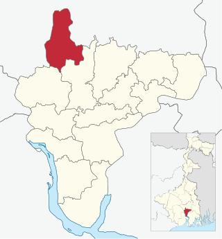
Udaynarayanpur is a community development block that forms an administrative division in Uluberia subdivision of Howrah district in the Indian state of West Bengal.
Atla is a village in Rampurhat I CD Block in Rampurhat subdivision of Birbhum district, West Bengal, India. It is famous for being the birthplace Bamakhepa, a saint of India.

Khemli is a village in Mavli Tehsil in Udaipur district in the Indian state of Rajasthan. It is administrated by Sarpanch who is elected representative of village.