
Saint Julian's is a town in the Central Region of Malta. As of 2020, its registered number of inhabitants stands at 13,792. It is situated along the coast, north of the country's capital, Valletta. It is known for tourism-oriented businesses, such as hotels, restaurants and nightclubs which are centred mainly in an area known as Paceville.

Cardiff city centre is the city centre and central business district of Cardiff, Wales. The area is tightly bound by the River Taff to the west, the Civic Centre to the north and railway lines and two railway stations – Central and Queen Street – to the south and east respectively. Cardiff became a city in 1905.
RÉSO, commonly referred to as the Underground City, is the name applied to a series of interconnected office towers, hotels, shopping centres, residential and commercial complexes, convention halls, universities and performing arts venues that form the heart of Montreal's central business district, colloquially referred to as Downtown Montreal. The name refers to the underground connections between the buildings that compose the network, in addition to the network's complete integration with the city's entirely underground rapid transit system, the Montreal Metro. Moreover, the first iteration of the Underground City was developed out of the open pit at the southern entrance to the Mount Royal Tunnel, where Place Ville Marie and Central Station stand today.

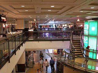
Path is a network of underground pedestrian tunnels, elevated walkways, and at-grade walkways connecting the office towers of Downtown Toronto, Ontario, Canada. It connects more than 70 buildings via 30 kilometres (19 mi) of tunnels, walkways, and shopping areas. According to Guinness World Records, Path is the largest underground shopping complex in the world, with 371,600 square metres (4,000,000 sq ft) of retail space which includes over 1,200 retail fronts (2016). As of 2016, over 200,000 residents and workers use the Path system daily with the number of private dwellings within walking distance at 30,115.

Lombard Bank Malta Plc is one of Malta's major banks, together with Bank of Valletta, HSBC Bank Malta and APS Bank. The Government of Malta through the National Development and Social Fund (NDSF) owns 49.1% percent of the bank. It acquired these shares from the now defunct Cyprus Popular Bank. Over 1,200 shareholders, and investment funds, hold the remaining shares. The Bank has a 71.5% stake in MaltaPost plc., the Maltese national postal operator.

Sliema is a town located on the northeast coast of Malta in the Northern Harbour District. It is a major residential and commercial area and a centre for shopping, bars, dining, and café life. It is also the most densely populated town on the island.

Paceville is a district in St Julian's which is the main nightlife hub in Malta, being heavily populated with nightclubs, bars, stripclubs, pubs and restaurants, it is hence also known as 'Malta's Sin City'. Paceville is located between Spinola Point and Dragonara Point, delimiting Spinola Bay and St. George's Bay respectively. Paceville is seen as a party destination in Europe and is a popular place for locals and tourists alike.
HKR International Limited is a conglomerate headquartered in Hong Kong. The company was founded by Cha Chi-ming, a textile industrialist from Shanghai and one of the pioneers of Hong Kong's industrial boom in the 1950-70s.

Downtown Toronto is the main central business district of Toronto, Ontario, Canada. Located entirely within the district of Old Toronto, it is approximately 16.6 square kilometres in area, bounded by Bloor Street to the northeast and Dupont Street to the northwest, Lake Ontario to the south, the Don Valley to the east, and Bathurst Street to the west. It is also the home of the municipal government of Toronto and the Government of Ontario.

Ġnejna Bay is a popular tourist destination located about 1 kilometer from the village of Mġarr on the western coast of Malta. The beach surrounding the bay is mostly sandy. A secluded strip of shore under the steep cliff on the northern side of the bay is a popular nudist beach, although the practice is technically illegal in Malta and frowned upon by the conservative Catholic population.

Corinthia Hotels Limited (CHL), based in Malta, is the operator and developer for Corinthia hotels in Europe, Africa and The Middle East. CHL operates restaurants such as Rickshaw, and has a spa division. It is wholly owned by International Hotel Investments (IHI).

Cabot Circus is a covered shopping centre in Bristol, England. It is adjacent to Broadmead, a shopping district in Bristol city centre. The Cabot Circus development area contains shops, offices, a hotel, 250 apartments and formerly, a cinema. It covers a total of 139,350 m2 (1,500,000 sq ft) floor space, of which 92,900 m2 (1,000,000 sq ft) is retail outlets and leisure facilities. It opened in September 2008, after a ten-year planning and building project costing £500 million.
As the capital city of Wales, Cardiff is the main engine of growth in the Welsh economy; the city has been developing as a significant service centre and economic driver for the wider south east Wales economy. The city and the adjoining Vale of Glamorgan contribute a disproportionately high share of economic output in Wales. The Cardiff travel to work area has grown significantly since 1991; the 2001-based version includes much of the central South Wales Valleys in addition to the Vale of Glamorgan.
Post codes in Malta are seven-character strings that form part of a postal address in Malta. Post codes were first introduced in 1991 by the mail operator MaltaPost. Like those in the United Kingdom and Canada, they are alphanumeric.

The Portomaso Business Tower is a high-rise office building in Malta. The tower stands in the Portomaso section of St. Julian's, a town just north of Malta's capital city, Valletta. Opened in 2001, the Tower is 97.54 metres (320.0 ft) tall, with 23 floors of mixed commercial office space. It became Malta's tallest building upon its completion, and remained so until 2020 when it was surpassed by the Mercury Tower, also in St. Julian's.

In Malta most of the main roads are in the outskirts of the localities to connect one urban area with another urban area. The most important roads are those that connect the south of the island with the northern part, like Tal-Barrani Road, Aldo Moro Street in Marsa and Birkirkara Bypass.
The Malta Financial Services Authority (MFSA) is a financial regulator of Malta. The MFSA was founded in 2002 when it assumed the responsibilities of the Central Bank of Malta, the Malta Stock Exchange, and the Malta Financial Services Centre. It regulates banking, investment, insurance, financial, pension companies and securities markets in Malta.


