Related Research Articles
Chien may refer to:
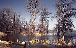
Reelfoot Lake is a shallow natural lake located in the northwest portion of the U.S. state of Tennessee, in Lake and Obion Counties. Much of it is swamp-like, with bayou-like ditches connecting more open bodies of water called basins, the largest of which is called Blue Basin. Reelfoot Lake is noted for its bald cypress trees and its nesting pairs of bald eagles.

Barataria Bay, also Barrataria Bay, is a bay of the Gulf of Mexico, about 15 miles (24 km) long and 12 miles (19 km) wide, in southeastern Louisiana, in Jefferson Parish and Plaquemines Parish, United States. It is separated from the gulf by two barrier islands, Grand Isle and Grand Terre.

Bayou Queue de Tortue is a waterway in the Mermentau River basin of southern Louisiana in the United States. The bayou is 55 miles (89 km) long and is partly navigable.
Armand Bayou is a bayou in U.S. State of Texas. It runs near Galveston Bay in Pasadena and the Clear Lake Area.

The Adams site (15FU4) is a Mississippian culture archaeological site located near Hickman in Fulton County, Kentucky, on Bayou de Chien, a creek that drains into the nearby Mississippi River.
Milburn is an unincorporated community in Carlisle County, Kentucky, United States. Its elevation is 482 feet (147 m), and it is located at 36°47′55″N88°53′59″W. Located along Kentucky Route 80 at its junction with Kentucky Routes 1371 and 1377, Milburn lies amid rolling countryside at the headwaters of Guess Creek, a tributary of Bayou du Chien; the nearest point on the Mississippi River is approximately 12 miles (19 km) to the west. Nearby cities include Arlington, 6 miles (9.7 km) by air to the west, and Bardwell, 8 miles (13 km) by air to the northwest; Milburn is connected to them by Kentucky Route 80 and Kentucky Route 1377 respectively. A state hunting preserve, the Obion Creek Wildlife Management Area, lies 2 miles (3.2 km) to the south. A fire station is located in Milburn, and a Creole cottage in the community, the George W. Stone House, is listed on the National Register of Historic Places.
The White Site is a prehistoric archaeological site located northeast of Hickman in Fulton County in the southwestern corner of the U.S. state of Kentucky. Discovered in the 1980s, it was occupied during a long period of time by peoples of multiple cultures, and it has been named a historic site.
Moscow is an unincorporated community in Hickman County, Kentucky, in the United States.

Kentucky Route 239 (KY 239) is a 10.3-mile-long (16.6 km) state highway in the U.S. state of Kentucky. The highway connects mostly rural areas of Fulton and Hickman counties with the Tennessee state line.
Bennetts Bayou is a stream in the U.S. states of Arkansas and Missouri. The stream source is in Howell County, Missouri, just south of US Route 160 west of Hocomo. The stream flows southwest into Ozark County, Missouri, and under Missouri Route 142 on the east side of Bakersfield. It then flows south through the extreme northwest corner of Fulton County, Arkansas, and into the northwest corner of Baxter County, Arkansas. It continues to the southwest and enters the northeast arm of Norfork Lake to the east of Gamaliel, Arkansas. The similarly named Bennetts River runs subparallel to Bennetts Bayou just to the southeast.
Belmont is a ghost town in Mississippi County, on the eastern border of the U.S. state of Missouri at the Mississippi River. The GNIS classifies it as a populated place under the name "Belmont Landing".
James Bayou Township is an inactive township in Mississippi County, in the U.S. state of Missouri.
St. James Township is an inactive township in Mississippi County, in the U.S. state of Missouri.
Portage Township is an inactive township in New Madrid County, in the U.S. state of Missouri.
St. John Township is an inactive township in New Madrid County, in the U.S. state of Missouri.
Gibson is an unincorporated community in Pemiscot County, in the U.S. state of Missouri.
Pemiscot Township is an inactive township in Pemiscot County, in the U.S. state of Missouri.
Bayou I Township is an inactive township in Ozark County, in the U.S. state of Missouri.
Bayou II Township is an inactive township in Ozark County, in the U.S. state of Missouri.
References
- ↑ U.S. Geological Survey Geographic Names Information System: Bayou de Chien
- ↑ Craig, Berry (May 28, 1990). "Despite French name, bayou is in Kentucky". Daily News. p. 2. Retrieved 29 April 2015.
- ↑ O'Brien, Michael J.; Meeting, Society for American Archaeology. (25 March 1998). Changing Perspectives on the Archaeology of the Central Mississippi Valley. University of Alabama Press. p. 66. ISBN 978-0-8173-0909-1.
36°34′36″N89°11′31″W / 36.5767276°N 89.1920126°W
| | This Fulton County, Kentucky state location article is a stub. You can help Wikipedia by expanding it. |
| | This Graves County, Kentucky state location article is a stub. You can help Wikipedia by expanding it. |
| | This Hickman County, Kentucky state location article is a stub. You can help Wikipedia by expanding it. |