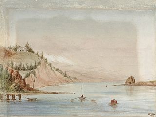
Penzance Bay is a popular bay located in Tennyson Inlet, New Zealand, within the Marlborough Sounds. Tennyson Inlet is an arm of Pelorus Sound / Te Hoiere. The bay is immediately north of Tuna Bay, which is accessed by the same road.

The Boulder Bank is a very unusual naturally formed landform in Nelson, New Zealand. It is a 13 km (8.1 mi) long stretch of rocky substrate which begins at the Mackay Bluff and ends at the Cut of the Nelson Harbour. Haulashore Island was once a part of the Boulder Bank, but the Cut made it an island, and it is no longer connected to the Boulder Bank. The Boulder Bank separates Tasman Bay and the Nelson Haven and is managed as a scenic reserve by the Department of Conservation. Land access is gained along Boulder Bank Drive, signposted at the northern end of Nelson Haven on State Highway 6.

The Rutherford Hotel is a luxury accommodation hotel in Nelson, New Zealand. It is the biggest hotel in Nelson and the city's tallest building. It is part of the chain company Heritage Hotels, which have hotels based in many locations around New Zealand.

Pepin Island is a privately owned tied island in New Zealand connected by a causeway to the settlement of Cable Bay, north-east of Nelson.

Arrow Rock is a small island in Tasman Bay / Te Tai-o-Aorere, off the coast of Nelson, New Zealand. There is a narrow channel between the rock and Haulashore Island. Situated within Nelson Harbour, Arrow Rock was site of the Fifeshire wreck in 1842, which gave the rock its secondary name. There are a number of spotted shags who live on the rock.

Haulashore Island is a small island in Tasman Bay, near Nelson, New Zealand. Formed in 1901, it was at one time a part of Boulder Bank. There is a narrow channel between the island and Arrow Rock. The 0.5 hectares island has had rabbits since its formation; ferrets were released on the island in the 1960s to control the rabbit population.

Tonga Island is a small (0.15 km2) island in Tasman Bay / Te Tai-o-Aorere, off the northern coast of the South Island of New Zealand. It lies within the Abel Tasman National Park, about 1 kilometre (0.62 mi) off Onetahuti Beach. The island has a flourishing fur seal colony, and is surrounded by the Tonga Island Marine Reserve, which was inaugurated in 1993.
Wakatu is an industrial suburb of Nelson in New Zealand.
Bronte, a locality in the Tasman District of New Zealand, lies between Richmond and Māpua.
Brooklands is a suburb in the north of Nelson, New Zealand. It lies on State Highway 6 on the shore of Nelson Haven, between Atawhai and central Nelson. Nelson's largest cemetery, Wakapuaka Cemetery, is located in Brooklands.
Britannia Heights is a major inner suburb of Nelson, New Zealand. It lies on State Highway 6 to the southwest of Nelson city centre, on the shore of Tasman Bay / Te Tai-o-Aorere, between Stepneyville and Tāhunanui.

Stepneyville is a suburb of Nelson, New Zealand.
Tasman Heights is one of the suburbs of Nelson, New Zealand. It lies to the southeast of Nelson city centre, between Wakatu and Moana.

Monaco is a small suburb of Nelson, New Zealand, west of town centre of Stoke. It lies on a narrow peninsula which extends into Tasman Bay / Te Tai-o-Aorere immediately to the south of Nelson Airport, southwest of central Nelson.

Waimea Inlet is a section of Tasman Bay / Te Tai-o-Aorere, in New Zealand's South Island. It is at the southern end of the bay, and separated from it by the partial barriers of Rabbit Island and Bell Island to the west and Monaco Peninsula and the reclaimed land of Nelson Airport to the east. The southern suburbs of Stoke and the town of Richmond lie close to the shore of Waimea Inlet.
Delaware Bay is an indentation in the New Zealand South Island coast east of Pepin Island, to the north of Nelson. It is part of the larger Tasman Bay / Te Tai-o-Aorere. The bay is named after the Delaware, a newly built brig which sank here on its maiden voyage from Nelson to Napier in 1863, an incident best remembered for the dramatic rescue attempts by a group of local Māori.
The Whangamoa Saddle is a pass traversed by State Highway 6 on its route between Blenheim and Nelson, immediately to the east of Hira. One of the two passes on the route, the Whangamoa Saddle lies between the valleys of the Whangamoa and Wakapuaka Rivers south of Delaware Bay. The elevation of the pass is 466 metres (1,529 ft) above sea level. The pass marks part of the boundary between Nelson and Marlborough District.

The Bryant Range is a range of low mountains in the northern South Island of New Zealand. They form part of the boundary of the Nelson and Tasman Districts with Marlborough Region, as well as forming the western boundary of Mount Richmond Forest Park The range is traversed by State Highway 6 at the Rai Saddle close to its northern end.

Dodson Valley is a sub-suburb in Nelson, New Zealand, located by heading north into Atawhai. It borders between the coast Nelson Haven and further inland, featuring the main St. Dodson Valley Road.
Croisilles Harbour is a natural inlet north of Nelson at the westernmost edge of the Marlborough Sounds on the northern coast of New Zealand's South Island. It has two major arms, Okiwi Bay and Squally Cove.


