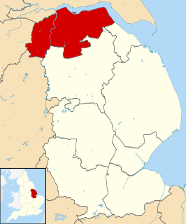
North Lincolnshire is a unitary authority area in Lincolnshire, England, with a population of 167,446 at the 2011 census. There are three significant towns: Scunthorpe, the administrative centre, Brigg and Barton-upon-Humber.

Cleethorpes is a seaside resort on the estuary of the Humber in North East Lincolnshire with a population of nearly 40,000 in 2011. It has been permanently occupied since the 6th century, with fishing as its original industry, then developing into a resort in the 19th century.

Grimsby, also Great Grimsby, is a large coastal English seaport and administrative centre in North East Lincolnshire, on the South Bank of the Humber Estuary, close to where it reaches the North Sea. It ran the largest fishing fleet in the world by the mid-20th century, but fishing declined dramatically after the Cod Wars denied UK access to Icelandic fishing grounds, and the European Union parcelled out fishing quotas in waters within a 200-mile limit of the UK coast to other European countries, in line with its Common Fisheries Policy. Since then Grimsby has suffered post-industrial decline, although food manufacturing has been encouraged since the 1990s. The Grimsby–Cleethorpes conurbation acts as a cultural, shopping and industrial centre for much of northern and eastern Lincolnshire. Grimsby people are called Grimbarians; the term codhead is also used jokingly, often for Grimsby football supporters. Great Grimsby Day is 22 January.
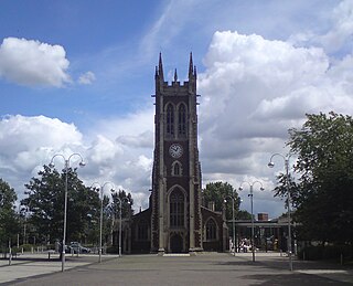
Scunthorpe is an industrial town in North Lincolnshire, England. It is the administrative centre of the North Lincolnshire unitary authority, and had an estimated total resident population of 82,334 according to the 2016 census. A predominantly industrial town, Scunthorpe, the United Kingdom's largest steel processing centre, is also known as the "Industrial Garden Town". It is the third largest settlement in Lincolnshire, after Lincoln and Grimsby. The Member of Parliament for Scunthorpe is Nic Dakin (Labour).

Humberside was a non-metropolitan and ceremonial county in Northern England from 1 April 1974 until 1 April 1996. It was composed of land from either side of the Humber Estuary, created from portions of East Riding of Yorkshire, West Riding of Yorkshire, and the district of Lindsey, Lincolnshire. The county council's headquarters was County Hall at Beverley, inherited from the East Riding, and its largest settlement and only city was Kingston upon Hull. The county stretched from Wold Newton in its northern tip to a different Wold Newton at its most southern point.

The A15 is a major road in England. It runs north from Peterborough via Market Deeping, Bourne, Sleaford and Lincoln along a variety of ancient, Roman, and Turnpike alignments before it is interrupted at its junction with the M180 near Scawby. The road restarts 10 miles (16 km) east, and then continues north past Barton-upon-Humber, crossing the Humber on the Humber Bridge before terminating at Hessle near Kingston upon Hull.

The Parts of Lindsey are a traditional division of Lincolnshire, England, covering the northern part of the county. The Isle of Axholme, which is on the west side of the River Trent, has normally formed part of it. The district's name originated from the Kingdom of Lindsey of Anglo-Saxon times, whose territories were merged with that of Stamford to form Lincolnshire.

Market Deeping is a market town and civil parish in the South Kesteven district of Lincolnshire, England, on the north bank of the River Welland and the A15 road. The population of the town at the 2011 census was 6,008.

Cleethorpes is a constituency created in 1997, represented in the House of Commons of the UK Parliament since 2010 by Martin Vickers of the Conservative Party.

The Barton line is a railway line in North and North East Lincolnshire, England. It runs from Barton-upon-Humber south east to Cleethorpes and was designated by the Department for Transport as a community rail line in February 2007. Barton station is near to the Humber Bridge. It is situated on the south bank of the Humber Estuary.
Lincolnshire is one of the few counties within the UK that still uses the eleven-plus to decide who may attend grammar school, in common with Buckinghamshire and Kent.
Brigg was a county constituency centred on the town of Brigg in North Lincolnshire. It returned one Member of Parliament (MP) to the House of Commons of the Parliament of the United Kingdom, elected by the first-past-the-post voting system.

KCFM is an Independent Local Radio station serving Kingston upon Hull and the East Riding of Yorkshire. This new licence was advertised by Ofcom in 2006. It was owned by the Lincs FM Group, but in early 2019 it was sold on to Nation Broadcasting.
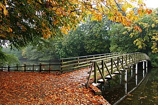
Hartsholme Country Park lies about 3 miles (5 km) southwest of the city centre of Lincoln in the East Midlands of England. Access is from the Skellingthorpe Road (B1378).
The Pods is a leisure centre in Scunthorpe. The leisure centre offers a wide range of modern facilities, including two swimming pools, a state of the art gym, a dance studio, a café and a crèche. The leisure centre is located in the town's Central Park near Ashby Road.
The south bank of the Humber Estuary in England is a relatively unpopulated area containing large scale industrial development built from the 1950s onward, including national scale petroleum and chemical plants as well as gigawatt scale gas fired power stations.
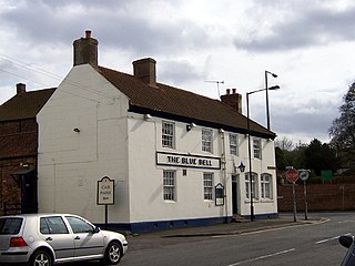
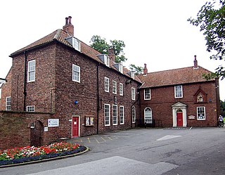
The Blue Bell is a grade II listed building and former public house in Barton-upon-Humber, North Lincolnshire, UK.