Bdwah Dam

Last updated

Bdwah dam
Saudi Arabia relief location map.jpg
Red pog.svg
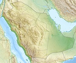
Location of Bdwah dam in Saudi Arabia
Country Saudi Arabia
Location Asir
Coordinates 19°41′47″N42°29′15″E / 19.69639°N 42.48750°E / 19.69639; 42.48750
PurposeFlood control
Opening date2002;21 years ago (2002)
Owner(s) Ministry of Environment, Water and Agriculture (Saudi Arabia)

The Bdwah dam is a dam in Saudi Arabia opened in 2002 and located in Asir region. The main purpose of the dam is flood control. [1]


See also


Related Research Articles

<span class="mw-page-title-main">Najran Province</span> Administrative region of Saudi Arabia

Najran is a province of Saudi Arabia, located in the south of the country. It has an area of 149,511 km². Its capital is Najran.

<span class="mw-page-title-main">Provinces of Saudi Arabia</span> Administrative regions of the Arabian Kingdom

The Provinces of Saudi Arabia, also known as Regions, and officially the Emirates of the Provinces of the Kingdom of Saudi Arabia, are the 13 first-level administrative divisions of the Kingdom of Saudi Arabia.

<span class="mw-page-title-main">Tabuk, Saudi Arabia</span> City in Tabuk, Saudi Arabia

Tabuk is the capital city of the Tabuk Region in northwestern Saudi Arabia. It has a population of 667,000. It is close to the Jordan–Saudi Arabia border and houses the largest air force base in Saudi Arabia.

<span class="mw-page-title-main">Abha</span> Capital governorate of Asir Region in Saudi Arabia

Abha is the capital of 'Asir Region in Saudi Arabia. It is situated 2,270 metres above sea level in the fertile Asir Mountains of south-western Saudi Arabia, near Asir National Park. Abha's mild climate makes it a popular tourist destination for Saudis. Saudis also call the city the Bride of Mountain due to its position above the sea.

<span class="mw-page-title-main">Irrigation in Saudi Arabia</span>

Center pivot irrigation in Saudi Arabia is typical of many isolated irrigation projects scattered throughout the arid and hyper-arid regions of the Earth. Nonrenewable fossil water is mined from depths as great as 1 km (3,000 ft), pumped to the surface, and distributed via large center pivot irrigation feeds. The circles of green irrigated vegetation may comprise a variety of agricultural commodities from alfalfa to wheat. Diameters of the normally circular fields range from a few hundred meters to as much as 3 km (1.9 mi).

Bisha, also known as Qal`at Bishah, is a town in the south-western Saudi Arabian province, 'Asir. Bisha was its own province before merging with its neighboring province, 'Asir. Bisha has a population of 205,346 according to the 2010 Census, with nearly 240 villages and 58 larger settlements that are spread out on both sides of the Bisha Valley. The city is located to the south of the Arabian Peninsula, which is almost entirely under the administration of the Kingdom of Saudi Arabia. It stands at an altitude of approximately 610 meters (2,000 ft.) above sea level.

al-H̨āyir, Al Ha'ir, Ha'ir or Hayer is a small town in Riyadh Province, Saudi Arabia. It is located 208 kilometres (129 mi) by road northwest of Riyadh, in the valley known as Wadi Hanifa. As of the 2004 census it had a population of 13,473 people. The Ha'ir dam serves the area, and it also contains Ha'ir prison.

<span class="mw-page-title-main">Najran Valley Dam</span> Dam in Wadi Najran, Najran Province

The Najran Valley Dam is an arch dam on Wadi Najran about 15 km (9.3 mi) southwest of Najran, in the Najran Province of southwest Saudi Arabia. It has several purpose to include water supply, flood control and groundwater recharge. Its collects run-off and sediment in the wadi and helps release it downstream slowly throughout the year. The dam was completed in 1981, and inaugurated by the Crown Prince of Saudi Arabia Nayef bin Abdulaziz Al Saud in 1982. It is owned by the Ministry of Water and Electricity.

<span class="mw-page-title-main">Jizan Dam</span> Dam in Abu `Arish, Jizan Province

The Jizan Dam, also spelled Jazan, is a gravity dam on Wadi Jizan about 16 km (9.9 mi) northeast of Abu `Arish in Jizan Province of southwest Saudi Arabia. It has several purpose to include irrigation and flood control. Located in a desert, the dam collects run-off and stores it for periodic releases downstream. Water released from the dam is distributed by two diversion dams downstream for the irrigation of 8,000 ha of land. Crops grown include sorghum with eucalyptus and tamarisk grown for anti-desertification. The dam was completed in 1970 and is owned by the Ministry of Water and Electricity.

The Aayash Dam is a dam in Saudi Arabia opened in 2005 and located in Asir region. The main purpose of the dam is flood control.

The Al-Alab dam is a dam in Saudi Arabia opened in 1974 and located in Riyadh region. The main purpose of the dam is flood control.

The Araer dam is a dam in Saudi Arabia opened in 1985 and located in Asir region. The main purpose of the dam is flood control.

The Arda dam, also known as the Wadi Arda dam, is a dam in Saudi Arabia opened in 1984 and located in Tayif city of Mecca region. The main purpose of the dam is flood control. The estimated cost of the dam is SR140 million.

The Ashran dam is a dam in Saudi Arabia opened in 1985 and located in Asir region. The main purpose of the dam is flood control.

The Assadir dam is a dam in Saudi Arabia opened in 1982 and located in Al Baha region. The main purpose of the dam is irrigation.

The Fareah dam is a dam in Saudi Arabia opened in 1982 and located in Madinah region. The main purpose of the dam is flood control.

The Hatheam dam is a dam in the Asir region of Saudi Arabia that opened in 1984. The main purpose of the dam is flood control.

The Hareeq dam is a dam in Saudi Arabia opened in 1984 and located in Riyadh region.

References

  1. "GeoNetwork - the portal to spatial data and information". Archived from the original on 14 November 2012. Retrieved 28 October 2019.{{cite web}}: CS1 maint: bot: original URL status unknown (link)