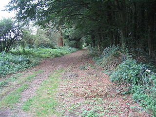
The Peddars Way is a long distance footpath that passes through Suffolk and Norfolk, England.

Knettishall Heath is a 91.7-hectare (227-acre) biological Site of Special Scientific Interest west of Knettishall in Suffolk. A larger area of 176 hectares is the Knettishall Heath Nature Reserve, which is managed by the Suffolk Wildlife Trust.

Breckland is a local government district in Norfolk, England. Its council is based in Dereham, although the largest town is Thetford. The district also includes the towns of Attleborough, Swaffham and Watton, along with numerous villages and surrounding rural areas.
Beacon Hill may refer to:

Colkirk is a village situated about two miles south of Fakenham in the county of Norfolk, England. Dating from at least the time of the Domesday Book. The village including Oxwick, Pattesley and South Raynham currently (2011) has 588 inhabitants living in 266 dwellings. The village has a church,, in the north west corner of the village, a Village Hall, a church pond, a Camping Land. There is also a thriving village school for students from the age of four to eleven, a lively village Pub called "The Crown" and a playing field for soccer, cricket, rounders and school sports days.

Oxwick is a hamlet in the English county of Norfolk. It lies close to the source of the River Wensum and lies one mile south of the village of Colkirk.

Gateley is a village and civil parish in the Breckland district of Norfolk, England.
Pattesley is a village in the English county of Norfolk, about one mile (1.6 km) south of the village of Oxwick. It consists of a few scattered houses. The population is included in the civil parish of Colkirk.

The Bloodgate Hill Iron Age Fort is an Iron Age hill fort in Norfolk, England, situated on a hill above the village of South Creake in the north of the county. The meaning of the name Bloodgate is unknown, but is taken from the road that runs from the fort to the village.
Ralph Tatham was an English academic and churchman.

North Elmham railway station served the village of North Elmham in the English county of Norfolk. The station was part of the Wymondham to Wells Branch and is part of a section of the line being restored by the Mid-Norfolk Railway from Dereham to County School.

Tittleshall is a village and civil parish in the English county of Norfolk.

Fakenham East railway station was a railway station in the market town of Fakenham in the English county of Norfolk.
Thursford railway station was a station in Norfolk, England on the Midland and Great Northern Joint Railway line between Melton Constable and South Lynn. It was closed in 1959 along with the rest of the line. It served the settlement of Thursford, where Station Road remains as a reminder.

Honeypot Wood is a 9.5-hectare (23-acre) biological Site of Special Scientific Interest west of Dereham in Norfolk. It is managed by the Norfolk Wildlife Trust

Ringstead Downs is a 6.9-hectare (17-acre) biological Site of Special Scientific Interest east of Hunstanton in Norfolk. It is in the Norfolk Coast Area of Outstanding Natural Beauty, and it is the western part of the 11-hectare (27-acre) Ringstead Downs nature reserve, which is managed by the Norfolk Wildlife Trust.

Beetley and Hoe Meadows is an 11.4-hectare (28-acre) biological Site of Special Scientific Interest north of Dereham in Norfolk, United Kingdom. The site is in two nearby areas, and Hoe Meadow is part of Hoe Rough nature reserve, which is managed by the Norfolk Wildlife Trust

Potter and Scarning Fens, East Dereham is a 6.2-hectare (15-acre) biological Site of Special Scientific Interest south of Dereham in Norfolk. It is part of the Norfolk Valley Fens Special Area of Conservation. Scarning Fen is a Nature Conservation Review site, Grade I, and it is managed by the Norfolk Wildlife Trust.

Snettisham Carstone Quarry is an 11-hectare (27-acre) biological Site of Special Scientific Interest north of King's Lynn in Norfolk. It is in the Norfolk Coast Area of Outstanding Natural Beauty.

Swangey Fen, Attleborough is a 48.4-hectare (120-acre) biological Site of Special Scientific Interest south-west of Attleborough in Norfolk. It is part of the Norfolk Valley Fens Special Area of Conservation.
This page is based on this
Wikipedia article Text is available under the
CC BY-SA 4.0 license; additional terms may apply.
Images, videos and audio are available under their respective licenses.


