Angleworm Lake is an unorganized territory in Saint Louis County, Minnesota, United States. As of the 2000 census, the unorganized territory had a total population of 0.
Sunday Lake is an unorganized territory located in Saint Louis County, Minnesota, United States. As of the 2000 census, its population was zero.

The Boundary Waters, also called the Quetico-Superior country, is a region of wilderness straddling the Canada–United States border between Ontario and Minnesota, in the region just west of Lake Superior. This region is part of the Superior National Forest in northeastern Minnesota, and in Canada it includes La Verendrye and Quetico Provincial Parks in Ontario. Voyageurs National Park in Minnesota may also be considered part of the Boundary Waters. The name "Boundary Waters" is often used in the U.S. to refer specifically to the U.S. Wilderness Area protecting its southern extent, the Boundary Waters Canoe Area Wilderness.

The Arrowhead Region is located in the northeastern part of the U.S. state of Minnesota, so called because of its pointed shape. The predominantly rural region encompasses 10,635.26 square miles (27,545.2 km2) of land area and includes Carlton, Cook, Lake and Saint Louis counties. Its population at the 2000 census was 248,425 residents. Aitkin, Itasca, and Koochiching counties are also sometimes considered as part of the region. This would increase the land area to 18,221.97 square miles (47,194.7 km2) and the population to 322,073 residents.
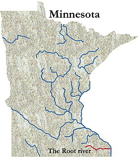
The Root River flows for 80 miles (130 km) through the Driftless Area of southeastern Minnesota and is a tributary of the Upper Mississippi River. It is an excellent river for canoeing. The gentle to moderate flowing river drops an average of 3.4 ft/mile from Chatfield, Minnesota, to its pour point in the Mississippi River into Navigation Pool 7 just south of La Crosse, Wisconsin.
The Snake River is a tributary of the Red River of the North in northwestern Minnesota in the United States. It is one of three streams in Minnesota with this name.
KXLC is a radio station licensed to La Crescent, Minnesota, serving the La Crosse, Wisconsin area. The station is owned by Minnesota Public Radio (MPR), and airs MPR's "News and Information" network, originating from KNOW in Minneapolis/St. Paul.
The Basswood River is a river that forms part of the Canada–United States border between Minnesota and Ontario.
The Bottle River is a river that forms part of the Canada–United States border between Minnesota and Ontario.

The Caribou River is a 15.0-mile-long (24.1 km) river in northern Minnesota, the United States. It rises in a swamp about .6 miles (1 km) south of Morris Lake and two miles (3.2 km) east of Echo Lake, near the Lake/Cook County line, at an altitude about 1620 feet above sea level. It descends some 1,020 feet in elevation as it flows south to its mouth at Lake Superior, also near the eastern border of Lake County.
The Horse River is a river of Minnesota.
The Island River is a river of Minnesota.
The Knife River (Minnesota–Ontario) is a river of Minnesota and Ontario.
The Little Isabella River is a small stream in Superior National Forest, a United States National Forest in the U.S. state of Minnesota. The stream runs through Stony River Township, which is part of Lake County. The Little Isabella River Campground, which is operated by the United States Forest Service, is about 5 miles (8.0 km) north of Isabella, Minnesota, an unincorporated community.
The Little Knife River (West) is a 7.4-mile-long (11.9 km) river in St. Louis County, Minnesota, United States. It is a tributary of the Knife River. A second Little Knife River flows into the Knife River from the east, in Lake County.
The Perent River is a river of Minnesota.
The Range River is a river of Minnesota.
The Shagawa River is a river of Minnesota. The river flows through the east–central part of Morse Township in northern Saint Louis County.

Beartrap Canyon Wilderness is a 40-acre (0.2 km2) wilderness area in the US state of Utah. It was designated March 30, 2009, as part of the Omnibus Public Land Management Act of 2009. Located adjacent to the Kolob Canyons region of Zion National Park, it encompasses and protects part of Beartrap Canyon Creek, a tributary of the Wild & Scenic Virgin River. Beartrap Canyon Wilderness is bordered by the Zion Wilderness to the east.
Rush Creek is a stream in Fillmore and Winona counties, in the U.S. state of Minnesota. It is a tributary of the South Branch Root River.
