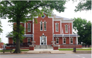
Washington County is a county located in the U.S. state of Illinois. As of the 2020 census, it had a population of 13,761. Its county seat is Nashville. It is located in the southern portion of Illinois known locally as "Little Egypt".

Perry County is a county in Illinois. According to the 2020 census, it had a population of 20,945. Its county seat is Pinckneyville. It is located in the southern portion of Illinois known as "Little Egypt".

The White River is an American two-forked river that flows through central and southern Indiana and is the main tributary to the Wabash River. Via the west fork, considered to be the main stem of the river by the U.S. Board on Geographic Names, the White River is 362 miles (583 km) long. Indiana's capital, Indianapolis, is located on the river. The two forks meet just north of Petersburg and empty into the Wabash River at Mount Carmel, Illinois.

The St. Joseph River is an 86.1-mile-long (138.6 km) tributary of the Maumee River in northwestern Ohio and northeastern Indiana in the United States, with headwater tributaries rising in southern Michigan. It drains a primarily rural farming region in the watershed of Lake Erie.

The Etowah River is a 164-mile-long (264 km) waterway that rises northwest of Dahlonega, Georgia, north of Atlanta. On Matthew Carey's 1795 map the river was labeled "High Town River". On later maps, such as the 1839 Cass County map, it was referred to as "Hightower River", a name that was used in most early Cherokee records.
Salt Creek is a 43.4-mile-long (69.8 km) stream in northeastern Illinois. It is an important tributary of the Des Plaines River, part of the Illinois River and ultimately the Mississippi River watersheds. It rises in northwest Cook County at Wilke Marsh in Palatine and flows in a meandering course generally southward through DuPage County, returning to central Cook County and emptying into the Des Plaines River in Riverside, Illinois. Most of the creek's watershed is urbanized, densely populated and flood-prone.
The Big Muddy River is a 156-mile-long (251 km) river in southern Illinois. It joins the Mississippi River just south of Grand Tower. The Big Muddy has been dammed near Benton, forming Rend Lake.

The Embarras River is a 195-mile-long (314 km) tributary of the Wabash River in southeastern Illinois in the United States. The waters of the Embarras reach the Gulf of Mexico via the Wabash, Ohio, and Mississippi Rivers. The river drains a watershed around 1,566,450 acres (6,339.2 km2) in an agricultural region. It arises near Champaign-Urbana and flows south to near Vincennes, Indiana. The name comes from French explorers, who used the French word, embarras, for river navigation obstacles, blockages, and difficulties relating to logjams.
Carp River is a 40.2-mile-long (64.7 km) river in Chippewa and Mackinac counties in the U.S. state of Michigan. 21.7 miles (34.9 km) of the river were added to the National Wild and Scenic Rivers System in 1992.
Casey Creek is a major tributary of the Big Muddy River in Illinois, United States. It is about 39.0 miles (62.8 km) long, measured from the junction of its arm of Rend Lake with the arm formed by the Big Muddy River.
The Mazon River or Mazon Creek, is a tributary of the Illinois River in the United States. The confluence is near Morris, Illinois.
Henderson Creek is a 64.6-mile-long (104.0 km) tributary of the Mississippi River, which it joins in Henderson County, Illinois, near the villages of Gladstone and Oquawka.
Somonauk Creek is a tributary of the Fox River, which it joins in the Northville Township part of Sheridan, Illinois, United States. Somonauk Creek is approximately 36 miles (58 km) in length, and its source is 3.5 mi (6 km) north of Waterman. It has been dammed to form Lake Holiday, south of the village of Somonauk. The lake is the second lake in the City of Sandwich, with the first, Lake Davis, having been drained in the early 1900s to create usable farmland. The community later needed a lake to replace the one it lost, so in agreement with the Village of Somonauk, the community decided to place a dam on Somonauk Creek to form the new lake. The lake was marketed to the suburbs of Chicago as a recreation spot, with the community later making it a permanent subdivision, with housing located around the whole lake.
Salt Creek is a major tributary to the Sangamon River, which it joins at the boundary between Mason and Menard County, Illinois. There are at least two other Salt Creeks in Illinois, Salt Creek, and in Effingham County, Illinois.
Salt Creek is a tributary of the Little Wabash River, which it joins near Edgewood, Illinois, near the boundary between Effingham and Clay counties. There are at least two other "Salt Creeks" in Illinois: Salt Creek and Salt Creek.

Stillman Creek, also known during different eras as Mud Creek, Old Man's Creek, Sycamore Creek, and Stillman's Run, is part of the Rock River watershed, and located in Ogle County, Illinois, United States. The stream was named for Isaiah Stillman, who also lent his name to the village of Stillman Valley, Illinois, which lies along the creek.
Indian Creek, also known as Big Indian Creek, is a 51.5-mile-long (82.9 km) tributary of the Fox River in Lee, LaSalle, and DeKalb counties in Illinois.
Sturgeon River is a 63.6-mile-long (102.4 km) river in the U.S. state of Michigan, flowing mostly southward through Alger County and Delta County counties on the Upper Peninsula.
Owens Creek is a 15.0-mile-long (24.1 km) stream in the Kishwaukee River watershed in northern Illinois. It is a tributary of the South Branch Kishwaukee River.
Beaucoup is an unincorporated community in Beaucoup Township, Washington County, Illinois, United States. Beaucoup is located along the Evansville Western Railway near Illinois Route 15, 4.8 miles (7.7 km) east of Nashville. On October 12, 1948, Thomas E. Dewey gave a speech to a crowd of 1,000 during his presidential campaign.
