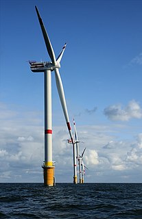
The M62 is a 107-mile-long (172 km) west–east trans-Pennine motorway in Northern England, connecting Liverpool and Hull via Manchester and Leeds; 7 miles (11 km) of the route is shared with the M60 orbital motorway around Manchester. The road is part of the unsigned Euroroutes E20 and E22.

The M7 motorway is a motorway in Ireland. The motorway runs continuously from the outskirts of Naas in County Kildare to Rossbrien on the outskirts of Limerick City. The M7 forms part of the Dublin to Limerick N7 national primary road. The section of the motorway bypassing Naas, an 8 km stretch, was the first section of motorway to open in the Republic of Ireland, in 1983. Following substantial works to extend the M7 to Limerick; by the end of 2010, the motorway replaced all of the old single-carriageway N7 route which is now designated as R445. At 166.5 km, the M7 is the longest motorway in Ireland.

The A48 is a major trunk road in Great Britain. It runs from the A40 at Highnam, 3 miles (4.8 km) west of Gloucester, to the A40 at Carmarthen. Before the Severn Bridge opened on 8 September 1966, it was the principal route between South Wales and South West England. For most of its journey through South Wales, it runs almost parallel to the M4 motorway. During times of high winds at the Severn Bridge, the A48 is used as part of the diversion route and is still marked as a Holiday Route.
The A595 is a primary route in Cumbria, in Northern England that starts in Carlisle, passes through Whitehaven and goes close to Workington, Cockermouth and Wigton. It passes Sellafield and Ravenglass before ending at the Dalton-in-Furness by-pass, in southern Cumbria, where it joins the A590 trunk road. The road is mostly single carriageway, apart from in central Carlisle, where it passes the castle as a busy dual carriageway road named Castle Way, and prior to that as Bridge Street and Church Street, where it passes close to the McVitie's or Carr's biscuit factory. The Lillyhall bypass is also dual carriageway.

Weston under Penyard is a small village in Herefordshire, England. The population of the Civil Parish at the 2011 Census was 1,007.

Leominster (district) was a local government district in England from 1 April 1974 to 1 April 1998 with its administrative seat in the town of Leominster.

The River Bandon is a river in County Cork, Ireland. It rises at Nowen Hill, to the north of Drimoleague. The river then flows to Dunmanway, before turning eastward towards the twin villages of Ballineen and Enniskean. It then makes its way through the centre of Bandon town, and on to Innishannon and Kilmacsimon, before draining into Kinsale Harbour on Ireland's south coast.

The A4174 is a major ring road in England which runs around the northern and eastern edge of Bristol, mainly in South Gloucestershire, and through the southern suburbs of the city. When it was first conceived it was planned to circle the whole of Bristol, and is commonly referred to as the "Avon Ring Road", or less accurately the "Bristol Ring Road", on road signs. The road does not circle the whole city, instead covering roughly half of the route. It is broken in part where it is concurrent with the A4.

Garway (Llanwrfwy) is a civil parish in south-west Herefordshire, England. The population of the civil parish was at the 2011 census 430. It is set on a hillside above the River Monnow about 10 km northwest of Monmouth. It is a sparsely populated area, mainly agricultural in nature. There are several small centres of population: Garway, Broad Oak, The Turning and Garway Hill.
The R136 road is a regional road in Ireland, located in the southwest of Dublin. Named the Outer Ring Road, the route, which is dual carriageway, runs from the N4 at Lucan to the N81 at Tallaght, bypassing west of Clondalkin and crossing the N7 near Citywest. It was built as part of the planning for the new town of Adamstown.

The Bristol and Bath Railway Path is a 15-mile (24 km) off-road cycleway, part of National Cycle Network National Cycle Route 4. It has a 3-metre (9.8 ft) wide tarmacked surface, and was used for 2.4 million trips in 2007, increasing by 10% per year.

Whipsnade is a small village and civil parish in the county of Bedfordshire. It lies on the eastward tail spurs of the Chiltern Hills, about 2.5 miles south-south-west of Dunstable. It is the home of Whipsnade Tree Cathedral, as well as the famous ZSL Whipsnade Zoo, and is the namesake of Whipsnade Park Golf club, although it is actually in neighbouring Dagnall.
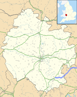
The village of Kinsham lies in the wooded hills of Herefordshire, England in the Marches near to the border with Wales and near the town of Presteigne. Surrounding villages include Stapleton and Lingen. Kinsham lies on the River Lugg. The 2001 census records that 71 people lived in the parish of Kinsham, of whom 32 were male and 39 female.

Queen Victoria Street, named after the British monarch who reigned from 1837 to 1901, is a street in London which runs east by north from its junction with New Bridge Street and Victoria Embankment in the Castle Baynard ward of the City of London, along a section that divides the wards of Queenhithe and Bread Street, then lastly through the middle of Cordwainer ward, until it reaches Mansion House Street at Bank junction. Beyond Bank junction, the street continues north-east as Threadneedle Street which joins Bishopsgate. Other streets linked to Queen Victoria Street include Puddle Dock, Cannon Street, Walbrook and Poultry.

The Herefordshire Trail is a long distance footpath forming a circular walk in the English county of Herefordshire.
Ryeish Green School was a comprehensive secondary school located in the hamlet of Ryeish Green, near Spencers Wood in Reading, Berkshire. The school closed in 2010, and a new school—Oakbank—opened on the site in 2012.

The M8 motorway is an inter-urban motorway in Ireland, which forms part of the motorway from the capital Dublin to Cork city. The 149 km motorway commences in the townland of Aghaboe, County Laois and runs through the counties of Kilkenny, Tipperary and Limerick, terminating at the Dunkettle interchange in County Cork. First called for in the Road Needs Study (1998), it was later incorporated into the National Development Plan (2000–2006) and later still formed part of the Irish Government's Transport 21 plan for infrastructural development. The majority of the M8 (115 km) was built between 2006 and 2010. On 28 May 2010, the motorway was completed and had replaced almost all of the single-carriageway N8 except for a short section of urban road in Cork City.
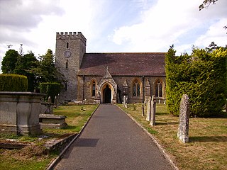
Titley is a village and civil parish in Herefordshire, England. It lies on the B4355 between Kington and Presteigne.

Capler Camp is an Iron Age hill fort located 2.5 km south of Fownhope, Herefordshire.

The B4265 road is a main road in the Vale of Glamorgan, southeastern Wales, running in a northwesterly direction along near the coast. It links Cardiff Airport to Bridgend, lasting for 15.9 miles (25.6 km). The road begins at the roundabout near the airport and the village of Penmark at 51°24′21″N3°20′39″W as a continuation of the A4226 road leading from Barry. Passing the junction turnoff to Gileston and St Athan, at Llantwit Major, the B4270 road branches off to the northwest to Llandow Industrial Estate. The road then moves progressively in northwesterly direction until St Brides Major, where the B4524 road to the south connects it to Southerndown and Ogmore-by-Sea. At St Brides Major, the road shifts to a northerly direction, where it passes Ewenny and Ogmore village leading to Bridgend, where it joins the A48 road and finally A473 road at 51°30′7″N3°34′34″W.


