Related Research Articles
Hanover Township is a township in Beaver County, Pennsylvania, United States. The population was 3,339 at the 2020 census. It is part of the Pittsburgh metropolitan area.

Potter Township is a township in Beaver County, Pennsylvania. It is States and is part of the Greater Pittsburgh metropolitan area. The population was 522 at the 2020 census. It is home to the Shell Pennsylvania Petrochemicals Complex.
Beaver Creek may refer to:

The Guyandotte River is a tributary of the Ohio River, approximately 166 mi (267 km) long, in southwestern West Virginia in the United States. It was named after the French term for the Wendat Native Americans. It drains an area of the unglaciated Allegheny Plateau south of the Ohio between the watersheds of the Kanawha River to the northeast and Twelvepole Creek and the Big Sandy River to the southwest. Via the Ohio River, it is part of the Mississippi River watershed.
Raccoon Creek may refer to:

The Ichetucknee River is a spring-fed, pristine river in North Central Florida. The entire 6 miles (9.7 km) of the river average 20 feet (6.1 m) wide, 5 feet (1.5 m) deep and most of the 6 miles lie within the boundaries of the Ichetucknee Springs State Park while the rest is to the south of US Highway 27. Three Rivers Estates Property Owners (TREPO) is the property owner association that manages the area along the private side of the river as it travels and flows into the Santa Fe River.
Raccoon Creek is a tributary of the Ohio River in Beaver County, Pennsylvania. Raccoon Creek joins the Ohio River in Potter Township. Only a small portion of the creek is located within Raccoon Creek State Park. The stream within the park is Little Traverse Creek.
Tygarts Creek is a tributary of the Ohio River in Carter and Greenup counties of northeastern Kentucky in the United States. It is 88 miles (142 km) long and drains an area of 339.6 square miles (880 km2). Via the Ohio, it is part of the watershed of the Mississippi River. Tygarts Creek is named for early Kentucky explorer Michael Tygart, who eventually drowned in the creek, somewhere near the mouth.

Carbondale is an unincorporated community in northwestern Waterloo Township, Athens County, Ohio, United States. It has a post office with the ZIP code 45717. It is located a short distance north of State Route 56.

Kanwaka Township is a township in Douglas County, Kansas, USA. As of the 2000 census, its population was 1,317. The name is a portmanteau of the Kansas River and Wakarusa River.

Mineral is an unincorporated community in Athens County, Ohio, United States. Centered on State Route 356, it was established as a coal mining community. It is located on Mud Lick Run, which flows into nearby Hewitt Fork, a tributary of Raccoon Creek. The B&O Railroad once ran through the community, but was abandoned in the 1980s. In recent years, the portion of the old railroad grade going west from the community has become the Moonville Rail-Trail. The King Switch Tunnel on the grade is close to the community. The next larger community is New Marshfield, also unincorporated, to the east in the same township.
Unity, Kentucky is a small unincorporated community and former coal mining community that formerly had a U.S. Post Office located two miles west of Catlettsburg. Kentucky Route 168 passes through the hamlet. Catletts Creek, a tributary of the Ohio River, runs through the community of Unity. Unity was served by the Catletts Creek School, later named Eidson Elementary, from 1962 to 1993, when all students were transferred to Catlettsburg Elementary. The hamlet of Unity is virtually non-existent today, as most residents of Unity refer to Catlettsburg as their home, since it is the postal zip code used.
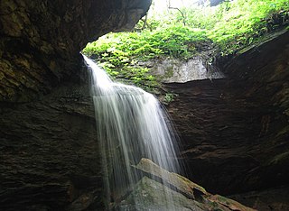
Raccoon Creek is a 114-mile-long (183 km) stream that drains parts of five Ohio counties in the United States. It originates in Hocking County, Ohio. It flows through Vinton County and Gallia County and a corner of Meigs County. Its largest tributary, Little Raccoon Creek, arises in Jackson County. The watershed also includes part of Athens County, drained by another tributary, Hewett Fork. The other major tributaries are Elk Fork, located entirely in Vinton County, and Brushy Fork, which is mostly in Vinton County with a small area in Hocking County.

Beaver Creek is a large creek in Lorain County, Ohio, USA. It flows through the township of Amherst, and through the western end of the corporation-limits of the City of Lorain, and into Lake Erie.
Beaver Run is a stream in Coshocton County, in the U.S. state of Ohio.
Hales Creek is an unincorporated community in Scioto County, in the U.S. state of Ohio.
Little Beaver Creek is a tributary of Beaver Creek in Lorain County, Ohio. Little Beaver Creek begins north of the Lorain County Regional Airport and runs northerly until the Little Beaver joins with the Big Beaver in the present city-limits of Lorain, Ohio.
Barney Creek is a former name for a creek within Amherst Township, Lorain County, Ohio. It is possibly an alternate name for Little Beaver Creek, or perhaps was simply a typographical-error for "Barnes Creek". Modern maps do not have "Little Beaver Creek" labeled separately, but only designate it as being a sub-branch of Beaver Creek.
Massie Creek is a stream in eastern Montgomery and southwestern Warren counties in the U.S. state of Missouri. It is a tributary of Loutre Slough.
References
- ↑ U.S. Geological Survey Geographic Names Information System: Beaver Creek (Raccoon Creek tributary)
- ↑ Sarchet, Cyrus P. B. (1911). History of Guernsey County, Ohio. Indianapolis: B.F. Bowen & Company. p. 29.
38°50′07″N82°22′16″W / 38.83528°N 82.37111°W
| | This article related to a river in Ohio is a stub. You can help Wikipedia by expanding it. |