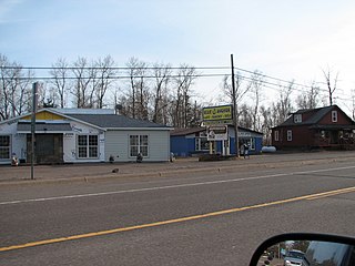
Lake County is a county located in the U.S. state of Minnesota. As of the 2010 census, the population was 10,866. Its county seat is Two Harbors.

Beaver Bay is a city in Lake County, Minnesota, U.S. The population was 181 at the 2010 census.

The Snowbank Trail is a hiking trail in the Boundary Waters Canoe Area Wilderness (BWCAW) in northern Minnesota. The trail runs the perimeter of Snowbank Lake and crosses the Kekekabic Trail at the south side of Snowbank Lake. The entire trail comprises a 24-mile (39 km) loop, numerous campsites are available. During the BWCAW Visitor' Distribution Program, permits are required for overnight use of the trail. It is located in Fall Lake Township in northernmost Lake County.
The North River is a river, approximately 6 miles (9.6 km) long, in northeastern Minnesota, the United States. Along with the East River, it is one of the primary tributaries of Seven Beaver Lake, the source of the Saint Louis River. Most of the North River lies in Lake County, with its outlet located in St. Louis County. The United States Geological Survey considers North River to be the source stream of the entire drainage basin of the Great Lakes and St. Lawrence system.
KQMN is a radio station licensed to Thief River Falls, Minnesota, and serving the Grand Forks area. The station is owned by Minnesota Public Radio (MPR), and airs MPR's "Classical Music Network", originating from KSJN in Minneapolis/St. Paul.
The Beaver River is a 23.4-mile-long (37.7 km) river in Lake County, Minnesota. It flows into Lake Superior.
The Burntside River is a river of Minnesota. The river flows through the west–central portion of Morse Township in northern Saint Louis County.

The Caribou River is a 15.0-mile-long (24.1 km) river in northern Minnesota, the United States. It rises in a swamp about .6 miles (1 km) south of Morris Lake and two miles (3.2 km) east of Echo Lake, near the Lake/Cook County line, at an altitude about 1620 feet above sea level. It descends some 1,020 feet in elevation as it flows south to its mouth at Lake Superior, also near the eastern border of Lake County.
The Dead River is a river of Minnesota. The river flows through the north–central part of Morse Township in northern Saint Louis County, and is a tributary of the Burntside River.
The East River is a small headwaters tributary of the Saint Louis River in northern Minnesota, United States. The East River, 3.0 miles (4.8 km) long, flows into Seven Beaver Lake, the source of the St. Louis River.
The Isabella River is a river of Minnesota.
The Island River is a river of Minnesota.
The Kawishiwi River is a river of Minnesota.
The Sand River is a river of Minnesota. It is a tributary of the Stony River.
The Snake River is a river of Minnesota. It is a tributary of the Isabella River.

The Manitou River is a 24.9-mile-long (40.1 km) river in northern Minnesota, which drains into Lake Superior along its north shore about three miles northeast of Little Marais. It flows southeast through the Superior National Forest, Finland State Forest, and George H. Crosby Manitou State Park in Lake County.

The Gitchi-Gami State Trail is a multi-use recreational trail in development along the North Shore of Lake Superior in Minnesota, USA. Planned to extend 88 miles (142 km) from Two Harbors to Grand Marais, the trail currently comprises five unconnected segments. The route will be situated primarily along state-owned right-of-way for Minnesota State Highway 61, with deviations for greater scenic diversity. "Gitchi-Gami" is an anglicization of the name for Lake Superior in the Ojibwe language.

Gooseberry River is a 23-mile stream in Lake County, Minnesota, USA, draining into Lake Superior. It is known for its waterfalls, near its mouth in Gooseberry Falls State Park. The Gooseberry, like many of its neighboring streams, has an irregular discharge highly dependent on runoff from rain and snow melt. The region around the river was heavily forested and much logging took place during the early 20th century. The forest has since regrown and the falls and mouth of the river are now a thriving tourist destination.
Stewart River is a stream in Lake County, in the U.S. state of Minnesota.
Seven Beaver Lake is a lake in the U.S. state of Minnesota.


