
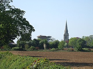
Leighton Buzzard is a town in Bedfordshire, England, near the Chiltern Hills and lying between Luton and Milton Keynes. It adjoins Linslade and the name Leighton Linslade is sometimes used to refer to the combination of the two towns; parts of this article also apply to Linslade as well as Leedon. For local government purposes, the town is part of the Central Bedfordshire district and is administered jointly with Linslade as the civil parish of Leighton-Linslade.

Studham is a village and civil parish in the county of Bedfordshire. It has a population of 1,128. The parish bounds to the south of the Buckinghamshire border, and to the east is the Hertfordshire border. The village lies in the wooded south facing dip slope of the Chiltern Hills. The hamlet of Holywell is located to the north of Studham, and forms part of the same civil parish.

Bedfordshire is an English shire county which lies between approximately 25 miles and 55 miles north of central London.

Bedfordshire County Council was the county council of the non-metropolitan county of Bedfordshire in England. It was established on 24 January 1889 and was abolished on 1 April 2009. The county council was based in Bedford.

Shefford is a town and civil parish located in the Central Bedfordshire district of Bedfordshire, England. At the 2001 census it had a population of 4,928, and was estimated to have grown to 5,770 by 2007. The population at the 2011 Census had risen to 5,881.
Ridgmont is a small village and civil parish in Bedfordshire, England. It is located beside junction 13 of the M1 motorway, and close to Milton Keynes and Woburn Abbey. The 2001 census states the total population to be 418, reducing to 411 at the 2011 Census.

Caddington is a village and civil parish in the Central Bedfordshire district of Bedfordshire, England. It is between the Luton/Dunstable urban area, and Hertfordshire.

Blunham is a village and civil parish in the Central Bedfordshire district of Bedfordshire, England, about 8 miles (13 km) east of Bedford. At the 2011 census date its population was 946. The River Ivel forms the parish's eastern boundary in places and the River Great Ouse its western and northern boundaries. The village is just over 0.6 miles (1 km) to the west of the A1 road, and Route 51 of the National Cycle Network passes to the south.
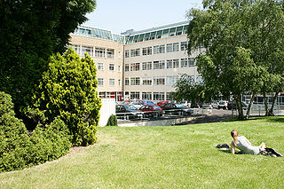
The University of Bedfordshire is a public university situated in Bedfordshire and Buckinghamshire, England. The university has roots from 1882, however, it gained university status in 1992 as University of Luton. Then changed the name to the University of Bedfordshire in 2006 by the approval of the Privy Council by merging the University of Luton and the Bedford campus of De Montfort University.

Slip End is a village and civil parish in Luton, Bedfordshire. As well as the village of Slip End, the parish contains the hamlets of Lower Woodside, Woodside and Pepperstock. It has a population of 1,976, reducing to 1,831 at the 2011 Census.

Cople is a village and civil parish in the English county of Bedfordshire. The name Cople is derived from the phrase Cock Pool, a place where chickens were kept, that was mentioned in the Domesday Book.

Aley Green is a hamlet located in Bedfordshire, England.

Woodside is a hamlet located in the Central Bedfordshire district of Bedfordshire, England.
Bedfordshire Fire and Rescue Service is the fire and rescue service for the ceremonial county of Bedfordshire in England, including the unitary authorities of Bedford, Central Bedfordshire, and Luton.

Tilsworth is a small village and civil parish in Bedfordshire. It lies to the north west of Dunstable, and the Roman Watling Street (A5) forms the north east boundary of the parish of 1,200 acres (4.8 km²). The village lies on the gault clay, where springs well up just south of a gentle gravelly ridge. A large proportion of the area is still farmland.

Luton, England, is a unitary authority, and remains part of the ceremonial county of Bedfordshire. Luton is currently represented on three different tiers of Government.

Central Bedfordshire is a unitary authority area in the ceremonial county of Bedfordshire, England. It was created from the merger of Mid Bedfordshire and South Bedfordshire District Councils on 1 April 2009. With a budget of £500m the unitary council provides over a hundred services to a quarter of a million people, and is responsible for schools, social services, rubbish collection, roads, planning, leisure centres, libraries, care homes and more.
George Herbert Fowler was an English zoologist, historian and archivist.

