| Beinn na h-Eaglaise | |
|---|---|
 Beinn na h-Eaglaise | |
| Highest point | |
| Elevation | 736 m (2,415 ft) [1] |
| Prominence | 305 m (1,001 ft) |
| Listing | Graham, Marilyn |
| Geography | |
| Location | Wester Ross, Scotland |
| Parent range | Northwest Highlands |
| OS grid | NG909523 |
| Topo map | OS Landranger 25 |
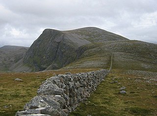
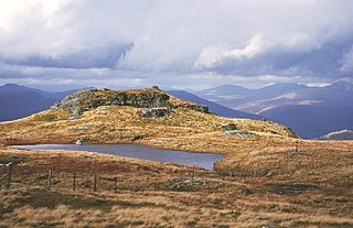
Beinn na h-Eaglaise (736 m) is a mountain in the Northwest Highlands of Scotland. It lies in Wester Ross, south of the village of Torridon.
The Northwest Highlands are located in the northern third of Scotland that is separated from the Grampian Mountains by the Great Glen. The region comprises Wester Ross, Assynt, Sutherland and part of Caithness. The Caledonian Canal, which extends from Loch Linnhe in the south-west, via Loch Ness to the Moray Firth in the north-east splits this area from the rest of the country. The city of Inverness and the town of Fort William serve as gateways to the region from the south.

Wester Ross is an area of the Northwest Highlands of Scotland in the council area of Highland. The area is loosely defined, and has never been used as a formal administrative region in its own right, but is generally regarded as lying to the west of the main watershed of Ross, thus forming the western half of the county of Ross and Cromarty. The southwesternmost part of Ross and Cromarty, Lochalsh, is not considered part of Wester Ross by the local tourist organisation, Visit Wester Ross, but is included within the definition used for the Wester Ross Biosphere Reserve.
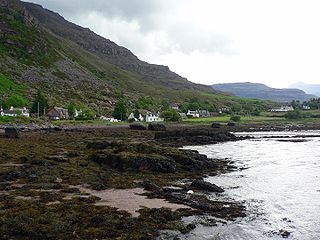
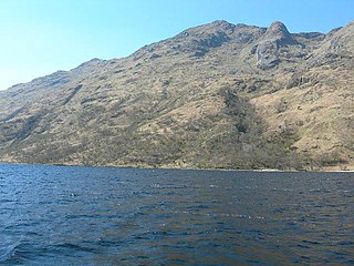
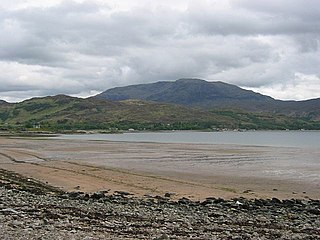
Torridon is a small village in the Northwest Highlands of Scotland. However the name is also applied to the area surrounding the village, particularly the Torridon Hills, mountains to the north of Glen Torridon. It lies on the shore of Loch Torridon.
A steep mountain, it has a very craggy north east face and is almost entirely surrounded by stalker's paths. The view from the summit takes in the peak's famous neighbours such as the Munros Liathach and Maol Cheann-dearg. [2]
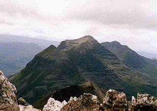
Liathach is a mountain in the Torridon Hills. At a height of 3,461 feet (1,055 m), it lies to the north of the A896 road, in the Northwest Highlands of Scotland, and has two peaks of Munro status: Spidean a' Choire Lèith at the east of the main ridge, and Mullach an Rathain at the western end of the mountain. The name Liathach is pronounced [ˈʎiəhəx] in Scottish Gaelic, and means 'The grey one'. When seen from the roadside below, its slopes appear to rise up in a series of near vertical rocky terraces.

Maol Cheann-dearg is a Scottish Mountain situated between Upper Loch Torridon and Loch Carron, in the Coulags deer forest in Wester Ross, Highland region. It is one of three Munros in this area and reaches a height of 933 metres (3,060 feet), it is slightly isolated from the other two being separated by a low col of 420 metres and therefore tends to be ascended separately. The mountain is typical of the region in that geologically it is made up of a mixture of sandstone and quartzite, it has a steep flanks and is rock-strewn. The dome shaped summit is littered with red sandstone boulders and lacking in vegetation making its translated name of “Bald Red Head” especially appropriate. The mountain is not to be confused with Maol Chinn-dearg, another Munro on the south Glen Shiel ridge.