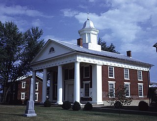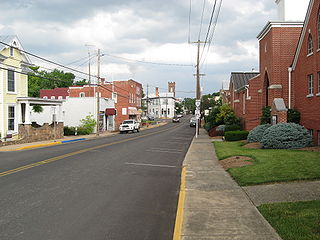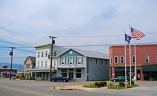
Greene County is a county in Virginia in the eastern United States. As of the 2020 census, the population was 20,552. Its county seat is Stanardsville.

Rockingham County is a county located in the U.S. state of Virginia. As of the 2020 census, the population was 83,757. Its county seat is the independent city of Harrisonburg.

Harrisonburg is an independent city in the Shenandoah Valley region of the Commonwealth of Virginia in the United States. It is also the county seat of the surrounding Rockingham County, although the two are separate jurisdictions. At the 2020 census, the population was 51,814. The Bureau of Economic Analysis combines the city of Harrisonburg with Rockingham County for statistical purposes into the Harrisonburg, Virginia Metropolitan Statistical Area, which had an estimated population of 126,562 in 2011.

Luray is the county seat of Page County, Virginia, United States, in the Shenandoah Valley in the northern part of the Commonwealth. The population was 4,895 at the 2010 census.

Shenandoah is a town in Page County, Virginia, United States. The population was 2,373 at the 2010 census.

Dayton is a town in Rockingham County, Virginia, United States. The population is 1,530 as of the 2010 census. It is included in the Harrisonburg, Virginia Metropolitan Statistical Area.

Elkton is an incorporated town in Rockingham County, Virginia, United States. It is included in the Harrisonburg Metropolitan Statistical Area. The population was 2,762 at the 2010 census. Elkton was named for the Elk Run stream.

Massanutten is a census-designated place (CDP) in Rockingham County, Virginia, United States, built around a ski resort. The population was 2,291 at the 2010 census. It is part of the Harrisonburg Metropolitan Statistical Area.

Mount Jackson is a town in Shenandoah County, Virginia, United States. The population was 1,994 at the 2010 census.

New Market is a town in Shenandoah County, Virginia, United States. Founded as a small crossroads trading town in the Shenandoah Valley, it has a population of 2,146 as of the most recent 2010 U.S. census. The north–south U.S. 11 and the east–west U.S. 211 pass near it and cross Massanutten Mountain at the town's titular gap.

Strasburg is a town in Shenandoah County, Virginia, United States, which was founded in 1761 by Peter Stover. It is the largest town by population in the county and is known for its grassroots art culture, pottery, antiques, and American Civil War history. The population was 6,398 at the 2010 census.

The Shenandoah Valley is a geographic valley and cultural region of western Virginia and the Eastern Panhandle of West Virginia in the United States. The valley is bounded to the east by the Blue Ridge Mountains, to the west by the eastern front of the Ridge-and-Valley Appalachians, to the north by the Potomac River and to the south by the James River. The cultural region covers a larger area that includes all of the valley plus the Virginia highlands to the west, and the Roanoke Valley to the south. It is physiographically located within the Ridge and Valley province and is a portion of the Great Appalachian Valley.

The Southwest Mountains of Virginia are a mountain range centered on Charlottesville, parallel to and geologically associated with the Blue Ridge Mountains, which lie about 30 miles (50 km) to the west. Some of the more prominent peaks include Carters Mountain, Fan Mountain, Brush Mountain, Peters Mountain, Walton's Mountain, and Hightop Mountain.

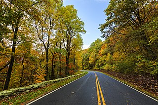
Shenandoah National Park is a national park in the Eastern United States that encompasses part of the Blue Ridge Mountains in the Commonwealth of Virginia. The park is long and narrow, with the Shenandoah River and its broad valley to the west, and the rolling hills of the Virginia Piedmont to the east. Skyline Drive is the main park road, generally traversing along the ridgeline of the mountains. Almost 40% of the park's land—79,579 acres —has been designated as wilderness areas and is protected as part of the National Wilderness Preservation System. The highest peak is Hawksbill Mountain at 4,051 feet (1,235 m).
Smith Creek is a 35.5-mile-long (57.1 km) tributary stream of the North Fork of the Shenandoah River in the Shenandoah Valley of Virginia. Its watershed comprises 106 square miles (270 km2) within Shenandoah and Rockingham counties on the western slope of the Massanutten Mountain ridge. Its headwaters lie in Rockingham County just north of Harrisonburg, and its confluence with the North Fork of the Shenandoah River is located just south of Mount Jackson.
The Roach River is an 11.0-mile-long (17.7 km) tributary of the North Fork Rivanna River in the U.S. state of Virginia. It is part of the James River watershed.
Hamburg is an unincorporated community in Page County in the U.S. state of Virginia. For a time, Herbert Barbee's studio was located there.
Dale Enterprise is an unincorporated community in Rockingham County, Virginia, United States. The name dates to 1872, when it was time to name the village's post office. The place was previously known as Millersville, after the Miller family who ran an early store there. After the Civil War, Mr. J. W. Minnick started a new mercantile “enterprise” at the crossroads of Silver Lake Road and Route 33. Minnick’s store was located near a “dale,” so the chosen name became Dale Enterprise.

Cootes Store is an unincorporated community in Rockingham County, Virginia, United States. Located in the Shenandoah Valley, it is situated north of Harrisonburg, south of Bergton, and west of Timberville. The border with West Virginia is nearby, as is the edge of George Washington National Forest. Cootes Store is within a gorge where the North Fork Shenandoah River breaks, at the crossroads of Route 613 and Route 259.

Beahm, Virginia is an extinct unincorporated community in Page County, Virginia.


