Bella Vista Norte

Last updated
Bella Vista
Paraguay adm location map.svg
Red pog.svg
Bella Vista
Coordinates: 22°7′48″S56°31′12″W / 22.13000°S 56.52000°W
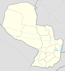
 / -22.13000; -56.52000
Country Paraguay
Department Amambay
Population
 (2008)
  Total6,145
Climate Am

Bella Vista is a border town in northeast of Paraguay, bordering the Brazilian town of Bela Vista, Mato Grosso do Sul. Both towns are divided by the Apa River, only connected by a borderbridge. It is a small town in the northern region of Amambay. Getting there is possible by way of Brazil or over a red earth road from the Paraguayan country-side.

Sources

Coordinates: 22°07′S56°31′W / 22.117°S 56.517°W / -22.117; -56.517


Related Research Articles

Paraguay Country in South America

Paraguay, officially the Republic of Paraguay, is a country in South America. It is bordered by Argentina to the south and southwest, Brazil to the east and northeast, and Bolivia to the northwest. It has a population of 7 million, nearly 3 million of which live in the capital and largest city of Asunción, and its surrounding metro. Although one of only two landlocked countries in South America, the country has coasts, beaches and ports on the Paraguay and Paraná rivers that give exit to the Atlantic Ocean through the Paraná-Paraguay Waterway.

Geography of Paraguay

Paraguay is a country in South America, bordering Brazil, Argentina and Bolivia. The Paraguay River divides the country into strikingly different eastern and western regions. Both the eastern region and the western region gently slope toward and are drained into the Paraguay River, which separates and unifies the two regions. With the Paraneña region reaching southward and the Chaco extending to the north, Paraguay straddles the Tropic of Capricorn and experiences both subtropical and tropical climates.

Iguazu Falls Waterfalls on the Iguazú River on the border of Argentina and Brazil

Iguazú Falls or Iguaçu Falls are waterfalls of the Iguazu River on the border of the Argentine province of Misiones and the Brazilian state of Paraná. Together, they make up the largest waterfall in the world. The falls divide the river into the upper and lower Iguazu. The Iguazu River rises near the heart of the city of Curitiba. For most of its course, the river flows through Brazil; however, most of the falls are on the Argentine side. Below its confluence with the San Antonio River, the Iguazu River forms the border between Argentina and Brazil.

Geography of Argentina

The geography of Argentina describes the geographic features of Argentina, a country located in Southern South America. Bordered by the Andes in the west and the South Atlantic Ocean to the east, neighbouring countries are Chile to the west, Bolivia and Paraguay to the north, and Brazil and Uruguay to the northeast.

Cuquenan Falls

Kukenan Falls is the second tallest major waterfall in Venezuela after Angel Falls. It is also the second tallest free-leaping waterfall in the world. Overall, it is usually cited as the 11th highest waterfall in the world. The falls drop in a single leap of around 2,211 feet (674 m) and the final portion of the falls trickles down towards the base of the Kukenan Tepui.

Bella Vista is the name of several places in the world:

Triple Frontier

The Triple Frontier is a tri-border area along the junction of Paraguay, Argentina and Brazil, where the Iguazú and Paraná rivers converge. Near the confluence are the cities of Ciudad del Este (Paraguay); Puerto Iguazú (Argentina) and Foz do Iguaçu (Brazil). This area is near Iguazú Falls and the Itaipú hydroelectric plant.

Amambay Department Department of Paraguay

Amambay is a department in Paraguay. The capital is Pedro Juan Caballero.

Foz do Iguaçu Municipality in Sul, Brazil

Foz do Iguaçu is the Brazilian city on the border of Iguaçu Falls. The city is the 7th largest in the state of Paraná. The city's population is approximately 258,000. It is approximately 650 km (400 mi) west of the capital of the state, Curitiba, being the westernmost city in that state.

Gran Chaco Region of Southern America

The Gran Chaco or Dry Chaco is a sparsely populated, hot and semiarid lowland natural region of the Río de la Plata basin, divided among eastern Bolivia, western Paraguay, northern Argentina, and a portion of the Brazilian states of Mato Grosso and Mato Grosso do Sul, where it is connected with the Pantanal region. This land is sometimes called the Chaco Plain.

Corumbá Municipality in Mato Grosso do Sul, Brazil

Corumbá[koɾũˈba] is a municipality in the Brazilian state of Mato Grosso do Sul, 425 km northwest of Campo Grande, the state's capital. It has a population of approximately 112,000 inhabitants, and its economy is based mainly on agriculture, animal husbandry, mineral extraction, and tourism, being the gateway to the biggest wetlands of the world, the Pantanal. Due to its border with Bolivia, Bolivians in Brazil constitute a significant portion of the city's population, forming a distinct cultural community.

UTC−03:00 Identifier for a time offset from UTC of −3

UTC−03:00 is an identifier for a time offset from UTC of −03:00.

Battle of Yatay Allied victory in the Paraguayan War

In the Paraguayan War, the Battle of Yatay was fought on August 17, 1865 between the troops of the Triple Alliance and the soldiers of Paraguay near Paso de los Libres, Corrientes, Argentina.

Battle of Cerro Corá Last battle of the Paraguayan War

The Battle of Cerro Corá was fought on 1 March 1870 on a hill-surrounded valley of the same name, in the north-east of Paraguay. This was the last battle in the Paraguayan War.

Ponta Porã Municipality in Central-West, Brazil

Ponta Porã is a municipality located in the Brazilian state of Mato Grosso do Sul. Its population is 93,937 (2020) and its area is 5,329 km2. It has a dry border and a conurbation with the city of Pedro Juan Caballero in Paraguay.

Desmochados Place in Ñeembucú, Paraguay

Desmochados is a village in Paraguay, near the northern border of Argentina.

Apa River

The Apa River is a river of Paraguay and Brazil. It is a tributary of the Paraguay River, which in turn is a tributary of the Paraná River. It starts in the Amambai Mountains of the Brazilian state of Mato Grosso do Sul. The Apa forms part of the border between Paraguay and Brazil beginning at the twin cities of Bella Vista Norte and Bela Vista.

Várzea Grande, Mato Grosso Municipality in Center-West, Brazil

Várzea Grande is a municipality in the state of Mato Grosso in the Central-West Region of Brazil.

BR-060

BR-060 is a federal highway of Brazil. The 1329 kilometre road connects Brasilia to Bela Vista, on the Paraguayan border.

Venezuelan Brazilians are individuals of full, partial, or predominantly Venezuelan ancestry, or a Venezuelan-born person residing in Brazil. Until the early 2010s, the immigration of this group was little expressive compared to the immigration of other South American peoples such as Argentines, Bolivians or Paraguayans. However, the crisis in Venezuela and the subsequent refugee crisis has led to Brazil becoming home to a large number of Venezuelan refugees, most of whom enter the border through the northern state of Roraima. By the beginning of the 2020, more than 200,000 of Venezuelans have migrated to the country looking for refuge.