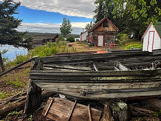
Isle Royale National Park is an American national park consisting of Isle Royale, along with more than 400 small adjacent islands and the surrounding waters of Lake Superior, in the state of Michigan.

Kingston is a city in Ontario, Canada, on the northeastern end of Lake Ontario. It is at the beginning of the St. Lawrence River and at the mouth of the Cataraqui River, the south end of the Rideau Canal. Kingston is midway between Toronto, Ontario, and Montreal, Quebec, and is also near the Thousand Islands, a tourist region to the east, and the Prince Edward County tourist region to the west. Kingston is nicknamed the "Limestone City" because it has many heritage buildings constructed using local limestone.
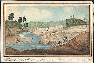
The Cataraqui River forms the lower portion of the Rideau Canal and drains into Lake Ontario at Kingston, Ontario. The name is taken from the original name for Kingston, Ontario; its exact meaning, however, is undetermined. Early maps showed several name variations including the Great Cataraqui River and Grand River Cataraquay. The river was once called Riviere de Frontenac, or Frontenac River. The alternate spelling "Cadaraqui" also appears in some historic texts.

Fundy National Park is a national park of Canada located on the Bay of Fundy, near the village of Alma, New Brunswick. It was officially opened on 29 July 1950. The park showcases a rugged coastline which rises up to the Canadian Highlands, the highest tides in the world and more than 25 waterfalls. The park covers an area of 207 km2 (80 sq mi) along Goose Bay, the northwestern branch of the Bay of Fundy. When one looks across the Bay, one can see the northern Nova Scotia coast.

Thousand Islands National Park, formerly known as the St. Lawrence Islands National Park, is a Canadian National Park located on the 1000 Islands Parkway in the Thousand Islands Region of the Saint Lawrence River. The islands are actually the worn-down tops of ancient mountains. This region, the Frontenac Axis, connects the Canadian Shield from Algonquin Park in Ontario to the Adirondack Mountains in New York.

Peel is a seaside town and small fishing port in the Isle of Man, in the historic parish of German but administered separately. Peel is the third largest town in the island after Douglas and Ramsey but the fourth largest settlement, as Onchan has the second largest population but is classified as a village. Until 2016 Peel was also a House of Keys constituency, electing one Member of the House of Keys (MHK), who, from September 2015, was Ray Harmer. Peel has a ruined castle on St Patrick's Isle, and a cathedral, seat of the Diocese of Sodor and Man.

Pettigrew State Park is a North Carolina State Park in Tyrrell and Washington Counties, North Carolina in the United States. It covers 5,951 acres (24.08 km2) around the shore lines of Lake Phelps and the Scuppernong River. The park's developed facilities are south of U.S. Route 64 near Roper and Creswell, North Carolina. Pettigrew State Park is open for year-round recreation, including hiking, camping, fishing, boating and picnicking.

The Stein Valley Nlaka’pamux Heritage Park is located near Lytton, BC northeast of Vancouver. The park was established in 1995. Currently, the park is being co-managed, operated and planned through partnership between the Lytton First Nations and the BC Government. The park provides recreational opportunities and cultural heritage activities.
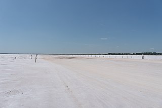
The Salt Plains National Wildlife Refuge is part of the United States system of national wildlife refuges. It is located in Alfalfa County in northern Oklahoma, north of Jet, along Great Salt Plains Lake, which is formed by a dam on the Salt Fork of the Arkansas River.

Mississagi Provincial Park is a natural environment-class provincial park north of Elliot Lake, in Algoma District, Ontario, Canada. It lies on the Boland River, a tributary of the Little White River, which is itself a tributary of the Mississagi River. The park is accessed via Highway 639.
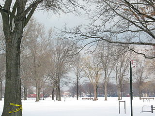
Marine Park is a public park located in the neighborhood of Marine Park in Brooklyn, New York. Its 798 acres (3.2 km2) surround the westernmost inlet of Jamaica Bay. Most of the land for Marine Park was donated to New York City to be turned into public park land by the Whitney family in 1920 and by Frederic B. Pratt and Alfred Tredway White, who jointly donated 150 acres (0.61 km2) in 1917. The land donated consists of the area between the current day Fillmore Avenue and Gerritsen Avenue and East 38th Street. Originally almost 2,000 acres (810 ha), over half of which has been donated to the National Park Service as part of the Gateway National Recreation Area, the park is mainly a fertile salt marsh which is supplied with freshwater from Gerritsen Creek.
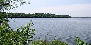
Sakatah Lake State Park is an 842-acre (341 ha) state park of Minnesota, USA, on a natural widening of the Cannon River near the town of Waterville. The Dakota native to the area called it "Sakatah" which means "singing hills". To honor this native heritage, some of the trails in the park have been given Dakota names. The Sakatah Singing Hills State Trail, which connects Faribault and Mankato, runs through this park.
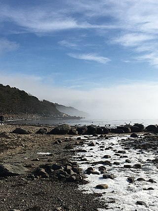
Archipelago National Park is a national park in Southwest Finland. It was established in 1983 and includes 500 km2 (190 sq mi) of land area. Most of the land is on islands smaller than 1 km2 (0.39 sq mi). The park encompasses about 2,000 of the 8,400 islets and skerries within the cooperative area. The larger islands are mainly owned by their inhabitants. Archipelago National Park is part of the UNESCO biosphere reserves and received a PAN Parks certificate in 2007.
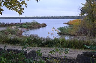
Marshall State Fish and Wildlife Area is an Illinois state park on 6,000 acres (2,400 ha) in Marshall County, Illinois, United States.

Silver Springs State Fish and Wildlife Area is an Illinois state park on 1,350 acres (550 ha) in Kendall County, Illinois, United States. The park was established in the late 1960s and is named for the natural spring within its boundaries. The park has two artificial lakes and the Fox River flows through the northern end of the park. Silver Springs hosts a variety of activities including fishing, hunting, boating and hiking. The park has areas of native prairie restoration, a sledding hill and a seven-mile (11 km) equestrian trail. The prairie restoration areas hold many species of plants including lead plant, and purple coneflower.
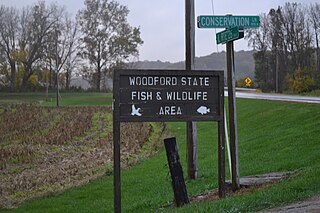
Woodford State Fish and Wildlife Area is an Illinois state park on 2,900 acres (1,200 ha) of area Woodford County, Illinois, United States. Most of this protected area is over the Goose Lake and Upper Peoria Lake sections of the Illinois River.
Carleton Island is located in the St Lawrence River in upstate New York. It is part of the Town of Cape Vincent, in Jefferson County.

Beaver Creek State Park is a 2,722-acre (1,102 ha) public recreation area in Columbiana County, Ohio in the United States. The park is near East Liverpool on the banks of Little Beaver Creek. Remnants of the historic Sandy and Beaver Canal can be found throughout the park. It is open for year-round recreation including, camping, boating, hunting, fishing and hiking.

Gould Lake Conservation Area is a rural conservation area located in the Canadian Shield northwest of the community of Sydenham in the Township of South Frontenac, Frontenac County, in eastern Ontario, Canada. The area was created to manage water resources, preserve wildlife habitat, and provide recreational and educational opportunities, and is managed by the Cataraqui Region Conservation Authority. The conservation area contains much of Gould Lake.
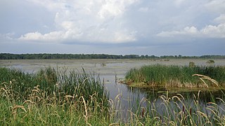
The Maple River State Game Area is a protected state game area in the U.S. state of Michigan. Located in the central region of the Lower Peninsula, it encompasses approximately 9,252 acres (3,744 ha) in segmented portions within Clinton, Gratiot, and Ionia counties. Governed by the Michigan Department of Natural Resources, the area is considered the state's longest contiguous wetland complex.


