Related Research Articles

Suffolk County is a county in the Commonwealth of Massachusetts, in the United States. As of 2019, the population was 803,907 making it the fourth-most populous county in Massachusetts. The county comprises the cities of Boston, Chelsea, Revere and Winthrop.

Roxbury is a neighborhood within the city of Boston, Massachusetts.

Milton is a town in Norfolk County, Massachusetts, United States, and an affluent suburb of Boston. The population was 27,003 at the 2010 census. Milton is the birthplace of former U.S. President George H. W. Bush and architect Buckminster Fuller. In 2007, 2009, and 2011, Money magazine listed Milton as 7th, 5th, and 2nd, respectively, on its annual list of the "Best Places to Live" in the United States.

Back Bay is an officially-recognized neighborhood of Boston, Massachusetts, built on reclaimed land in the Charles River basin. Construction began in 1859, as the demand for luxury housing exceeded the availability in the city at the time, and the area was fully built by around 1900. It is most famous for its rows of Victorian brownstone homes—considered one of the best preserved examples of 19th-century urban design in the United States—as well as numerous architecturally significant individual buildings, and cultural institutions such as the Boston Public Library. Initially conceived as a residential-only area, commercial buildings were permitted from around 1890, and Back Bay now features many office buildings, including the John Hancock Tower, Boston's tallest skyscraper. It is also considered a fashionable shopping destination and home to several major hotels.

Dorchester is a Boston neighborhood comprising more than 6 square miles (16 km2) in the City of Boston, Massachusetts, United States. Originally, Dorchester was a separate town, founded by Puritans who emigrated in 1630 from Dorchester, Dorset, England to the Massachusetts Bay Colony. This dissolved municipality, Boston's largest neighborhood by far, is often divided by city planners in order to create two planning areas roughly equivalent in size and population to other Boston neighborhoods.

West Roxbury is a neighborhood in Boston, Massachusetts bordered by Roslindale to the northeast, Hyde Park to the southeast, the town of Brookline to the north, the city of Newton to the northwest and the town of Dedham to the southwest. West Roxbury is often mistakenly confused with Roxbury, but the two are not connected. West Roxbury is separated from Roxbury by Jamaica Plain and Roslindale.

Roslindale is a primarily residential neighborhood of Boston, Massachusetts, bordered by Jamaica Plain, Hyde Park, West Roxbury and Mattapan. It is served by an MBTA Commuter Rail line, several MBTA bus lines and the MBTA Orange Line in nearby Jamaica Plain. Roslindale has its own branch of the Boston Public Library, the neighborhood is covered by Boston Police District E-5 in West Roxbury, Boston EMS Ambulance 17 is stationed in Roslindale, and the Boston Fire Department has a station on Canterbury Street which houses Ladder 16, Engine 53 & District Chief 12. Roslindale's original Engine Company 45, was deactivated on April 10, 1981, due to budget cuts. The portion of the Arnold Arboretum south of Bussey Street is located in Roslindale.

Forest Hills Cemetery is a historic 275-acre (111.3 ha) rural cemetery, greenspace, arboretum and sculpture garden located in the Forest Hills section of the Jamaica Plain neighborhood of Boston, Massachusetts. The cemetery was established in 1848 as a public municipal cemetery of the town of Roxbury, but was privatized when Roxbury was annexed to Boston.
Winter Hill is a neighborhood in Somerville, Massachusetts. It gets its name from the 120-foot hill that occupies its landscape, the name of which dates back to the 18th century. Winter Hill is located roughly north of Medford Street, west of McGrath Highway, and east of Magoun Square.

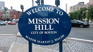
Mission Hill is a ¾ square mile neighborhood of Boston. Many medical and educational institutions are nearby. The population was estimated at 15,883 in 2011.

Central Square is a section of the neighborhood of East Boston in Boston, Massachusetts, United States. The square begins at the intersection of Bennington Street and Meridian Street, continues up Meridian to its intersection with White Street, and includes all the area to the left. The square’s intersecting streets also include Border, Saratoga, and Eutaw Street. It is within close proximity of the entrance to the Sumner Tunnel, which motorists take to downtown Boston.
Oak Hill Park (OHP) is a residential subdivision located in the Oak Hill village of Newton, Middlesex County, Massachusetts. Oak Hill Park is shown as a separate and distinct village on some city maps, including a map dated 2012 on the official City of Newton website. Situated adjacent to Boston, Oak Hill Park is roughly bounded by Mount Ida College to its northwest, Dedham Street to the northeast, the Charles River to the southwest, and Mount Lebanon Cemetery and the Boston city limit to the southeast.

The Leather District is a neighborhood of Boston near South Street, between the Financial District and Chinatown. The Leather District is a tightly defined area bounded by Kneeland Street to the south, Essex Street to the north, Atlantic Avenue to the east and Lincoln Street to the west. It is so named due to the dominance of the leather industry in the late 19th century.

The 1767 Milestones are historic milestones located along the route of the Upper Boston Post Road between the cities of Boston and Springfield in Massachusetts. The 40 surviving milestones were added to the National Register of Historic Places in 1971. Massachusetts has a total of 129 surviving milestones including those along the upper Post Road.

The Veterans of Foreign Wars Parkway is a historic parkway in Boston, Massachusetts. The southern terminus of the parkway is at Washington Street at the Dedham-West Roxbury border, from where it travels north and then east, ending at a junction with Centre Street, near the Arnold Arboretum. The highway is almost entirely contained within the West Roxbury neighborhood, although it passes through part of the Chestnut Hill neighborhood near its junction with the West Roxbury Parkway. Most of its length, from Spring Street in West Roxbury to its eastern end, is administered by the Massachusetts Department of Conservation and Recreation (DCR), a successor to the Metropolitan District Commission (MDC) which oversaw the road's construction. The parkway was built in stages between 1930 and 1942, and was designed to provide a parkway connection from the Upper Charles River Reservation to other MDC parks via the West Roxbury Parkway. The DCR portion of the road was listed on the National Register of Historic Places in 2005. The road formerly carried the designation for U.S. Route 1.

Pill Hill, also known as "High Street Hill," is a neighborhood of Brookline, Massachusetts, United States, and part of Greater Boston.

West Roxbury Parkway is a historic parkway running from Washington Street in Boston, Massachusetts, where the Enneking Parkway runs south, to Horace James Circle in Brookline, where it meets the Hammond Pond Parkway. The parkway serves as a connector between Stony Brook Reservation and Hammond Pond Reservation. West Roxbury Parkway was built between 1919 and 1929 and added to the National Register of Historic Places in 2006. The parkway is distinctive in the roadway system developed by the Metropolitan District Commission beginning around the turn of the 20th century in that it was built in collaboration with the City of Boston, and is maintained by the city.

Stony Brook Reservation is a woodland park in Boston and Dedham, Massachusetts, a unit of the Metropolitan Park System of Greater Boston, part of the state park system of Massachusetts. It was established in 1894 as one of the five original reservations created by the Metropolitan Park Commission. The park is served by the Stony Brook Reservation Parkways, a road system that was entered into the National Register of Historic Places in 2006.

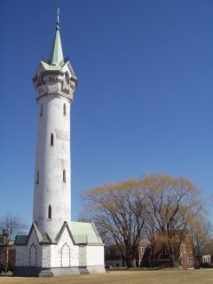
Fort Hill is a 0.4 square mile neighborhood and historic district of Roxbury, in Boston, Massachusetts. The approximate boundaries of Fort Hill are Malcolm X Boulevard on the north, Washington Street on the southeast, and Columbus Avenue on the southwest.

Parkway is a section of the West Roxbury and Roslindale neighborhoods of Boston, Massachusetts. Parkway takes its name from the parkways that pass through West Roxbury, specifically West Roxbury Parkway and VFW Parkway. Much of the land that makes up Parkway was once owned by the Weld family, as evidenced by Weld Street that runs through the area.
References
- ↑ "Bellevue Hill, Massachusetts". Peakbagger.com.
- ↑ "Archived copy". Archived from the original on 2006-12-08. Retrieved 2007-03-22.CS1 maint: archived copy as title (link)
- ↑ "Boston Cityviews". Archived from the original on 2007-02-05. Retrieved 2007-03-22.
- ↑ Boston Massachusetts, 1890
- ↑ Boston, MA Register of Historic Places Archived June 8, 2007, at the Wayback Machine
- ↑ Boston, MA Hotels | Travel, Tourism, and Hotels in Boston, Massachusetts Archived March 20, 2007, at the Wayback Machine
| This article about a location in Boston is a stub. You can help Wikipedia by expanding it. |