
Belmont Park (also called Belmont Pleasure Grounds) is a public park in Exeter, England. [1] [2] [3] Opened to the public in 1886 as a children's play area, it was subsequently enlarged for the use of the general public. [1]
Belmont Park (also called Belmont Pleasure Grounds) is a public park in Exeter, England. [1] [2] [3] Opened to the public in 1886 as a children's play area, it was subsequently enlarged for the use of the general public. [1]
The park is bounded by Belmont Road, Blackboy Road, Gordon Road, Jesmond Road, Grosvener Place and Clifton Hill and is in close proximity to Clifton Hill Sports Centre and Clifton Hill Driving Range.

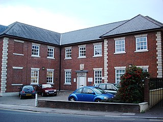
The Newtown Community Association, [2] the Exeter Scrapstore and the Belmont Bowling Club are all located at the park. There is an area for soccer practice or other "kick about" activity, and an area dedicated to half court basketball. Seating is provided and open spaces are available for picnics. There is a large dog-free zone with equipment for younger and older children. [1]
A sensory garden intended especially for the blind is situated at the eastern corner of the park. This aspect of the park was created in 1939 and restored in 2007. [1]
In 1886, Belmont park opened as a 5 acre recreational grounds. The other part of the site belonged to Mr. Philips who ran a brickfield and refused to sell his land to the council [3] . Years later the land ownership would fall to Mr. Philips son who subsequently sold the land to Exeter City Council, who expanded the park to the footprint it takes up today [3] .
In 1939 a sensory garden was opened in the east of the park [1] . This was an idea by Exeter resident Daniel Manning, a gardener at the time, who later became the Devon Horticultural Superintendent [4] .
During World War 2, the Army Pay Corps installed 20 wooden huts in the park for their use [5] . These were then taken over by Exeter Technical College (which later became Exeter College) in 1949 [3] . By 2008 just two of these huts remained. One ran by the charity organisation Exeter Scrapstore, and the other run as a community centre through Newton Community Association.
In 2007, the Sensory Garden was restored, with new landscaping, as well as picnic tables painted by local artist Ruth Oakley and Newtown resident Gay Smith [6]
In 2019 the old community centre was demolished and replaced with a new building, still run through Newton Community Association [7] .


Dartmouth is a town and civil parish in the English county of Devon. It is a tourist destination set on the western bank of the estuary of the River Dart, which is a long narrow tidal ria that runs inland as far as Totnes. It lies within the South Devon Area of Outstanding Natural Beauty and South Hams district, and had a population of 5,512 in 2001, reducing to 5,064 at the 2011 census. There are two electoral wards in the Dartmouth area. Their combined population at the above census was 6,822.

Alsager is a town and civil parish in the unitary authority of Cheshire East in Cheshire, England. It is located to the north-west of Stoke-on-Trent and east of Crewe. The town's population was 13,389 at the 2021 census.
Yeovil is a town and civil parish in Somerset, England. The population of Yeovil at the last census (2021) was 49,698. It is close to Somerset's southern border with Dorset, 126 miles (203 km) west of London, 41.8 miles (67.3 km) south of Bristol, 6 miles (9.7 km) west of Sherborne and 27.6 miles (44.4 km) east of Taunton. The aircraft and defence industries which developed in the 20th century made it a target for bombing in the Second World War; they are still major employers. Yeovil Country Park, which includes Ninesprings, is one of several open spaces with educational, cultural and sporting facilities. Religious sites include the 14th-century Church of St John the Baptist. The town is on the A30 and A37 roads and has two railway stations.

Exmouth is a port town, civil parish and seaside resort, sited on the east bank of the mouth of the River Exe and 11 miles (18 km) southeast of Exeter.

Teignmouth is a seaside town, fishing port and civil parish in the English county of Devon. It is on the north bank of the estuary mouth of the River Teign, about 12 miles south of Exeter. The town had a population of 14,749 at the 2011 census.

Teignbridge is a local government district in Devon, England. Its council is based in the town of Newton Abbot. The district also includes the towns of Ashburton, Buckfastleigh, Dawlish, Kingsteignton and Teignmouth, along with numerous villages and surrounding rural areas. Teignbridge contains part of the south Devon coastline, including the Dawlish Warren National Nature Reserve. Some of the inland western parts of the district lie within the Dartmoor National Park. It is named after the old Teignbridge hundred.

Newton Abbot is a market town and civil parish on the River Teign in the Teignbridge District of Devon, England. Its 2011 population of 24,029 was estimated to reach 26,655 in 2019. It grew rapidly in the Victorian era as the home of the South Devon Railway locomotive works. This later became a major steam engine shed, retained to service British Railways diesel locomotives until 1981. It now houses the Brunel industrial estate. The town has a race course nearby, the most westerly in England, and a country park, Decoy. It is twinned with Besigheim in Germany and Ay in France.

Crediton is a town and civil parish in the Mid Devon district of Devon, England. It stands on the A377 Exeter to Barnstaple road at the junction with the A3072 road to Tiverton, 7 miles (11 km) north west of Exeter and 14 miles (23 km) from the M5 motorway. It has a population of 21,990.

Cullompton is a town and civil parish in the district of Mid Devon and the county of Devon, England. It is 13 miles (21 km) north-east of Exeter and lies on the River Culm. In 2011, the parish as a whole had a population of 8,499, while the built-up area of the town had a population of 7,439.
Blacon is a council estate on the outskirts of Chester, England. It was once one of the largest council housing estates in Europe.

Bovey Tracey is a town and civil parish in Devon, England, on the edge of Dartmoor, its proximity to which gives rise to the slogan used on the town's boundary signs, "The Gateway to the Moor". It is often known locally as "Bovey". It is about 10 miles south-west of Exeter and lies on the A382 road, about halfway between Newton Abbot and Moretonhampstead. The village is at the centre of the electoral ward of Bovey. At the 2011 census the population of this ward was 7,721.

Lustleigh is a small village and civil parish in the Wray Valley, inside the Dartmoor National Park in Devon, England. It is between the towns of Bovey Tracey and Moretonhampstead. The village has often been named amongst the best or prettiest villages in the country in various publications, particularly due to the traditional thatched buildings in the village centre, and local activities such as the Lustleigh Show. This has also led to it being noted as the most expensive rural location to buy a house.
Trago Mills is a chain of four department stores in south Cornwall, south Devon in England, and south Wales. It owns a site with an amusement park and some independent businesses, adjoining the store near Newton Abbot.

Cranbrook is a new town being developed in East Devon, England, which at the 2021 census, had a population of 6,743 residents across 8 "phases". However, the town is growing at a fast pace. It is located 9 kilometres east-north-east of the centre of Exeter, just north-west of the village of Rockbeare, between the B3174 road and the West of England Main Line railway. The civil parish was formed on 1 April 2015.

Stagecoach South West is a bus operator providing services in Devon and East Cornwall along with coach services to Bristol. It is a subsidiary of Stagecoach.

Newtown is an area of Exeter between St Sidwells and Heavitree and was traditionally an area for the poor since Saxon times. A workhouse was built in 1671 on a site currently used as a car park, but Newtown remained largely rural up until the 19th century. Around 1700 a new workhouse was built on what is now the site of Heavitree Hospital.

The A380 is a road in South West England, connecting the Torbay area to the Devon Expressway, and hence to the rest of Great Britain's main road network.

The Haldon Hills, usually known simply as Haldon, is a ridge of high ground in Devon, England. It is situated between the River Exe and the River Teign and runs northwards from Teignmouth, on the coast, for about 24 km (15 mi) until it dwindles away north west of Exeter at the River Yeo, just south of Crediton. The highest points of just over 250 metres (820 ft) lie to the south west of Exeter. The southernmost part is known as Little Haldon; it is partially separated from the main bulk of the hills by a col formed by the valleys of the Dawlish Water to the east and the valley at Rixdale to the west.

The A382 is a road in South West England, connecting Newton Abbot to the A38, then to Bovey Tracey and on through Moretonhampstead to the A30.
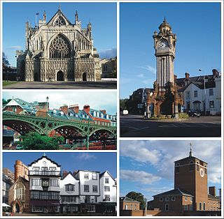
Exeter is a cathedral city and the county town of Devon, South West England. It is situated on the River Exe, approximately 36 mi (58 km) northeast of Plymouth and 65 mi (105 km) southwest of Bristol.