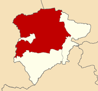
Belvoir was a rural district in Leicestershire, England from 1894 to 1935.
Rural districts were a type of local government area – now superseded – established at the end of the 19th century in England, Wales, and Ireland for the administration of predominantly rural areas at a level lower than that of the administrative counties.

Leicestershire is a landlocked county in the English Midlands. The county borders Nottinghamshire to the north, Lincolnshire to the north-east, Rutland to the east, Northamptonshire to the south-east, Warwickshire to the south-west, Staffordshire to the west, and Derbyshire to the north-west. The border with most of Warwickshire is Watling Street.

England is a country that is part of the United Kingdom. It shares land borders with Wales to the west and Scotland to the north-northwest. The Irish Sea lies west of England and the Celtic Sea lies to the southwest. England is separated from continental Europe by the North Sea to the east and the English Channel to the south. The country covers five-eighths of the island of Great Britain, which lies in the North Atlantic, and includes over 100 smaller islands, such as the Isles of Scilly and the Isle of Wight.
It was formed under the Local Government Act 1894 from the part of the Grantham Rural Sanitary District that was in Leicestershire. It was a small district, named after the village of Belvoir and contained nine parishes:

The Local Government Act 1894 was an Act of the Parliament of the United Kingdom that reformed local government in England and Wales outside the County of London. The Act followed the reforms carried out at county level under the Local Government Act 1888. The 1894 legislation introduced elected councils at district and parish level.
BelvoirBEE-vər is a village and civil parish in the Melton district of Leicestershire, England, close to the county boundary with Lincolnshire. The nearest town is Grantham, 13 kilometres (8 mi) east of the village.

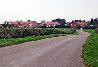
Barkestone-le-Vale is a quiet village in the north east of Leicestershire, England. The population is included in the civil parish of Redmile.

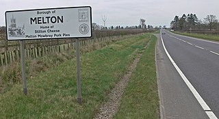
Bottesford is an English village and civil parish. It lies in the Vale of Belvoir and forms part of the Borough of Melton in Leicestershire.
Croxton Kerrial is a village and civil parish in the Melton borough of Leicestershire, England, 6.6 miles (10.6 km) south-west of Grantham, 7.9 miles (12.7 km) north-east of Melton Mowbray, and 0.5 miles (0.8 km) west of Leicestershire's boundary with Lincolnshire. The civil parish, which includes the hamlet of Branston, had a population of 530 at the 2011 census.
Under the County Review Orders of the 1930s it was merged with the Melton Rural District to form the Melton and Belvoir Rural District. The merger took effect in 1935.
The Local Government Act 1929 was an Act of the Parliament of the United Kingdom that made changes to the Poor Law and local government in England and Wales.
Melton was a rural district in Leicestershire, England from 1894 to 1935.
Melton and Belvoir Rural District was a rural district of Leicestershire, England, from 1935 to 1974.