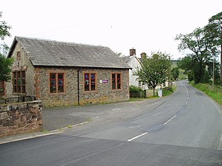
The geography of France consists of a terrain that is mostly flat plains or gently rolling hills in the north and west and mountainous in the south and the east.
Villahoz is a village and municipality in the Province of Burgos, Spain. The village is in the wine region known as Ribera del Arlanza, 15 km from Lerma.

CFSF-FM is a Canadian radio station, broadcasting at 99.3 FM in Sturgeon Falls, Ontario. The station airs an adult contemporary format branded on-air as 99.3 The Moose. The station is owned by Vista Radio.

Nieuw Amsterdam is the capital of the Commewijne District in Suriname. It is a small coastal town situated at the confluence of the Suriname River and Commewijne River, just across from Paramaribo, the country's capital. Its population at the 2012 census was 5,650, with around 1,200 people living in the main town, most of whom are of Javanese and East Indian origin. It is the location of the historical Fort Nieuw-Amsterdam, today an open-air museum.
German submarine U-978 was a World War II Type VIIC U-boat operated by Nazi Germany's Kriegsmarine. She holds the distinction of having completed the longest underwater patrol of World War II.
CFBK-FM is a Canadian radio station that airs at 105.5 FM in Huntsville, Ontario with an adult hits format branded as 105.5 Moose FM.

The West Island Way is a waymarked long distance footpath on the Isle of Bute. The route opened in September 2000 as part of Bute's millennium celebrations, and was the first waymarked long distance route on a Scottish island. As of 2018 it was estimated that between six and seven thousand people were using the trail each year. The route is designated as one of Scotland's Great Trails by Scottish Natural Heritage.

The Moorfoot Hills are a range of hills south of Edinburgh in east central Scotland, one of the ranges which collectively form the Southern Uplands.

Longriggend is a village in North Lanarkshire, Scotland, with a population of approximately 200. It is situated on moorland 8 km north-east of Airdrie, in the parish of New Monkland. It is roughly half way between Upperton and Caldercruix. The village appeared on a map by Timothy Pont, under the name of Langrodge. It was published in 1596 but the letters are difficult to read. The toponymy is listed along with other -rigg placenames. Longriggend is also shown on another map by Roy c1754. Slamannan Railway joined Longriggend with Airdrie and the Union Canal in 1840, but its gauge prevented its connection with the Edinburgh & Glasgow Railway. Coal pits in the area used the railway extensively, and by 1895 there was a station at Longriggend. By 1901 its population had reached over 1500, and it had a post and telegraph office, and an inn nearby.
The Garpel Water is a river near Muirkirk, Scotland. It flows under the Sanquhar bridge and Tibbie's Brig. It flows into the River Ayr.

German submarine U-997 was a Type VIIC/41 U-boat built for Nazi Germany's Kriegsmarine for service during World War II. She was laid down on 7 December 1942 by Blohm & Voss, Hamburg as yard number 197, launched on 18 August 1943 and commissioned on 23 September 1943 under Oberleutnant zur See Hans Lehmann.
German submarine U-1203 was a Type VIIC U-boat built for Nazi Germany's Kriegsmarine for service during World War II. She was laid down on 15 May 1943 by Schichau-Werke, Danzig as yard number 1573, launched on 9 December 1943 and commissioned on 10 February 1944 under Kapitänleutnant Erich Steinbrink.

German submarine U-1272 was a Type VIIC/41 U-boat of Nazi Germany's Kriegsmarine during World War II.

German submarine U-1301 was a Type VIIC/41 U-boat of Nazi Germany's Kriegsmarine during World War II.

German submarine U-1307 was a Type VIIC/41 U-boat of Nazi Germany's Kriegsmarine during World War II.

German submarine U-773 was a Type VIIC U-boat of Nazi Germany's Kriegsmarine during World War II.

German submarine U-779 was a Type VIIC U-boat of Nazi Germany's Kriegsmarine during World War II.

German submarine U-826 was a Type VIIC U-boat of Nazi Germany's Kriegsmarine during World War II.

German submarine U-1052 was a Type VIIC U-boat of Nazi Germany's Kriegsmarine during World War II.


