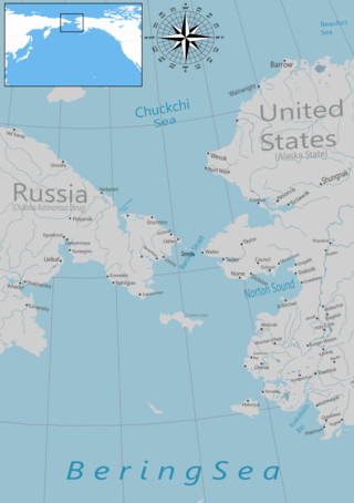
The Bering Strait is a strait between the Pacific and Arctic oceans, separating the Chukchi Peninsula of the Russian Far East from the Seward Peninsula of Alaska. The present Russia-United States maritime boundary is at 168° 58' 37" W longitude, slightly south of the Arctic Circle at about 65° 40' N latitude. The Strait is named after Vitus Bering, a Danish explorer in the service of the Russian Empire.
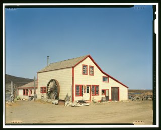
Nome Census Area is a census area located in the U.S. state of Alaska, mostly overlapping with the Seward Peninsula. As of the 2020 census, the population was 10,046, up from 9,492 in 2010. It is part of the unorganized borough and therefore has no borough seat. Its largest community by far is the city of Nome.

Diomede is an incorporated town and is the only habitable area on Little Diomede Island. The island is located in the Nome Census Area of the Unorganized Borough of the U.S. state of Alaska. All the buildings are on the west coast of Little Diomede, which is the smaller of the two Diomede Islands located in the middle of the Bering Strait between the United States and the Russian Far East. Diomede is the only settlement on Little Diomede Island. The population is 82 people, down from 115 at the 2010 census and 146 in 2000.
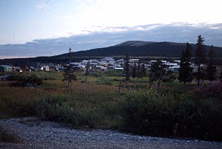
Elim is a city in Nome Census Area, Alaska, United States. At the 2010 census the population was 330, up from 313 in 2000.

Nome is a city in the Nome Census Area in the Unorganized Borough of the US state of Alaska. The city is located on the southern Seward Peninsula coast on Norton Sound of the Bering Sea. It had a population of 3,699 recorded in the 2020 census, up from 3,598 in 2010. Nome was incorporated on April 9, 1901. It was once the most-populous city in Alaska. Nome lies within the region of the Bering Straits Native Corporation, which is headquartered in Nome.

Port Clarence is a census-designated place (CDP) in the Nome Census Area of Alaska. The population was 0 at the 2020 census, down from 24 in 2010. It is located on the spit separating Port Clarence Bay from the Bering Strait.

Savoonga is a city in Nome Census Area, Alaska. It is located on St. Lawrence Island in the Bering Sea. As of the 2020 census, Savoonga's population was 835, up from 671 in 2010.

Shaktoolik is a city in Nome Census Area, Alaska, United States. At the 2010 census the population was 251, up from 230 in 2000. Shaktoolik is one of a number of Alaskan communities threatened by erosion and related global warming effects. The community has been relocated twice.

Shishmaref is a city in the Nome Census Area, Alaska, United States. It is located on Sarichef Island in the Chukchi Sea, just north of the Bering Strait and five miles from the mainland. Shishmaref lies within the Bering Land Bridge National Preserve. The population was 563 at the 2010 census, up from 562 in 2000.

Teller is a city in the Nome Census Area, Alaska, United States. At the 2010 census the population was 229, a decrease from 268 in 2000.

Unalakleet is a city in Nome Census Area, Alaska, United States, in the western part of the state. At the 2010 census the population was 688, down from 747 in 2000. Unalakleet is known in the region and around Alaska for its salmon and king crab harvests; the residents rely for much of their diet on caribou, ptarmigan, oogruk, and various salmon species.

Wales is a city in the Nome Census Area, Alaska, United States. At the 2010 census the population was 145, down from 152 in 2000. It is the westernmost city on the North American mainland, although Adak, located on Adak Island, is the westernmost city in Alaska. Wales Airport serves Wales with flights on Bering Air and Ravn Alaska to Nome.

The Iñupiat are a group of Alaska Natives whose traditional territory roughly spans northeast from Norton Sound on the Bering Sea to the northernmost part of the Canada–United States border. Their current communities include 34 villages across Iñupiat Nunaat, including seven Alaskan villages in the North Slope Borough, affiliated with the Arctic Slope Regional Corporation; eleven villages in Northwest Arctic Borough; and sixteen villages affiliated with the Bering Straits Regional Corporation. They often claim to be the first people of the Kauwerak.

St. Lawrence Island is located west of mainland Alaska in the Bering Sea, just south of the Bering Strait. The village of Gambell, located on the northwest cape of the island, is 50 nautical miles from the Chukchi Peninsula in the Russian Far East. The island is part of Alaska, but closer to Russia and Asia than to the Alaskan and North American mainland. St. Lawrence Island is thought to be one of the last exposed portions of the land bridge that once joined Asia with North America during the Pleistocene period. It is the sixth largest island in the United States and the 113th largest island in the world. It is considered part of the Bering Sea Volcanic Province. The island is jointly-owned by the predominantly Siberian Yupik villages of Gambell and Savoonga, the two main settlements on the island. For its size, Saint Lawrence Island has an abundance of both flora and fauna; the Saint Lawrence Island shrew is a specialized species of shrew that is endemic to the island.

Little Diomede Island or Yesterday Island is an inhabited island, which is off of the coast of Alaska, and is a part of Alaska. It is the smaller of the two Diomede Islands located in the middle of the Bering Strait between the Alaskan mainland and Siberia. The island's one town is also called the town of Diomede.

The Seward Peninsula is a large peninsula on the western coast of the U.S. state of Alaska whose westernmost point is Cape Prince of Wales. The peninsula projects about 200 mi (320 km) into the Bering Sea between Norton Sound, the Bering Strait, the Chukchi Sea, and Kotzebue Sound, just below the Arctic Circle. The entire peninsula is about 210 mi (330 km) long and 90–140 mi (145–225 km) wide. Like Seward, Alaska, it was named after William H. Seward, the United States Secretary of State who fought for the U.S. purchase of Alaska.
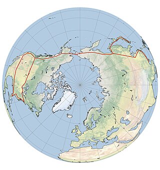
A Bering Strait crossing is a hypothetical bridge or tunnel that would span the relatively narrow and shallow Bering Strait between the Chukotka Peninsula in Russia and the Seward Peninsula in the U.S. state of Alaska. The crossing would provide a connection linking the Americas and Afro-Eurasia.
Bering Straits Native Corporation (BSNC) was formed in 1972 as the Alaska Native Claims Settlement Act (ANCSA) regional corporation for the Bering Straits and Norton Sound region. The corporation actively pursues responsible development of resources and other business opportunities. Through its subsidiaries, BSNC serves the federal government and commercial customers.
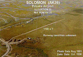
Solomon is an unincorporated community in the Nome Census Area of the Unorganized Borough of Alaska. As of the 2010 census, the population was zero (uninhabited), down from four in 2000.
The Nome–Council Highway is a highway that runs for 71.970 miles (115.824 km) between the communities of Council and Nome in the Nome Census Area of the Unorganized Borough in the U.S. state of Alaska. The road travels east from Nome, following the shore of the Bering Sea until it reaches the ghost town of Solomon. From there, the route travels northeast through the interior of the Seward Peninsula before it terminates on the south bank of the Niukluk River, south of Council. One of three highways traveling from Nome to surrounding communities, the highway is disconnected from the rest of the Alaska Highway System. The route is unpaved for its entire length and becomes impassable for automobiles in the winter outside of a short portion immediately outside of Nome. The portion of the road between Nome and Solomon is part of the Iditarod Trail and the highway passes several historic sites associated with the trail and the area's gold mining history.


