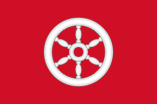
The Electorate of Mainz, previously known in English as Mentz and by its French name Mayence, was one of the most prestigious and influential states of the Holy Roman Empire. In the hierarchy of the Catholic Church, the Archbishop-Elector of Mainz was also the Primate of Germany, a purely honorary dignity that was unsuccessfully claimed from time to time by other archbishops. There were only two other ecclesiastical Prince-electors in the Empire: the Electorate of Cologne and the Electorate of Trier.

The Fulda is a river of Hesse and Lower Saxony, Germany. It is one of two headstreams of the Weser. The Fulda is 220.4 kilometres (137.0 mi) long.
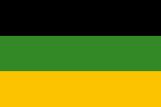
Saxe-Weimar-Eisenach was a German state, created as a duchy in 1809 by the merger of the Ernestine duchies of Saxe-Weimar and Saxe-Eisenach, which had been in personal union since 1741. It was raised to a grand duchy in 1815 by resolution of the Congress of Vienna. In 1903, it officially changed its name to the Grand Duchy of Saxony, but this name was rarely used. The grand duchy came to an end in the German Revolution of 1918–19 with the other monarchies of the German Empire. It was succeeded by the Free State of Saxe-Weimar-Eisenach, which was merged into the new Free State of Thuringia two years later.

Battenberg is a small town in the district of Waldeck-Frankenberg in the state of Hesse, Germany. It is located on the river Eder, a tributary of the Fulda, which flows into the Weser, and lies at the southeastern edges of the Rothaar Mountains. The closest larger cities are Marburg, Siegen, and Kassel, and the town is approximately equally far away from Frankfurt am Main, Cologne, and Dortmund.
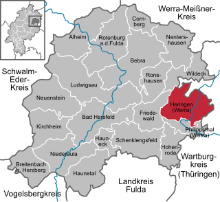
Heringen (Werra) is a small town in Hersfeld-Rotenburg district in eastern Hesse, Germany lying right at the boundary with Thuringia.

Bad Berka is a German spa town, situated in the south of Weimar region in the state of Thuringia. With its almost 8,000 inhabitants Bad Berka is the second biggest city in Weimarer Land district. The river flowing through the town, which is embedded in new red sandstone, is called Ilm. Since 1 December 2008, the city has incorporated the former municipality of Gutendorf.

Berka/Werra is a town and a former municipality in the Wartburgkreis district, in Thuringia, in central Germany. Since 1 January 2019, it is part of the town Werra-Suhl-Tal. It is situated on the river Werra, 19 km west of Eisenach.

The Wisper is a 29.7-kilometre-long (18.5 mi) river in Hesse, Germany, right tributary of the Rhine. Its source is in the western Taunus, Rheingau-Taunus-Kreis district, near a small village named Wisper. It flows southwest through a densely forested valley with some medieval castle ruins surrounded by a popular hiking area. A man-made lake, the Wispersee, is stocked with trout and is a popular fishing destination. The Wisper flows into the Rhine at Lorch.
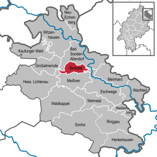
Berkatal is a municipality in the Werra-Meißner-Kreis in Hesse, Germany.
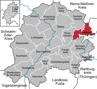
Wildeck is a municipality in Hersfeld-Rotenburg district in northeastern Hesse, Germany lying right at the boundary with Thuringia, 54 km southeast of Kassel.

Söse is a river of Lower Saxony, Germany. It is a right tributary of the river Rhume and 38 kilometres (24 mi) long.

The Modau is a 44-kilometre-long (27 mi) right tributary of the river Rhine running through the German state of Hesse. Historically, there have been many watermills on the river and its tributaries, giving rise to the name Mühltal, a district through which the river flows. It passes through Darmstadt, and Ober-Ramstadt, and Pfungstadt, and flows into a branch of the Rhine in Stockstadt am Rhein.

Kupferbach is a small river of Hesse, Germany. It is a right tributary of the Berka near Wellingerode.
Suhl is a river of Hesse and Thuringia, Germany. It flows into the Weihe near Berka/Werra.
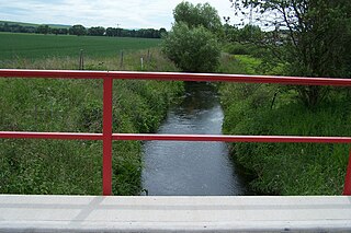
Suhl is a river of Thuringia, Germany. It flows into the Werra near Berka/Werra.

Bigherd is a village in, and the capital of, Tang-e Narak Rural District of the Central District of Khonj County, Fars province, Iran.

The Salzungen Werra Upland is a natural region in Germany that forms part of the East Hesse Highlands in the German states of Hesse and Thuringia.
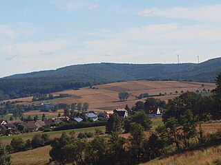
The Seulingswald is a hill range in the German Central Uplands which reaches heights of up to 480.3 m above sea level (NHN). It is part of the Fulda-Werra Uplands in the East Hesse Highlands within the Hessian county of Hersfeld-Rotenburg; small ridges extend into the Thuringian county of Wartburgkreis. It is a sandstone range and one of the largest contiguous woodland areas in Hesse.


