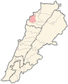
Alma is a village in Zgharta District, in the Northern Governorate of Lebanon. Its population is Maronite Christians and Sunni Muslim.
Ashash, Aachach, Achache or Aachache is a village in Zgharta District, in the Northern Governorate of Lebanon. Its population is solely Maronite Catholic
Aslout is a village in Zgharta District, in the Northern Governorate of Lebanon. It is a Maronite Christian community.
Basloukit or Beslouqit is a village in Zgharta District, in the Northern Governorate of Lebanon.
Bchennine, Bchannine, is a village in Zgharta District, in the Northern Governorate of Lebanon. Its population is predominantly Maronite Catholic.
Kfarzeina, Kfarzaina, is a village in Zgharta District, in the Northern Governorate of Lebanon. Its population is predominantly Maronite Christians.
Mazraat Al Toufah, Mazraat Et Teffah, Mazraat Et-Teffah, is a village in Zgharta District, in the Northern Governorate of Lebanon. It is 123 kilometres (76 mi) from Beirut, the capital of Lebanon.

Mejdlaya, Mejdlaiya, is a village in Zgharta District, in the Northern Governorate of Lebanon.
Rachiine, Rachaaine, is a village in Zgharta District, in the Northern Governorate of Lebanon. Its population is Maronite Christians and other confessions.
Aaba is a village in the Koura District of Lebanon, whose inhabitants are Greek Orthodox and other confessions. It is located 240 metres above sea level.
Kfarsaroun in Koura District, in the Northern Governorate of Lebanon. The population are Greek Orthodox and Maronite.
Darchmezzine, Dar Chmizzine, is a Greek Orthodox and Maronite Christian village in Koura District of Lebanon.
Bsarma is a Christian village in Koura District of Lebanon. The population is Greek Orthodox and Maronite.

Bziza a village in Koura District of Lebanon with some Eastern Orthodox residents. There is a well-preserved Roman temple with three of its frontal portico columns still standing. In Byzantine times a two-apse church known as Our Lady of the Columns was built within its walls.
Mijdel, Majdel Ouel, is a Maronite village in Koura District of Lebanon.
Mitrit is a Maronite village in the Koura District, Lebanon of Lebanon.
Badebhoun is a Sunni Muslim village in Koura District of Lebanon.
Btouratige, Btouratij, is a Sunni Muslim village in Koura District of Lebanon.
Ijdeebrine, Ijd Aabrine, is a Sunni Muslim and Maronite Christian community, in the Koura District of Lebanon. Both religions coexist peacefully. It is beautiful, lush and the river jaus passes through it.
Barsa is a village in Koura District of Lebanon. It has a Maronite and Greek Orthodox population.


