National Rail (NR) is the trading name licensed for use by the Rail Delivery Group, an unincorporated association whose membership consists of the passenger train operating companies (TOCs) of England, Scotland, and Wales. The TOCs run the passenger services previously provided by the British Railways Board, from 1965 using the brand name British Rail. Northern Ireland, which is bordered by the Republic of Ireland, has a different system. National Rail services share a ticketing structure and inter-availability that generally do not extend to services which were not part of British Rail.
Maya the Ayodhya district of the Indian state of Uttar Pradesh, India. Maya is 24 km away from district headquarters Ayodhya city.
Bhadarsa is a town and nagar panchayat in Ayodhya district in state of Uttar Pradesh, India. Bhadarsa is 22 km south of district headquarters Ayodhya city.
Bikapur is a town, tehsil and nagar panchayat of Ayodhya district of Uttar Pradesh state in India. Bikapur is 25 km south of the district headquarters Ayodhya city.
Kurebhar is a town in Sultanpur district of the Uttar Pradesh state in India. Kurebhar is 20 km north of district headquarters Sultanpur city.

The IGI Airport Metro Station is a key part of the Delhi Airport Express Line, also known as the Orange Line of the Delhi Metro. It serves as an essential transit hub for passengers traveling to and from Indira Gandhi International Airport (IGI), providing a direct and rapid link between the airport and central Delhi.
Akbarpur Junction railway station is a junction station between Lucknow, Ayodhya, and Varanasi. It serves Akbarpur city. Railway stations near Akbarpur are Shahganj Junction (SHG), Jaunpur Junction (JNU), Goshainganj (GGJ), Malipur (MLPR) and Bilwai (BWI). This station is under Redevelopment.

Madhupur Junction, station code MDP, is the railway station serving the city of Madhupur in the Deoghar district in the Indian state of Jharkhand. It connects the town and nearby areas to various metropolitan cities of the country. Howrah–Delhi main line via Mughalsarai–Patna route and Madhupur–Giridih–Koderma line are the two routes on this station. The Madhupur–Giridih–Koderma route is a single broad-gauge line. The total length of this route is 137 kilometres (85 mi). It has four platforms and handles many trains daily. Madhupur is located at 24.16°N 86.38°E. It has an average elevation of 228 metres (748 ft).
Sohawal is a town and tehsil in Ayodhya district in the Indian state of Uttar Pradesh and is sub post office of Ayodhya. Sohawal is 18 km west of district headquarters Ayodhya.
Masodha is a town in Ayodhya district in the Indian state of Uttar Pradesh. It is a sub post office of Ayodhya and is close to the Ayodhya city. Masodha is 6 km south of the district magistrate's office. Masodha is also a block in Ayodhya district.
Tarun is a town in Bikapur tehsil, Ayodhya district in the Indian state of Uttar Pradesh, India. Tarun is 30 km south of district headquarters Ayodhya city.

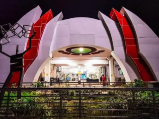
Murshidabad Junction is a railway station on the Sealdah-Lalgola line and is located at Lalbagh, Murshidabad in Murshidabad district in the Indian state of West Bengal.
Bhelsar or Bhilser is a village in Rudauli tehsil, Ayodhya district in the Indian state of Uttar Pradesh, India. Bhelsar is situated on NH-27 Lucknow- Ayodhya road in Ayodhya, Uttar Pradesh. Bhelsar 3 km away from Rudauli Town. And Bhelsar is 39 km west of district headquarters Ayodhya city.

Rudauli railway station is a railway station in Ayodhya district, Uttar Pradesh in Northern India. And it is well connected with Delhi, Kanpur, Lucknow, Varanasi. Rudauli is the busiest station between Lucknow to Varanasi after Ayodhya Junction.

Nabadwip Dham railway station is a railway station on Bandel–Katwa line connecting from Bandel to Katwa, and under the jurisdiction of Howrah railway division of Eastern Railway zone. This is the main railway station of Nabadwip town of Nadia district in the state of West Bengal. It is situated beside State Highway 8, connecting Nabadwip and Krishnanagar through Gouranga Bridge. It serves Nabadwip and the surrounding areas. Almost all EMU and Passenger trains stop at Nabadwip railway station. The distance between Howrah and Nabadwip railway station is approximately 105 km. It has 16th longest railway platform in world 720 m (2,362 ft).
Ramganga railway station is a small railway station in Bareilly district, Uttar Pradesh. Its code is RGB.

Raithuwa is a village in Sohawal tehsil in Ayodhya district of the Indian state of Uttar Pradesh, India. The nearest town to Raithuwa is Bhadarsa which is 6 km away. Raituwa is 19 km south of district headquarters Ayodhya city.
Nandigram, also known by ancient name Bharatkund, is a village and religious place in Sohawal tehsil in Ayodhya district in the Indian state of Uttar Pradesh, India. During the exile of Lord Ram, King Bharat ruled from Nandigram instead of the kingdom's capital Ayodhya. Nandigram is 19 km (12 mi) south of district headquarters Ayodhya city.
Haiderganj is a town in Bikapur tehsil in Ayodhya district of Uttar Pradesh state of India. Haiderganj is 40 km south of district headquarters Ayodhya city.
The 22478/22477 SMVD Katra - New Delhi Vande Bharat Express is India's 37th Vande Bharat Express train, connecting the states of Jammu and Kashmir, Punjab, Haryana and New Delhi. This will be the 2nd Vande Bharat Express train which will run on the New Delhi-Katra train line after 3 October 2019.


