Related Research Articles

Warren County is a county located in the eastern portion of the U.S. state of Missouri. As of the 2020 census, the population was 35,532. The county is located on the north side of the Missouri River. Its county seat is Warrenton. The county was established on January 5, 1833, and was named for General Joseph Warren, who died in the Battle of Bunker Hill during the American Revolutionary War.
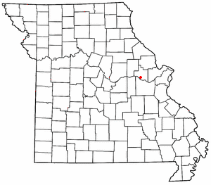
Treloar is an unincorporated community in southern Warren County, Missouri, United States. It is located on the north edge of the Missouri River floodplain and Kochs Creek enters the floodplain just west of the community. Route 94 passes just south of the community and Warrenton is twelve miles to the north.
The Cuivre River is a 41.6-mile-long (66.9 km) river in the east central part of the state of Missouri, north of the Missouri River terminus. A good part of its course marks the borders between Lincoln and St. Charles counties before emptying into the Mississippi River north of St. Louis. The Cuivre River State Park near Troy has its southwestern borders on the river. The river is considered a navigable stream by the Missouri water patrol.

The Big Piney River is a 110-mile-long (180 km) tributary of the Gasconade River in south central Missouri in the United States. Via the Gasconade and Missouri rivers, it is part of the Mississippi River basin.
Petite Saline Creek is a stream in Cooper, Moniteau and Morgan counties in the U.S. state of Missouri. It is a tributary of the Missouri River.
Sni-A-Bar Creek is a stream in Jackson and Lafayette counties in the U.S. state of Missouri. It is a tributary of the Missouri River.
Buck Creek is a stream in Lincoln County in the U.S. state of Missouri. It is a tributary of the North Fork of the Cuivre River.
Butcher Creek is a stream in southern Lincoln County in the U.S. state of Missouri. It is a tributary to Crooked Creek.
Nulls Creek is a stream in Lincoln County in the U.S. state of Missouri. The stream is a tributary of the North Fork of the Cuivre River.
Tavern Creek is a stream in Miller and Pulaski counties in the U.S. state of Missouri. It is a tributary of the Osage River. The stream headwaters are at 37°54′42″N92°22′19″W and the confluence with the Osage is at 38°19′04″N92°17′24″W.
Camp Creek is a stream in Montgomery, Warren and Lincoln counties in Missouri. It is a tributary of the West Fork of the Cuivre River.
Coon Creek is a stream in Audrain and Montgomery counties in the U.S. state of Missouri. It is a tributary of the West Fork Cuivre River.
Wakenda Creek is a stream in Carroll, Ray and Saline counties in the U.S. state of Missouri. It is a tributary of the Missouri River.
Indian Camp Creek is a stream in northeast Warren County and northwest St. Charles County in the U.S. state of Missouri. It is a tributary of Big Creek.
McCoy Creek is a stream in St. Charles and Warren Counties in the U.S. state of Missouri. It is a tributary to Big Creek.
Peruque Creek is a stream in St. Charles and Warren Counties in the U.S. state of Missouri. It is a tributary of the Mississippi River.
Flat Creek is a stream in Barry and Stone counties of southern Missouri. It is a tributary of the James River.
Femme Osage Creek is a stream in St. Charles County in the U.S. state of Missouri. It is a tributary of the Missouri River.
Hickory Lick Creek is a stream in Lincoln and Warren counties in the U.S. state of Missouri. It is a tributary to Big Creek.
Yeater Branch is a stream in Warren County in the U.S. state of Missouri. It is a tributary of Big Creek.
References
- ↑ Warrenton, Missouri, 7.5 Minute Topographic Quadrangle, USGS, 1973 (1986 rev.)
- 1 2 3 U.S. Geological Survey Geographic Names Information System: Big Creek
- 1 2 Missouri Atlas & Gazetteer, DeLorme, 1998, First edition, p. 39-40, ISBN 0-89933-224-2
- ↑ "Warren County Place Names, 1928–1945". The State Historical Society of Missouri. Archived from the original on June 24, 2016. Retrieved December 30, 2016.