Trout Lake is an unincorporated community and census-designated place (CDP) in Klickitat County, Washington, United States. The population was 672 at the 2020 census. The town is notable for its organic dairy and herb farms, and as an access point to Mount Adams and the Gifford Pinchot National Forest.

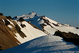
Mount Adams, known by some Native American tribes as Pahto or Klickitat, is an active stratovolcano in the Cascade Range. Although Adams has not erupted in more than 1,000 years, it is not considered extinct. It is the second-highest mountain in Washington, after Mount Rainier.

The Klamath Mountains are a rugged and lightly populated mountain range in northwestern California and southwestern Oregon in the western United States. As a mountain system within both the greater Pacific Coast Ranges and the California Coast Ranges, the Klamath Mountains have a varied geology, with substantial areas of serpentinite and marble, and a climate characterized by moderately cold winters with very heavy snowfall and warm, very dry summers with limited rainfall, especially in the south. As a consequence of the geology and soil types, the mountains harbor several endemic or near-endemic trees, forming one of the largest collections of conifers in the world. The mountains are also home to a diverse array of fish and animal species, including black bears, large cats, owls, eagles, and several species of Pacific salmon. Millions of acres in the mountains are managed by the United States Forest Service. The northernmost and largest sub-range of the Klamath Mountains are the Siskiyou Mountains.

Gifford Pinchot National Forest is a National Forest located in southern Washington, managed by the United States Forest Service. With an area of 1.32 million acres (5,300 km2), it extends 116 km (72 mi) along the western slopes of Cascade Range from Mount Rainier National Park to the Columbia River. The forest straddles the crest of the South Cascades of Washington State, spread out over broad old-growth forests, high mountain meadows, several glaciers, and numerous volcanic peaks. The forest's highest point is at 12,276 ft (3,742 m) at the top of Mount Adams, the second-tallest volcano in the state after Rainier. Often found abbreviated GPNF on maps and in texts, it includes the 110,000-acre (450 km2) Mount St. Helens National Volcanic Monument, established by Congress in 1982.

Indian Heaven is a volcanic field in Skamania County in the state of Washington, in the United States. Midway between Mount St. Helens and Mount Adams, the field dates from the Pleistocene to the early Holocene epoch. It trends north to south and is dominated by six small shield volcanoes; these shields are topped by small spatter and cinder cones, and the field includes a number of subglacial volcanoes and tuyas. The northernmost peak in the field is Sawtooth Mountain and the southernmost is Red Mountain; its highest point is Lemei Rock at an elevation of 5,925 feet (1,806 m).

The Wind River Experimental Forest is an ecological and silvicultural research in Stabler, Washington, in the United States. Used as a research site by the U.S. Forest Service beginning in 1908, and functioning as an experimental forest since 1932, it is "known as the cradle of forest research in the Pacific Northwest". The site is probably best known for the Wind River Canopy Crane Research Facility (WRCCRF), a 285-foot (87 m)-high freestanding tower crane which supported an 8-person gondola allowing scientists to view the forest canopy from above. The tallest trees in the forest are about 220 feet (67 m).

The Coconino National Forest is a 1.856-million acre United States National Forest located in northern Arizona in the vicinity of Flagstaff, with elevations ranging from 2,600 feet to the highest point in Arizona at 12,633 feet. Originally established in 1898 as the "San Francisco Mountains National Forest Reserve", the area was designated a U.S. National Forest by Pres. Theodore Roosevelt on July 2, 1908, when the San Francisco Mountains National Forest Reserve was merged with lands from other surrounding forest reserves to create the Coconino National Forest. Today, the Coconino National Forest contains diverse landscapes, including deserts, ponderosa pine forests, flatlands, mesas, alpine tundra, and ancient volcanic peaks.

Tahoe National Forest is a United States National Forest located in California, northwest of Lake Tahoe. It includes the 8,587-foot (2,617 m) peak of Sierra Buttes, near Sierra City, which has views of Mount Lassen and Mount Shasta. It is located in parts of six counties: Sierra, Placer, Nevada, Yuba, Plumas and El Dorado. The forest has a total area of 871,495 acres. Its headquarters is in Nevada City, California. There are local ranger district offices in Camptonville, Foresthill, Sierraville and Truckee.

The Mount Washington Wilderness is a wilderness area located on and around Mount Washington in the central Cascade Range of Oregon in the United States. The wilderness was established in 1964 and comprises 54,278 acres (219.66 km2) of the Willamette National Forest and Deschutes National Forest. It is administered by the U.S. Forest Service.

State Route 141 (SR 141) is a state highway in Klickitat County, Washington, United States. It runs north–south for 29 miles (47 km), connecting SR 14 in Bingen to White Salmon and Trout Lake. The highway follows the White Salmon River towards the base of Mount Adams, terminating at the Skamania County border at the entrance to the Gifford Pinchot National Forest, where it becomes Forest Road 24. SR 141 is a state scenic highway that provides access to recreation areas on the south side of Mount Adams.

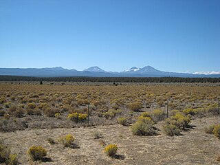
The Eastern Cascades Slopes and Foothills ecoregion is a Level III ecoregion designated by the United States Environmental Protection Agency (EPA) in the U.S. states of Oregon, Washington, and California. In the rain shadow of the Cascade Range, the eastern side of the mountains experiences greater temperature extremes and receives less precipitation than the west side. Open forests of ponderosa pine and some lodgepole pine distinguish this region from the Cascades ecoregion, where hemlock and fir forests are more common, and from the lower, drier ecoregions to the east, where shrubs and grasslands are predominant. The vegetation is adapted to the prevailing dry, continental climate and frequent wildfire. Volcanic cones and buttes are common in much of the region.

Indian Heaven Wilderness is a protected area located inside the Gifford Pinchot National Forest of southwestern Washington state. The wilderness consists of 20,782 acres (8,410 ha) of broad, forested plateau, with meadows straddling numerous volcanic peaks and at least 150 small lakes, ponds, and marshes. The wilderness also contains the Indian Heaven volcanic field. Originally known to the Indians as "Sahalee Tyee," the area has been and remains culturally important to Native Americans. During the past 9,000 years, the Yakama, Klickitat, Cascades, Wasco, Wishram, and Umatilla tribes gathered in this area for berry picking, fishing, and hunting.
Goose Lake, in the U.S. state of Washington, is located within the Gifford Pinchot National Forest. Travel to Goose Lake is via a dirt road, along Forest Road 60, also called the Carson Guler Road, typically free of snow by late June. Fed by several streams, Goose Lake was dammed by a lava flow from Big Lava Bed, directly to the south. The lake is 58 acres in size and includes a boat launch and a campground with 18 primitive campsites. Popular for fishing in summer and early fall, Goose Lake contains brook, brown, and coastal cutthroat trout.

Lemei Rock is a shield volcano, and part of the Indian Heaven polygenetic volcanic field in Washington, United States. It is located midway between Mount St. Helens and Mount Adams, and dates from the Pleistocene and Holocene. Lemei Rock is the highest point at 5,925 feet (1,806 m).

Takhlakh Lake is a lake situated 7.3 miles (11.7 km) northwest of Mount Adams in the U.S. state of Washington. It is fed by a few small unnamed inflow creeks originating near Takh Takh Meadows, tributary to the Cispus River. A popular 53-site campground on the west side of the lake brings summer and early fall campers as well as hikers hiking the Takhlakh Loop Trail and the Takh Takh Meadows Trail, and nearby trails in the Mount Adams Wilderness. A day use area offers a picnic area and provides a boat ramp as well. The lake is one of the five lakes, all within a seven-mile radius, in the Midway High Lakes Area. It is managed by the Gifford Pinchot National Forest.

Olallie Lake is an alpine lake and one of several in the area fed by streams coming off the glaciers from nearby Mount Adams. A small, but popular Olallie Lake Campground offers scenic camping as well as non-motorized boating and fishing experiences. It is located at 4,200 feet elevation in the Gifford Pinchot National Forest, in Washington state.

Babyshoe Pass, is a high pass within Gifford Pinchot National Forest. Forest Route 23 traverses the pass, northwest of Mount Adams in the State of Washington, between Mount Adams flank to the east and Babyshoe Ridge to the west. The pass separates the Lewis River Watershed and the Cispus River drainage. It was built to connect a Forest Highway together, providing the main north-south access on the east side of the Gifford Pinchot National Forest and the many trails within or near the Mount Adams Wilderness and the Midway High Lakes Area.

Midway High Lakes Area, also known as High Lakes Area, is a United States Forest Service–designated area located in Washington’s Cascade Mountains. It lies on a high plateau on Mount Adams' northwestern flank. It is between the Goat Rocks on the north and Mount Hood to the south and contains Takhlakh Lake along with several other lakes. The area offers five scenic high elevation lakes all within a seven-mile (11 km) radius. It is administered by the Gifford Pinchot National Forest. While even the most visited areas at Mount Adams pale in comparison to nearby St. Helens or Rainier, it is by its own standards one of the most popular recreational areas around Mount Adams. Some of the lakes offers photogenic views of Mount Adams from across the lake.

Horseshoe Lake is a lake situated in the east side of the Midway High Lakes Area below Mount Adams's northwest flank. The lake is popular for camping, quiet boating, hiking, and biking on a trail halfway around the lake. Other activities include scenic viewing and fishing. The lake offers an eleven-site campground, administered by the Gifford Pinchot National Forest in the State of Washington.

The Mount Adams Recreation Area is a 21,000-acre (8,500 ha) recreation area in the U.S. state of Washington managed by the Yakama Nation Tribal Forestry Program. The area encompasses an ecologically complex and geologically active landscape. The region features the most rugged side of Mount Adams, including canyons and the Great Gap section of the Mount Adams circumnavigation route, a three-mile trail-less section over two great canyons and many difficult glacial creeks. At 12,276 feet (3,742 m), Mount Adams is one of the major Cascade mountains. The recreation area is on the east side of the mountain and is part of the Yakama Indian Reservation and includes the popular Bird Creek Meadows area.


