Bongadobhan is a village development committee in Baglung District in the Dhaulagiri Zone of central Nepal. At the time of the 1991 Nepal census it had a population of 4,537 and had 904 houses in the town.
Daga Tumdada is a village development committee in Baglung District in the Dhaulagiri Zone of central Nepal. At the time of the 1991 Nepal census it had a population of 4,874 and had 897 houses in the town.
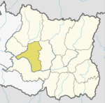
Damek is a village development committee in Baglung District in the Dhaulagiri Zone of central Nepal. At the time of the 1991 Nepal census it had a population of 5,824 and had 1072 houses in the town.
Devisthan is a village development committee in Baglung District in the Dhaulagiri Zone of central Nepal. At the time of the 1991 Nepal census it had a population of 6,151 and had 1247 houses in the town.
Hile is a village development committee in Baglung District in the Dhaulagiri Zone of central Nepal. At the time of the 1991 Nepal census it had a population of 2,891 and had 530 houses in the village. The town was founded in 1978.
Jaljala is a Village Development Committee in Baglung District in the Dhaulagiri Zone of central Nepal. At the time of the 1991 Nepal census it had a population of 3,637 and had 624 houses in the town.
Khunga is a Village Development Committee in Baglung District in the Dhaulagiri Zone of central Nepal. At the time of the 1991 Nepal census it had a population of 2,926 and had 583 houses in the town.
Lekhani is a Village Development Committee in Baglung District in the Dhaulagiri Zone of central Nepal. At the time of the 1991 Nepal census it had a population of 2,431 and had 507 houses in the village.
Salyan is a village development committee in Baglung District in the Dhaulagiri Zone of central Nepal. At the time of the 1991 Nepal census it had a population of 1,935 and had 396 houses in the village.
Isma Rajasthal is a Village Development Committee in Gulmi District in the Lumbini Zone of central Nepal. At the time of the 1991 Nepal census it had a population of 2974 persons living in 568 individual households.

Chhorambu is a village and Village Development Committee in Khotang District in the Sagarmatha Zone of eastern Nepal. At the time of the 1991 Nepal census it had a population of 2,376 persons living in 428 individual households.
Baksila is a village and Village Development Committee in Khotang District in the Sagarmatha Zone of eastern Nepal. At the time of the 1991 Nepal census it had a population of 3,996 persons living in 796 individual households. Baksila is located at five hours walk from Diktel, headquarters of Khotang District. Surrounded by Baspani, Sungdel, Dipsung, Rakha Saptewor and Kharmi, this village split into nine wards geographically
Damarkhu Shivalaya is a town and Village Development Committee in Khotang District in the Sagarmatha Zone of eastern Nepal. At the time of the 1991 Nepal census it had a population of 3,237 persons living in 602 individual households.
Ghitung is a village and Village Development Committee in Khotang District in the Sagarmatha Zone of eastern Nepal. At the time of the 1991 Nepal census it had a population of 2,515 persons living in 482 individual households.
Khartamchha is a village and Village Development Committee in Khotang District in the Sagarmatha Zone of eastern Nepal. At the time of the 1991 Nepal census it had a population of 2,387 persons living in 497 individual households.
Khotang Bazar is a village and Village Development Committee in Khotang District in Province No. 1 in eastern Nepal. At the time of the 1991 Nepal census, it had a population of 2,433 persons living in 458 individual households.....
Lichki Ramche is a village and Village Development Committee in Khotang District in the Sagarmatha Zone of eastern Nepal. At the time of the 1991 Nepal census it had a population of 3,363 persons living in 606 individual households.
Simpani is a town and Village Development Committee in Khotang District in the Sagarmatha Zone of eastern Nepal. At the time of the 1991 Nepal census it had a population of 3,597 persons living in 676 individual households. According to Simpani VDC record in 2008, its total population is 5713.
Waplukha is a Village Development Committee in Khotang District in the Sagarmatha Zone of eastern Nepal. At the time of the 1991 Nepal census it had a population of 2,571 persons living in 484 individual households.
Chapakot is a village and Village Development Committee in Kaski District in the Gandaki Zone of northern-central Nepal. At the time of the 1991 Nepal census it had a population of 2,966 persons residing in 574 individual households.