
This is a list of sites in Minnesota which are included in the National Register of Historic Places. There are more than 1,600 properties and historic districts listed on the NRHP; each of Minnesota's 87 counties has at least 2 listings. Twenty-two sites are also National Historic Landmarks.

The Omaha Rail and Commerce Historic District, roughly bounded by Jackson, 15th, and 8th Streets, as well as the Union Pacific main line, is located in downtown Omaha, Nebraska. Today this historic district includes several buildings listed individually on the National Register of Historic Places, including the Union Pacific Depot and the Burlington Station.

The Christian Specht Building is located at 1110 Douglas Street in downtown Omaha, Nebraska. It is the only existing building with a cast-iron facade known in Nebraska today, and one of the few ever built in the state. The building was deemed an Omaha landmark in 1981, and was listed on the National Register of Historic Places in 1977.

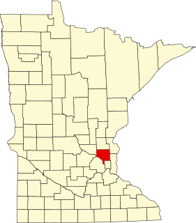
This is a list of the National Register of Historic Places listings in Dakota County, Minnesota. It is intended to be a complete list of the properties and districts on the National Register of Historic Places in Dakota County, Minnesota, United States. Dakota County is located in the southeastern part of the U.S. state of Minnesota, bounded on the northeast side by the Upper Mississippi River and on the northwest by the Minnesota River. The locations of National Register properties and districts for which the latitude and longitude coordinates are included below, may be seen in an online map.
This is a list of the National Register of Historic Places listings in Anoka County, Minnesota. It is intended to be a complete list of the properties and districts on the National Register of Historic Places in Anoka County, Minnesota, United States. The locations of National Register properties and districts for which the latitude and longitude coordinates are included below, may be seen in an online map.

This is a list of the National Register of Historic Places listings in Crow Wing County, Minnesota. It is intended to be a complete list of the properties and districts on the National Register of Historic Places in Crow Wing County, Minnesota, United States. The locations of National Register properties and districts for which the latitude and longitude coordinates are included below, may be seen in an online map.

This is a list of the National Register of Historic Places listings in Winona County, Minnesota. It is intended to be a complete list of the properties and districts on the National Register of Historic Places in Winona County, Minnesota, United States. The locations of National Register properties and districts for which the latitude and longitude coordinates are included below, may be seen in an online map.

This is a list of the National Register of Historic Places listings in Wabasha County, Minnesota. It is intended to be a complete list of the properties and districts on the National Register of Historic Places in Wabasha County, Minnesota, United States. The locations of National Register properties and districts for which the latitude and longitude coordinates are included below, may be seen in an online map.
This is a list of properties and historic districts on the National Register of Historic Places within the city limits of St. Louis, Missouri, south of Interstate 64 and west of Downtown St. Louis. For listings in Downtown St. Louis, see National Register of Historic Places listings in Downtown and Downtown West St. Louis. For those north of I-64 and west of downtown, see National Register of Historic Places listings in St. Louis north and west of downtown. For listings in St. Louis County and outside the city limits of St. Louis, see National Register of Historic Places listings in St. Louis County, Missouri.

This is a list of the National Register of Historic Places listings in Todd County, Minnesota. It is intended to be a complete list of the properties and districts on the National Register of Historic Places in Todd County, Minnesota, United States. The locations of National Register properties and districts for which the latitude and longitude coordinates are included below, may be seen in an online map.

This is a list of the National Register of Historic Places listings in Mille Lacs County, Minnesota.

There are 65 properties listed on the National Register of Historic Places in Albany, New York, United States. Six are additionally designated as National Historic Landmarks (NHLs), the most of any city in the state after New York City. Another 14 are historic districts, for which 20 of the listings are also contributing properties. Two properties, both buildings, that had been listed in the past but have since been demolished have been delisted; one building that is also no longer extant remains listed.

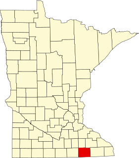
This is a list of the National Register of Historic Places listings in Waseca County, Minnesota. It is intended to be a complete list of the properties and districts on the National Register of Historic Places in Waseca County, Minnesota, United States. The locations of National Register properties and districts for which the latitude and longitude coordinates are included below, may be seen in an online map.
This is a list of the National Register of Historic Places listings in Mower County, Minnesota. It is intended to be a complete list of the properties and districts on the National Register of Historic Places in Mower County, Minnesota, United States. The locations of National Register properties and districts for which the latitude and longitude coordinates are included below, may be seen in an online map.


