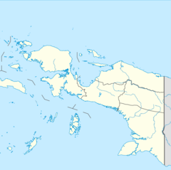
Western New Guinea, also known as Papua, Indonesian New Guinea, and Indonesian Papua, is the western half of the island of New Guinea, formerly Dutch and granted to Indonesia in 1962. Given the island is alternatively named Papua, the region is also called West Papua.

The dwarf cassowary, also known as Bennett's cassowary, little cassowary, mountain cassowary or muruk, is the smallest of the three extant species of cassowaries.

The South Halmahera–West New Guinea (SHWNG) languages are a branch of the Malayo-Polynesian languages, found in the islands and along the shores of the Halmahera Sea in the Indonesian province of North Maluku and of Cenderawasih Bay in the provinces of Papua and West Papua. There are 38 languages.

The Bird's Head Peninsula or Doberai Peninsula is a large peninsula that makes up the northwest portion of the island of New Guinea, comprising the Indonesian provinces of Southwest Papua and West Papua. It is often referred to as The Vogelkop, and is so named because its shape looks like a bird's head on the island of New Guinea. The peninsula at the opposite end of the island is called the Bird's Tail Peninsula. The peninsula just to the south is called the Bomberai Peninsula.
Misool, formerly spelled Mysol or Misol, is one of the four major islands in the Raja Ampat Islands in Southwest Papua, Indonesia. Its area is 2,034 km2. The highest point is 561 m and the main towns are Waigama, located on the island's northwest coast, and Lilinta on the island's southeast coast.

The northern variable pitohui is a species of pitohui in the family Oriolidae. It is found on New Guinea and a number of neighbouring islands. Its natural habitat is subtropical or tropical moist lowland forests. It is also one of the few known poisonous birds.

Melanotaenia is a genus of rainbowfish from Australia, Indonesia, New Guinea, and nearby smaller islands.

The Northern New Guinea lowland rain and freshwater swamp forests is a tropical moist broadleaf forest ecoregion of northern New Guinea.
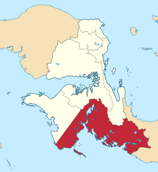
Bomberai Peninsula is located in the Western New Guinea region. It is south of the Bird's Head Peninsula, and Bintuni Bay separates the two peninsulas. To the west lies the Sebakor Bay and to the south Kamrau Bay. On the southeast Arguni Bay lies between the peninsula and the Bird's Neck Isthmus.

New Guinea is the world's second-largest island, with an area of 785,753 km2 (303,381 sq mi). Located in Melanesia in the southwestern Pacific Ocean, the island is separated from Australia by the 150-kilometre wide Torres Strait, though both landmasses lie on the same continental shelf, and were united during episodes of low sea level in the Pleistocene glaciations as the combined landmass of Sahul. Numerous smaller islands are located to the west and east. The island's name was given by Spanish explorer Yñigo Ortiz de Retez during his maritime expedition of 1545 due to the resemblance of the indigenous peoples of the island to those in the African region of Guinea.

The Central Range montane rain forests is a tropical moist forest ecoregion on the island of New Guinea. The ecoregion covers the Central Range of the New Guinea Highlands, which extends along the spine of the island. The montane rain forests of the ecoregion are distinct from the surrounding lowland forests, and are home to many endemic plants and animals.
New Guinea, lying within the tropics and with extensive mountain areas, comprises a wide range of ecoregions. These include rainforests, grasslands and mangrove.
Kaimana Regency is a regency in the south of West Papua province of Indonesia. It covers an area of 18,500 sq. km, and had a population of 46,249 at the 2010 Census and 62,256 at the 2020 Census; the official estimate as at mid 2023 was 65,490. The administrative centre is the town of Kaimana. The Mairasi languages are spoken in the regency, among other languages.
Teluk Wondama Regency or Wondama Bay Regency is a regency of West Papua province of Indonesia. It covers a land area of 4,844.035 km2, and had a population of 26,321 at the 2010 Census and 41,644 at the 2020 Census; the official estimate as at mid 2023 was 44,534. The administrative centre lies in the small town of Rasiei.
The Ayamaru Lakes are a group of lakes found in the west-central part of the Bird's Head Peninsula in Southwest Papua, Indonesia. The nearest village to the group is Greemakolo. The many villages around the Ayamaru Lakes speak the Ayamaru language, a dialect of the Maybrat language.

The Vogelkop–Aru lowland rain forests is a tropical moist forest ecoregion in Indonesia. The ecoregion covers the peninsular lowlands of western New Guinea, along with the Aru Islands and other nearby islands.

The Vogelkop montane rain forests is a tropical moist forest ecoregion in western New Guinea. The ecoregion covers the mountains of western New Guinea's Bird's Head and Bomberai peninsulas.
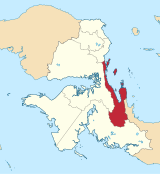
The Wondiboy Peninsula, also known as the Wondiwoi, Wandammen, Wondama, or in old sources Mandamy is a mountainous peninsula in Wondama Bay Regency, Western New Guinea. It extends northwards from the Bird's Neck Isthmus into Cenderawasih Bay, and is composed administratively of the Rasiei, Wondiboy, Wasior and Teluk Duairi Districts (kecamatan) within the regency. At the northern end of the peninsula the land breaks up into a series of islands which form Roon District, of which the largest is Roon Island.