
Strömstad Municipality is a municipality in Västra Götaland County in western Sweden. Its seat is located in the city of Strömstad.

Hyżne is a village in Rzeszów County, Subcarpathian Voivodeship, in south-eastern Poland. It is the seat of the gmina called Gmina Hyżne. It lies on the Tatyna river, approximately 17 km (11 mi) south-east of the regional capital Rzeszów.
Kråkerøy is an island and a former municipality in Østfold county, Norway.

Dragoman is the seat of Dragoman Municipality in the Sofia Province, western Bulgaria. The town is located very close to the border with Serbia. As of 2011 the population is 5,362.

Janov is a village and municipality in Prešov District in the Prešov Region of eastern Slovakia.

Chiscani is a commune located in Brăila County, Romania. It is composed of three villages: Chiscani, Lacu Sărat and Vărsătura.
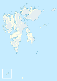
Bölscheøya is an island southwest of Negerpynten, the southeastern point of Edgeøya. It is part of Thousand Islands. The island was named in 1868 by the German geographer August Petermann (1822–78) after the German journalist Carl Bölsche, father of the German writer and zoologist Wilhelm Bölsche (1843–93). The remains of a whaling station from the 17th century can be found on the island.
Brækmoholmane is an island group composed of three islands, Store Brækmoholmen, Trønderen and Alkekongen. They form part of Thousand Islands, an archipelago south of Edgeøya. The islands are named after the Norwegian sailor and fisherman Sivert Brækmo (1853-1930), who visited Svalbard regularly between 1876 and 1895.
Blokkøya is an island in the southwestern part of Scareholmane, an island group in Thousand Islands, an archipelago south of Edgeøya.
Căiuți is a commune in Bacău County, Romania. It is composed of nine villages: Blidari, Boiștea, Căiuți, Florești, Heltiu, Mărcești, Popeni, Pralea and Vrânceni.
Dagâța is a commune in Iași County, Romania. It is composed of eight villages: Bălușești, Boatca, Buzdug, Dagâța, Mănăstirea, Piscu Rusului, Poienile, Tarnița and Zece Prăjini. The commune had 4809 people at the 2002 census; of these, 89.8% were ethnic Romanian and 10.2% were Roma. 98.9% of inhabitants were Romanian Orthodox.

Buceș is a commune in Hunedoara County, Romania. It is composed of seven villages: Buceș, Buceș-Vulcan, Dupăpiatră (Dupapiátra), Grohoțele, Mihăileni (Miheleny), Stănija (Sztanizsa) and Tarnița.
Nieborów is a village in the administrative district of Gmina Hyżne, within Rzeszów County, Subcarpathian Voivodeship, in south-eastern Poland. It lies close to Hyżne, approximately 17 km (11 mi) south-east of the regional capital Rzeszów.
Okunica is a village in the administrative district of Gmina Pyrzyce, within Pyrzyce County, West Pomeranian Voivodeship, in north-western Poland. It lies approximately 7 kilometres (4 mi) north-east of Pyrzyce and 35 km (22 mi) south-east of the regional capital Szczecin.
Nagygörbő is a village in Zala County, Hungary.
Dragievtsi is a village in Gabrovo Municipality, in Gabrovo Province, in northern central Bulgaria.
Blackwelder Glacier is a pocket glacier, 1 nautical mile (2 km) wide and 2 nautical miles (4 km) long, between Salmon Hill and Hobbs Glacier in Victoria Land. The glacier was studied during U.S. Navy Operation Deepfreeze, 1957–58, by Troy L. Pewe and was named by him for Eliot Blackwelder, former head of the Geology Department at Stanford University.
Torckler Rocks are three small islands lying at the north side of the entrance to Heidemann Bay, Vestfold Hills. Mapped by Norwegian cartographers from air photos taken by the Lars Christensen Expedition, 1936-37. Remapped from ANARE air photos and named for R.M. Torckler, radio officer at Davis Station in 1959.
Käkimaa is an island belonging to the country of Estonia.


