Blackwater or Black Water may refer to:

The River Nore is one of the principal rivers in the South-East Region of Ireland. The 140-kilometre-long (87 mi) river drains approximately 2,530 square kilometres (977 sq mi) of Leinster and Munster, that encompasses parts of three counties. Along with the River Suir and River Barrow, it is one of the constituent rivers of the group known as the Three Sisters.

Hook Head, historically called Rindowan, is a headland in County Wexford, Ireland, on the east side of the estuary of The Three Sisters. It is part of the Hook peninsula and is adjacent to the historic townland of Loftus Hall. It is situated on the R734 road, 50 kilometres (31 mi) from Wexford town.

The River Slaney is a large river in the southeast of Ireland. It rises on Lugnaquilla Mountain in the western Wicklow Mountains and flows west and then south through counties Wicklow, Carlow and Wexford for 117.5 km (73 mi), before entering St George's Channel in the Irish Sea at Wexford town. The estuary of the Slaney is wide and shallow and is known as Wexford Harbour. The catchment area of the River Slaney is 1,762 km2. The long-term average flow rate of the River Slaney is 37.4m3/s

The Eleven Point River is a 138-mile-long (222 km) river in southern Missouri and northern Arkansas, United States.
The River Feale rises near Rockchapel in the Mullaghareirk Mountains of County Cork in the southwest of Ireland and flows northwestwards for 75 kilometres through Abbeyfeale in County Limerick and Listowel in County Kerry before finally emptying into Cashen Bay, a wide estuary north of Ballyduff. Then it flows out through the Shannon's estuary and joins with the Atlantic Ocean with a flow rate of 34.6 m2/s. The river, along with its tributaries, combine to add to over 160 km of waterways. For the final 10 km stretch it is known as the Cashen River. The river contains a large salmon and sea trout population.

The River Bandon is a river in County Cork, Ireland.
The River Deel is in County Cork and County Limerick, Ireland.

The Irish Wilderness is a 16,227-acre (66 km2) wilderness area in the U.S. State of Missouri. The U.S. Congress designated it a wilderness in 1984. The Irish Wilderness is located within the Eleven Point Ranger District of the Mark Twain National Forest, 10 miles (16 km) northeast of Alton, Missouri. The Irish Wilderness is one of eight wilderness areas protected and preserved in Missouri.

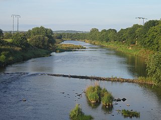
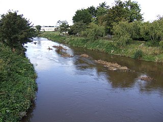
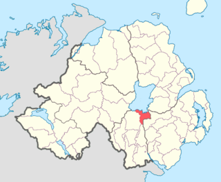
Newry River, also known as the River Clanrye, is a river in Northern Ireland flowing through counties Down and Armagh. The river passes through the city of Newry and empties into Carlingford Lough near Warrenpoint.

The N29 road is a national primary road in Ireland. It connects the Port of Waterford at Belview, County Kilkenny to Waterford City via the N25. The road and port are located on the north bank of the River Suir.

The R683 road is a regional road in County Waterford, Ireland. It connects Waterford city to the village and ferry port of Passage East. The ferry operates across the River Barrow estuary to the village of Ballyhack, County Wexford.

Cloghduv or Cloghduff is a village in County Cork, Ireland. It has a population of 440 people. The main industry is agriculture, although it is also a commuter village for Cork City. Cloughduv is part of the Dáil constituency of Cork North-West. The village is 1.4 km from the River Bride.

The N65 road is a national secondary road in Ireland. It links the N52 at Borrisokane, County Tipperary to the M6 north of Loughrea in County Galway.

Tyrone House in County Galway is a ruined manor house, built in the 1770s on a promontory by the estuary of the Kilcolgan river, about 2 miles (3 km) from the village of Kilcolgan, County Galway, Ireland.

The River Fane is a river flowing from County Monaghan to Dundalk Bay in County Louth, Ireland.

The Castletown River is a river which flows through the town of Dundalk, County Louth, Ireland. It rises near Newtownhamilton, County Armagh, Northern Ireland, and is known as the Creggan River in its upper reaches. Its two main tributaries are the Kilcurry and Falmore rivers and it enters the Irish Sea at Dundalk Bay.

The River Duff, or Bunduff, is a river in County Sligo and County Leitrim, Ireland. The River Duff is 14 miles (23 km) long, flowing from Glenade Valley in County Leitrim to the sea. In County Leitrim it is also known as the Black River. It is joined by the Ballanaghtrillick River, which runs out of the Horseshoe Pass.

Belfast Upper is a barony in County Antrim, Northern Ireland. To its east lies the barony of Belfast and Belfast Lough, and it is bordered by five other baronies: Belfast Lower to the north-east; Antrim Upper to the north-west; Massereene Lower to the west; Massereene Upper to the south-west; and Castlereagh Upper to the south. The Forth River flows through both Belfast Upper and Lower. The most prominent hills in the barony are Black Hill and Lyle's Hill.
Oneilland East is a barony in the north-east of County Armagh, Northern Ireland. It is also called Clanbrasil. It lies in the north-east corner of the county, on the south-eastern shore of Lough Neagh and the boundary with County Down. Oneilland East is bordered by three other baronies: Oneilland West to the west; Iveagh Lower to the east; and Orior Lower to the south.
