The Acadian orogeny is a long-lasting mountain building event which began in the Middle Devonian, reaching a climax in the Late Devonian. It was active for approximately 50 million years, beginning roughly around 375 million years ago (Ma), with deformational, plutonic, and metamorphic events extending into the early Mississippian. The Acadian orogeny is the third of the four orogenies that formed the Appalachian Mountains and subsequent basin. The preceding orogenies consisted of the Grenville and Taconic orogenies, which followed a rift/drift stage in the Neoproterozoic. The Acadian orogeny involved the collision of a series of Avalonian continental fragments with the Laurasian continent. Geographically, the Acadian orogeny extended from the Canadian Maritime provinces migrating in a southwesterly direction toward Alabama. However, the northern Appalachian region, from New England northeastward into Gaspé region of Canada, was the most greatly affected region by the collision.
The geology of Tennessee is as diverse as its landscapes. Politically, Tennessee is broken up into three Grand Divisions: East, Middle, and West Tennessee. Physically, Tennessee is also separated into three main types of landforms: river valley plain, highlands and basins, and mountains.

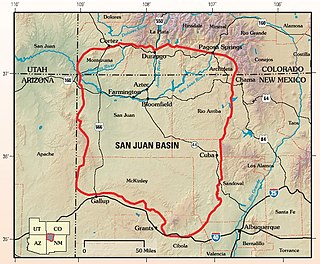
The San Juan Basin is a geologic structural basin located near the Four Corners region of the Southwestern United States. The basin covers 7,500 square miles and resides in northwestern New Mexico, southwestern Colorado, and parts of Utah and Arizona. Specifically, the basin occupies space in the San Juan, Rio Arriba, Sandoval, and McKinley counties in New Mexico, and La Plata and Archuleta counties in Colorado. The basin extends roughly 100 miles (160 km) N-S and 90 miles (140 km) E-W.

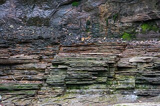
The Clinton Group is a mapped unit of sedimentary rock found throughout eastern North America. The interval was first defined by the geologist Lardner Vanuxem, who derived the name from the village of Clinton in Oneida County, New York where several well exposed outcrops of these strata can be found. The Clinton Group and its lateral equivalents extend throughout much of the Appalachian Foreland Basin, a major structural and depositional province extending from New York to Alabama. The term has been employed in Kentucky, Maryland, Michigan, New York, Ohio, Pennsylvania, Tennessee, Virginia, and West Virginia, though in many of these areas the same interval is referred to as the Rose Hill, Rockwood, or Red Mountain Formations. Historically the term "Clinton" has also been assigned to several lower Silurian stratigraphic units in Ohio and Kentucky which are now known to be significantly older than the Clinton Group as it was originally defined. Many parts of this succession are richly fossiliferous, making the Clinton Group an important record of marine life during the early Silurian. Several economically valuable rock-types are found within this interval, though it is perhaps best known as a significant source of iron ore

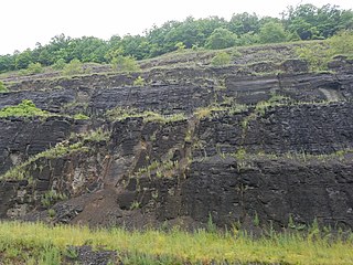
The Mississippian Pocono Formation is a mapped bedrock unit in Pennsylvania, Maryland, and West Virginia, in the United States. It is also known as the Pocono Group in Maryland and West Virginia, and the upper part of the Pocono Formation is sometimes called the Burgoon Formation or Burgoon Sandstone in Pennsylvania. The Pocono is a major ridge-former In the Ridge-and-Valley Appalachians of the eastern United States

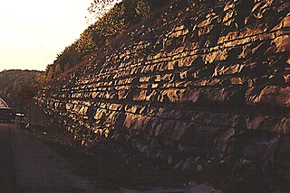
The Pennsylvanian Pottsville Formation is a mapped bedrock unit in Pennsylvania, western Maryland, West Virginia, Ohio, and Alabama. It is a major ridge-former in the Ridge-and-Valley Appalachians of the eastern United States. The Pottsville Formation is conspicuous at many sites along the Allegheny Front, the eastern escarpment of the Allegheny or Appalachian Plateau.

The Bedford Shale is a shale geologic formation in the states of Ohio, Michigan, Pennsylvania, Kentucky, West Virginia, and Virginia in the United States.

The New Albany Shale is an organic-rich geologic formation of Devonian and Mississippian age in the Illinois Basin of the United States. It is a major source of hydrocarbons.

The Devonian Foreknobs Formation is a mapped bedrock unit in Pennsylvania, Maryland, Virginia, and West Virginia.

Berea Sandstone, also known as Berea Grit, is a sandstone formation in the U.S. states of Michigan, Ohio, Pennsylvania, West Virginia, and Kentucky. It is named after Berea, Ohio. The sandstone has been used as a building stone and is a source of oil and gas.

The Mississippian Borden Formation is a mapped bedrock unit in Kentucky, Indiana, Illinois, Ohio, West Virginia, and Tennessee. It has many members, which has led some geologists to consider it a group rather than a formation.

The Logan Formation is the name given to a Lower Carboniferous siltstone, sandstone and conglomeratic unit exposed in east-central Ohio and parts of western West Virginia, USA.

The Fayetteville Shale is a geologic formation of Mississippian age composed of tight shale within the Arkoma Basin of Arkansas and Oklahoma. It is named for the city of Fayetteville, Arkansas, and requires hydraulic fracturing to release the natural gas contained within.

The Waverly Group is a geologic group in Michigan and Ohio. It preserves fossils dating back to the Carboniferous period.

The Bluestone Formation is a geologic formation in West Virginia. It is the youngest unit of the Upper Mississippian-age Mauch Chunk Group. A pronounced unconformity separates the upper boundary of the Bluestone Formation from sandstones of the overlying Pennsylvanian-age Pocahontas Formation.

The Bluefield Formation is a geologic formation in West Virginia. It preserves fossils dating back to the Mississippian subperiod of the Carboniferous period. Sediments of this age formed along a large marine basin lying in the region of what is now the Appalachian Plateau. The Bluefield Formation is the lowest section of the primarily siliciclastic Mauch Chunk Group, underlying the Stony Gap Sandstone Member of the Hinton Formation and overlying the limestone-rich Greenbrier Group.

The Cleveland Shale, also referred to as the Cleveland Member, is a shale geologic formation in the eastern United States.

The Cuyahoga Formation is a geologic formation in Ohio. The age of the formation is difficult to determine, because of a lack of diagnostic fossils. Roughly, the formation dates from the Late Kinderhookian to the Middle Osagean. Eight members are recognized, among them the Orangeville Shale, Sharpsville Sandstone, and Meadville Shale.
The geology of Ohio formed beginning more than one billion years ago in the Proterozoic eon of the Precambrian. The igneous and metamorphic crystalline basement rock is poorly understood except through deep boreholes and does not outcrop at the surface. The basement rock is divided between the Grenville Province and Superior Province. When the Grenville Province crust collided with Proto-North America, it launched the Grenville orogeny, a major mountain building event. The Grenville mountains eroded, filling in rift basins and Ohio was flooded and periodically exposed as dry land throughout the Paleozoic. In addition to marine carbonates such as limestone and dolomite, large deposits of shale and sandstone formed as subsequent mountain building events such as the Taconic orogeny and Acadian orogeny led to additional sediment deposition. Ohio transitioned to dryland conditions in the Pennsylvanian, forming large coal swamps and the region has been dryland ever since. Until the Pleistocene glaciations erased these features, the landscape was cut with deep stream valleys, which scoured away hundreds of meters of rock leaving little trace of geologic history in the Mesozoic and Cenozoic.
The Molas Formation is a geologic formation that is found in the Four Corners region of the United States. Its age is poorly constrained but is thought to be Namurian.


