
Southern California is a geographic and cultural region that generally comprises the southern portion of the U.S. state of California. It includes the Los Angeles metropolitan area as well as the Inland Empire. The region generally contains ten of California's 58 counties: Imperial, Kern, Los Angeles, Orange, Riverside, San Bernardino, San Diego, Santa Barbara, San Luis Obispo, and Ventura counties.

San Bernardino County, officially the County of San Bernardino and sometimes abbreviated as S.B. County, is a county located in the southern portion of the U.S. state of California, and is located within the Inland Empire area. As of the 2020 U.S. Census, the population was 2,181,654, making it the fifth-most populous county in California and the 14th-most populous in the United States. The county seat is San Bernardino.

Greater Los Angeles is the most populous metropolitan area in the U.S. state of California, encompassing five counties in Southern California extending from Ventura County in the west to San Bernardino County and Riverside County in the east, with Los Angeles County in the center, and Orange County to the southeast. The Los Angeles–Anaheim–Riverside combined statistical area (CSA) covers 33,954 square miles (87,940 km2), making it the largest metropolitan region in the United States by land area. The contiguous urban area is 2,281 square miles (5,910 km2), whereas the remainder mostly consists of mountain and desert areas. With a population of 18.4 million in 2024, it is the second-largest metropolitan area in the country, behind New York, as well as one of the largest megacities in the world.

Piedmont is a small city located in Alameda County, California, United States, enclaved by the city of Oakland. Its residential population was 11,270 at the 2020 census. The name comes from the region of Piedmont in Italy, and it means 'foothill'. Piedmont was incorporated in 1907, and was developed significantly in the 1920s and 1930s.

Redlands is a city in San Bernardino County, California, United States. As of the 2020 census, the city had a population of 73,168, up from 68,747 at the 2010 census. The city is located approximately 45 miles (72 km) northwest of Palm Springs and 63 miles (101 km) east of Los Angeles.

San Bernardino is a city in and the county seat of San Bernardino County, California, United States. Located in the Inland Empire region of Southern California, the city had a population of 222,101 in the 2020 census, making it the 18th-largest city in California. San Bernardino is the economic, cultural, and political hub of the San Bernardino Valley and the Inland Empire. The governments of El Salvador, Guatemala, and Mexico have established the metropolitan area's only consulates in the downtown area of the city. Additionally, San Bernardino serves as an anchor city to the 3rd largest metropolitan area in California and the 12th largest metropolitan area in the United States; the San Bernardino-Riverside MSA.

The Victor Valley is a valley in the Mojave Desert and subregion of the Inland Empire, in San Bernardino County in Southern California.
Anza, Anzah, or de Anza might refer to:
Wildwood Canyon is a canyon and California state park in the eastern foothills of the San Bernardino Mountains, within San Bernardino County, southern California.
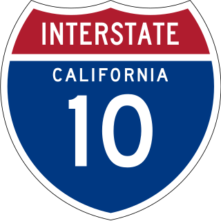
Interstate 10 (I-10) is a transcontinental Interstate Highway in the United States, stretching from Santa Monica, California, to Jacksonville, Florida. The segment of I-10 in California, also known as the Pearl Harbor Memorial Highway, runs east from Santa Monica through Los Angeles, San Bernardino, and Palm Springs before crossing into the state of Arizona. In the Greater Los Angeles area, it is known as the Santa Monica and San Bernardino freeways, linked by a short concurrency on I-5 at the East Los Angeles Interchange. I-10 also has parts designated as the Rosa Parks and Sonny Bono Memorial freeways. Some parts were also formerly designated as the Christopher Columbus Transcontinental Highway. However, the California State Legislature removed this designation following the passage of a bill on August 31, 2022. I-10 is also known colloquially as "the 10" to Southern California residents (See also California English § Freeways).
San Bernardino, California, was named in 1810.

The history of Piedmont, California, covers the history of the area in California's San Francisco Bay Area that is now known as Piedmont, up to and beyond the legal establishment of a city.

Downtown San Bernardino is a district in the city of San Bernardino, California, in San Bernardino County, United States. It is home to city and county government buildings, and to the city's central business district. The downtown area of San Bernardino is home to multiple diplomatic missions for the Inland Empire, being one of only four California cities with multiple consulates. The governments of Guatemala and Mexico have established their consulates in the civic center. Downtown San Bernardino is bounded by I-215 to the west, Waterman Avenue to the east, Baseline Street to the north, and Mill Street to the south.

San Timoteo Canyon is a river valley canyon southeast of Redlands, in the far northwestern foothills of the San Jacinto Mountains in the Inland Empire region of Southern California.

The following outline is provided as an overview of and topical guide to the U.S. state of California.
Salt spring is a saltwater spring.

Blair Park is a small park in the city of Piedmont, California located in the Oakland Hills near the head of Moraga Canyon.

The Inland Empire is a metropolitan area and region inland of and adjacent to coastal Southern California, centering around the cities of San Bernardino and Riverside, and bordering Los Angeles County to the west and San Diego County to the south. The bulk of the population is centered in the cities of northwestern Riverside County and southwestern San Bernardino County, and is sometimes considered to include the desert communities of the Coachella and Victor Valleys, respectively on the other sides of the San Gorgonio Pass and San Bernardino Mountains from the Santa Ana River watershed that forms the bulk of the Inland Empire; a much broader definition includes all of Riverside and San Bernardino counties. The combined land area of the counties of the Inland Empire is larger than ten U.S. states—West Virginia, Maryland, Hawaii, Massachusetts, Vermont, New Hampshire, New Jersey, Connecticut, Delaware and Rhode Island.

Kaawchama, alternatively referred to as Wa’aachnga, was a significant Tongva village in the San Bernardino Valley located in what is now west Redlands, California. The village became referred to by the Spanish as the Guachama Rancheria in 1810 after a supply station was constructed at the village for Mission San Gabriel, which then became part of Rancho San Bernardino following the secularization of the missions in 1833.

Blair Park is a neighborhood in the city of San Bernardino, California. Like most neighborhoods in San Bernardino, the boundaries are informal; by common usage, Blair Park is bounded on the west by the 215 freeway; on the east by E street; on the south by the 210 freeway;and on the north by the Shandin Hills. Its main commercial streets are 30th street, Little Mountain Drive and E street.