| Blairich River | |
|---|---|
 | |
| Location | |
| Country | New Zealand |
| Physical characteristics | |
| Mouth | |
• location | Awatere River |
• elevation | about 130 m (430 ft) |
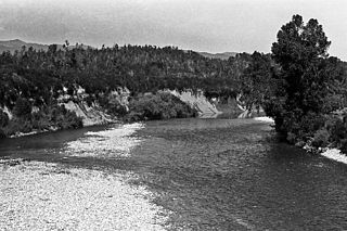
The Blairich River is a river in the Marlborough district of New Zealand. It is a tributary of the Awatere River
| Blairich River | |
|---|---|
| | |
| Location | |
| Country | New Zealand |
| Physical characteristics | |
| Mouth | |
• location | Awatere River |
• elevation | about 130 m (430 ft) |
The Blairich River is a river in the Marlborough district of New Zealand. It is a tributary of the Awatere River
The Inangahua River is located in the north-west of New Zealand’s South Island. It is a major tributary of the Buller River, where it joins at the town of Inangahua Junction.
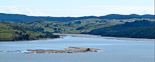
Tuamarina River is a river in Marlborough in the South Island of New Zealand. It flows into the Wairau River just south of Tuamarina.

The Blenheim Riverside Railway is a 2 ft narrow gauge heritage railway in Blenheim, New Zealand. It runs along the Taylor River, which winds its way through the middle of the town. It is operated by the all-volunteer Blenheim Riverside Railway Society.
The Collins River, New Zealand is a river of eastern Nelson, New Zealand. As a tributary of the Whangamoa River, it rises north of the Rai Saddle and flows north-westward to join that river at Whangamoa.
The Goulter River is a river in the Marlborough region of New Zealand. It rises in the Richmond Range near Lake Chalice. The lake was formed by a landslip about 2000 years ago, which dammed the river. The lake has no outlet, but water seeps through the landslip rubble into the Goulter. The river flows counter-clockwise around Mount Patriarch to join the Wairau River.
The Marchburn River is a river of Marlborough Region, New Zealand.

The Rai River is a river of the Tasman Region of New Zealand's South Island. It flows predominantly south, reaching the Pelorus River at Pelorus Bridge. The township of Rai Valley is located close to the river's banks.
The Rangitane River is a short river of the Northland Region of New Zealand's North Island. It flows east to reach the Tahoranui River 10 kilometres (6 mi) north of Kerikeri.
The Roding River is a river of the Tasman Region of New Zealand's South Island. It flows generally southwest from its sources in the hills above the city of Nelson, reaching the Wairoa River five kilometres south of Richmond. The rock type Rodingite is named after the Roding River. The catchment has numerous mine sites and shafts which attempted to make the copper and chromite deposits in the Dun Mountain Ophiolite Belt profitable in the late 19th century.
The Tawatahi River is a short river of the Waikato Region of New Zealand's North Island. It flows into the northern shore of Raglan Harbour.

The Taylor River is one of the two rivers that flow across the Wairau Plain into Blenheim, New Zealand, where it joins the Ōpaoa River. It arises near Taylor Pass to the south of the Wither Hills and flows north-east and north. The river and pass were named for Joseph Taylor, a New Zealand Company surveyor who worked in the area from 1842.
The Te Arai River is a river of the Gisborne Region of New Zealand's North Island. It flows generally north from its origins in rough hill country 20 kilometres (12 mi) north of Nūhaka before veering northeast past the township of Manutuke to reach the Waipaoa River five kilometres from the latter's outflow into Poverty Bay. Since 16 July 2020 the official name of the river has been Te Ārai River.
The Waikākaho River is a river of the Marlborough Region of New Zealand's South Island. It flows south from its sources southeast of Havelock to reach the Wairau River 5 kilometres (3 mi) west of Tuamarina.

The Wakamarina River is a river of the Marlborough Region of New Zealand's South Island. It flows generally northeast from its origins in the Richmond Range to reach the Pelorus River at the settlement of Canvastown, 10 kilometres (6 mi) west of Havelock. In 1864, gold was found in the river near Havelock, and soon 6,000 men were working in the area. The gold rush did not last long and most miners moved on to the West Coast Gold Rush.
The Avon River flows northeast from its sources in rough country southwest of Blenheim to reach the Waihopai River 20 kilometres (12 mi) from the latter's outflow into the Wairau River of New Zealand.
The Blythe River is a river in Canterbury, New Zealand. It flows east for 13 kilometres (8 mi), reaching the Pacific Ocean 12 kilometres (7 mi) south of the town of Cheviot. The river's course roughly parallels that of the larger Hurunui River, which lies 5 kilometres (3 mi) to the north.
Arrow Rock is a small island in Tasman Bay / Te Tai-o-Aorere, off the coast of Nelson, New Zealand. There is a narrow channel between the rock and Haulashore Island. Situated within Nelson Harbour, Arrow Rock was site of the Fifeshire wreck in 1842, which gave the rock its secondary name. There are a number of spotted shags who live on the rock.
The Whangamoa Saddle is a pass traversed by State Highway 6 on its route between Blenheim and Nelson, immediately to the east of Hira. One of the two passes on the route, the Whangamoa Saddle lies between the valleys of the Whangamoa and Wakapuaka Rivers south of Delaware Bay. The elevation of the pass is 466 metres (1,529 ft) above sea level. The pass marks part of the boundary between Nelson and Marlborough District.

The Bryant Range is a range of low mountains in the northern South Island of New Zealand. They form part of the boundary of the Nelson and Tasman Districts with Marlborough Region, as well as forming the western boundary of Mount Richmond Forest Park The range is traversed by State Highway 6 at the Rai Saddle close to its northern end.

Waipoua Settlement is a rural community in the Kaipara District of Northland, in New Zealand's North Island.
41°42′S173°56′E / 41.700°S 173.933°E