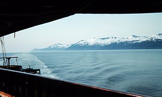
Revillagigedo Channel is an ocean channel in the Alexander Archipelago of the U.S. state of Alaska. Extending 56 km (35 mi) northwest from the Dixon Entrance, it lies between the mainland to the east, Revillagigedo Island to the north, and Duke Island and Annette Island to the southwest. It is part of the Inside Passage to Ketchikan.

Clarence Strait, originally Duke of Clarence Strait, is a strait in southeastern Alaska, in the United States in the Alexander Archipelago. The strait separates Prince of Wales Island, on the west side, from Revillagigedo Island and Annette Island, on the east side. Clarence Strait is 126 miles (203 km) long, extending from Dixon Entrance to Sumner Strait. Moira Sound is on the west side of the strait.
Sumner Strait is a strait in the Alexander Archipelago in the southeastern region of the U.S. state of Alaska. It is about 80 miles (130 km) long and 10 miles (16 km) wide, extending from the mouth of the Stikine River to Iphigenia Bay on the Gulf of Alaska, separating Mitkof Island, Kupreanof Island, and Kuiu Island on the north from Zarembo Island and Prince of Wales Island on the south.

Stephens Passage is a channel in the Alexander Archipelago in the southeastern region of the U.S. state of Alaska. It runs between Admiralty Island to the west and the Alaska mainland and Douglas Island to the east, and is about 170 km (105 mi) long. Juneau, the capital of Alaska, is near the north end, on Gastineau Channel.
Behm Canal is a natural channel in the Alexander Archipelago, in the southeastern part of the U.S. state of Alaska.
Grand Barachois is a large natural lagoon in Saint Pierre and Miquelon. It lies immediately south of Miquelon Island, and is formed largely by the 12 kilometre-long tombolo of La Dune.
South Somerset is a hamlet in the town of Somerset in Niagara County, New York, United States.
Brookfield is an unincorporated community in Stafford County, in the U.S. state of Virginia.

Central Point is an unincorporated community in Caroline County, in the U.S. state of Virginia.

Hawton is an unincorporated community in Cass Township, Sullivan County, in the U.S. state of Indiana.
Motleys Mill is an unincorporated community in Pittsylvania County, in the U.S. state of Virginia.
Bell Island is an island in the Alexander Archipelago in Southeast Alaska, United States. It is 14 kilometres (8.7 mi) long, lying in Behm Canal, north of Revillagigedo Island. George Vancouver first visited the island on August 12, 1793, in the evening dining on its south coast. He suspected that it was an island, but this was not proven until later in the same month, when Joseph Whidbey, master of HMS Discovery, charted its entire coastline. Vancouver later named it "Bell's Island" after one of his crew, Midshipman Bell.
Ernest Sound is a strait in Southeast Alaska, U.S.A. It extends 48 kilometres (30 mi) southwest, from the mouth of Bradfield Canal to Clarence Strait, separating Wrangell and Etolin Islands from the mainland. It was first traversed and charted in 1793 by James Johnstone, one of George Vancouver's officers during his 1791-95 expedition. Vancouver later named it "Prince Ernest's Sound", after Prince Ernest, Duke of Cumberland.
Bradfield Canal is an inlet in Southeast Alaska, United States. It extends 30 kilometres (19 mi) west from the mouth of the Bradfield River to Ernest Sound at Point Warde. It was first charted in 1793 by James Johnstone, one of George Vancouver's officers during his 1791–95 expedition. Vancouver later named it "Bradfield Channel".
The Narrows is a channel in Southeast Alaska, U.S.A. It is the shortest and narrowest stretch of waterway separating Wrangell Island from the mainland, connecting Blake Channel and Eastern Passage. It was named in 1917 by the U.S. Coast and Geodetic Survey. It was first traversed and charted in 1793 by James Johnstone, one of George Vancouver's officers during his 1791-95 expedition.
Eastern Passage is a channel in Southeast Alaska, U.S.A. It extends southeast 29 kilometres (18 mi) from the mouth of the Stikine River to The Narrows, separating the northeastern half of Wrangell Island from the mainland. It was named in 1877 by William Healy Dall of the U.S. Coast and Geodetic Survey. It was first traversed and charted in 1793 by James Johnstone, one of George Vancouver's officers during his 1791-95 expedition.
Ruthton is an unincorporated community in Keith County, Nebraska, in the United States.
Leonardsburg is an unincorporated community in Delaware County, in the U.S. state of Ohio.
Zadock is an unincorporated community in northern Stoddard County, in the U.S. state of Missouri. The community lies north of the Castor River about seven miles north of Bloomfield.


